- Chandabali
-
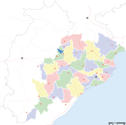
Chandabali — town — Coordinates 20°47′0″N 86°46′0″E / 20.783333°N 86.766667°ECoordinates: 20°47′0″N 86°46′0″E / 20.783333°N 86.766667°E Country India State Orissa District(s) Bhadrak district Time zone IST (UTC+05:30) Chandabali (or Chandbali) is a community in the Bhadrak district of Orissa on the bank of the River Baitarani, and a tourist destination for visitors to the Bhitarkanika Wildlife Sanctuary.[1]
Contents
History
Before the 19th century AD, Chandabali was a small fishing village, and a natural river port. In 1866 trading began from this port to Bengal and in 1881 it was declared a government port by the British government. This led to growth and development of a market for agricultural produce.
In the 1910s, the United States Hydrographic Office noted that the opening of the Bengal-Nagpur Railway had drawn trade away from the port, and that the port was now considered to be simply part of the port of Dhamra. At the time, the port had between 22 and 30 feet of anchorage, in front of the town, with three landing piers, the water 10 feet deep at their ends. A steamer service ran four times per week between there and Calcutta. The town itself had a single police station, a customhouse and warehouse, and a traveler's bungalow. The 1901 Census of India had recorded the population as 1,826.[2]
Attractions
The 650 km2 Bhitarkanika National Park is about 35 km away, accessible via ferry. The park, one of the few marine parks in India, was established to protect saltwater crocodiles, with the special status of "Crocodile Sanctuary. The Orissa government has established a saltwater crocodile-breeding center in the park.[3] Other attractions are the remains of two 9th century monuments and a temple dedicated to the worship of Lord Shiva.[citation needed] Chandabali is home to the Sri Aurobindo Dibyadham Ashram, its Relics Temple and Integral Education centre.[4]
References
- ^ "Chandbali". Bhadrak district. http://bhadrak.nic.in/chandbali.htm. Retrieved 2010-11-24.
- ^ USHO 1916, pp. 188.
- ^ "Bhitar Kanika National Park". India for Visitors. http://www.indiaforvisitors.com/states/orissa/bhitar.htm. Retrieved 2010-11-24.
- ^ "Sri Aurobindo Dibya Dham, Chandabali Bhadrak". MotherOrissa. http://www.motherorissa.com/1_Relics_Centers/chandbali.htm. Retrieved 2010-11-24.
Bibliography
- United States Hydrographic Office (1916). Bay of Bengal Pilot: Bay of Bengal and the Coasts of India and Siam. U.S.H.O. publications. Government Printing Office. OCLC 13679735.
Categories:- Cities and towns in Bhadrak district
- Orissa geography stubs
Wikimedia Foundation. 2010.


