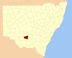
Sturt County, New South Wales — Infobox Australian cadastral name = Sturt state = New South Wales caption = Location in New South Wales near nw = Nicholson near n = Nicholson near ne = Cooper near e = Cooper near se = Boyd near s = Boyd near sw = Waradgery near w =… … Wikipedia
Sturt's Lock — Infobox Waterlock lock name = Sturt s Lock No. 6 caption= Sturt s Lock, 2008 waterway = Regent s Canal county = Islington Greater London maint = British Waterways operation = first = latest = length = width = fall = convert|8|ft|m|1|lk=on… … Wikipedia
Sturt — Recorded as Start, Starte, Stert, Sturt, Sturte and Sterte, this is an English surname. It is either locational from any of the various places named from Old English pre 7th century word steurt meaning a promontory as for example Start Point in… … Surnames reference
County of Adelaide — Adelaide South Australia Map of Adelaide County in 1886 showing the hundreds Established: 2 June 1842 Area: 2955 km² … Wikipedia
County of Adelaide, South Australia — Infobox Australian cadastral name = Adelaide state = South Australia caption = Map of Adelaide County in 1886 showing the hundreds est = 2 June 1842 area = 2955 near nw = Gawler near n = Light near ne = Eyre near e = Sturt near se = Hindmarsh… … Wikipedia
Evelyn Pitfield Shirley Sturt — Infobox Person name = Evelyn Pitfield Shirley Sturt image size = 200px caption = Evelyn Pitfield Shirley Sturt birth date = 1816 birth place = Dorset, England death date = death date|1885|2|10|mf=y death place = at sea occupation = Police… … Wikipedia
Poole County — Map of all coordinates from Google Map of all coordinates from Bing Export all coordinates as KML … Wikipedia
Michael Sturt — Michael Ormonde Cleasby Sturt (born 12 September 1941) is an English businessman and cricketer. Mike Sturt was born in Wembley, Middlesex. He played county cricket for Middlesex CCC in six separate seasons between 1961 and 1978, as a right handed … Wikipedia
Charles Sturt University, New South Wales — Charles Sturt University Wagga Wagga, New South Wales Charles Sturt University entrance Postcode … Wikipedia
Wentworth County — For the former county in Canada, see Wentworth County, Ontario. Map of all coordinates from Google Map of all coordinates from Bing Export all coordinates as KML … Wikipedia
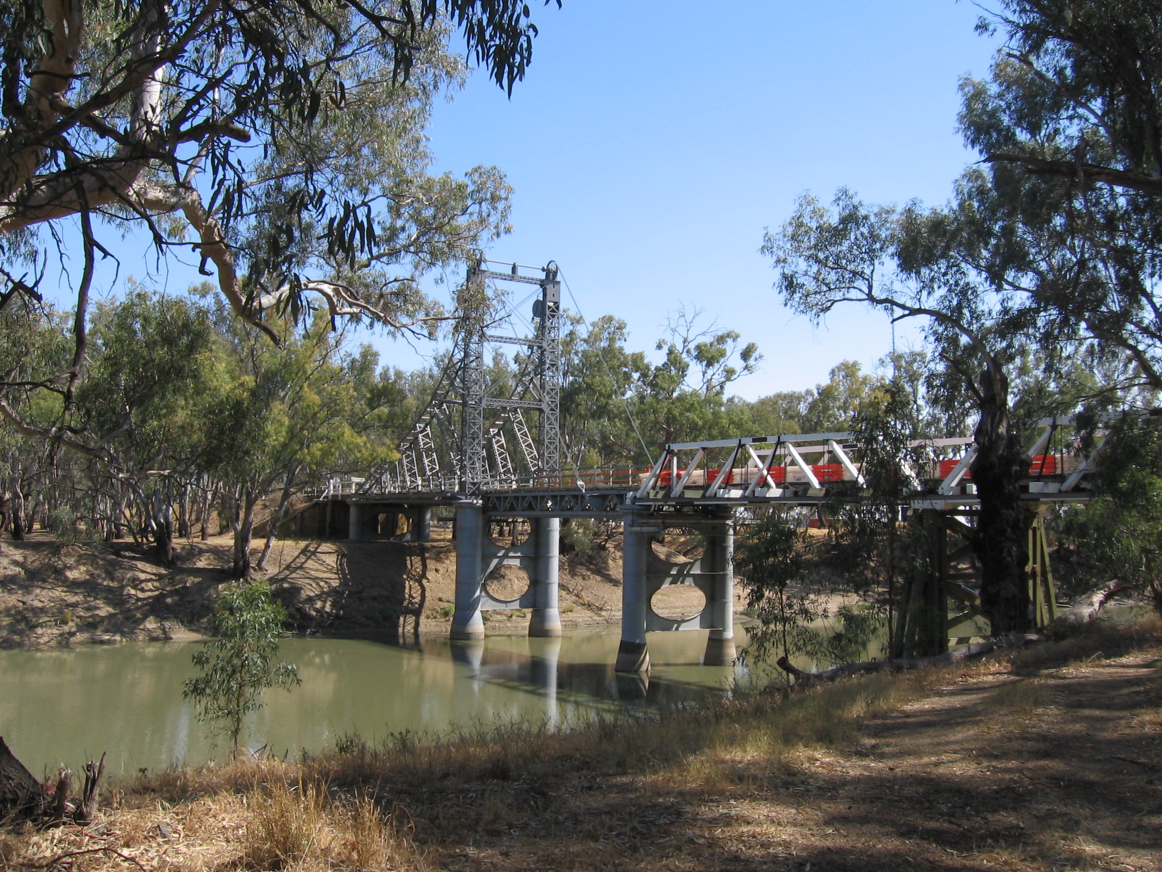
 The Carathool Bridge over the Murrumbidgee between Sturt and Boyd
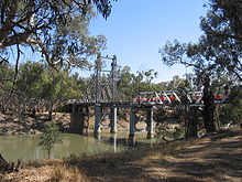