Wentworth County

Wentworth County
Wentworth
New South Wales
Wentworth NSW.PNG
Location in New South Wales
Lands administrative divisions around Wentworth
Windeyer Perry Manara
Tara Wentworth Taila
Millewa (Vic) Karkarooc (Vic) Taila

Wentworth County is one of the 141 Cadastral divisions of New South Wales. The Murray River is the boundary to the south, and the Anabranch of the Darling River is the western boundary. It includes the area where the Darling River joins the Murray River.

Wentworth County was named in honour of the explorer and statesman William Charles Wentworth (1790-1872).[1]

Parishes within this county

A full list of parishes found within this county; their current LGA and mapping coordinates to the approximate centre of each location is as follows:

Parish LGA Coordinates
Annand Wentworth Shire 33°41′35″S 142°53′37″E / 33.69306°S 142.89361°E / -33.69306; 142.89361 (Annand)
Arumpo Wentworth Shire 33°43′39″S 142°55′25″E / 33.7275°S 142.92361°E / -33.7275; 142.92361 (Arumpo)
Avoca Wentworth Shire 33°55′35″S 141°51′59″E / 33.92639°S 141.86639°E / -33.92639; 141.86639 (Avoca)
Belar Wentworth Shire 34°04′28″S 142°14′22″E / 34.07444°S 142.23944°E / -34.07444; 142.23944 (Belar)
Bingoo Wentworth Shire 33°45′22″S 141°54′40″E / 33.75611°S 141.91111°E / -33.75611; 141.91111 (Bingoo)
Brewang Wentworth Shire 34°02′46″S 142°28′46″E / 34.04611°S 142.47944°E / -34.04611; 142.47944 (Brewang)
Bullanmong Wentworth Shire 33°36′37″S 142°56′29″E / 33.61028°S 142.94139°E / -33.61028; 142.94139 (Bullanmong)
Bulubula Wentworth Shire 33°42′02″S 142°25′26″E / 33.70056°S 142.42389°E / -33.70056; 142.42389 (Bulubula)
Bunneringee Wentworth Shire 33°36′46″S 141°46′46″E / 33.61278°S 141.77944°E / -33.61278; 141.77944 (Bunneringee)
Buraguy Wentworth Shire 33°48′11″S 142°52′09″E / 33.80306°S 142.86917°E / -33.80306; 142.86917 (Buraguy)
Burrie Wentworth Shire 33°30′51″S 142°25′55″E / 33.51417°S 142.43194°E / -33.51417; 142.43194 (Burrie)
Burtundy Wentworth Shire 33°48′29″S 142°12′59″E / 33.80806°S 142.21639°E / -33.80806; 142.21639 (Burtundy)
Cliffs Wentworth Shire 34°09′33″S 142°21′23″E / 34.15917°S 142.35639°E / -34.15917; 142.35639 (Cliffs)
Connargee Wentworth Shire 33°32′56″S 142°31′52″E / 33.54889°S 142.53111°E / -33.54889; 142.53111 (Connargee)
Coonpa Wentworth Shire 33°37′09″S 142°47′47″E / 33.61917°S 142.79639°E / -33.61917; 142.79639 (Coonpa)
Copar Wentworth Shire 33°57′38″S 142°11′43″E / 33.96056°S 142.19528°E / -33.96056; 142.19528 (Copar)
Cowl Wentworth Shire 34°11′44″S 142°35′23″E / 34.19556°S 142.58972°E / -34.19556; 142.58972 (Cowl)
Cudmore Wentworth Shire 33°52′35″S 141°47′15″E / 33.87639°S 141.7875°E / -33.87639; 141.7875 (Cudmore)
Curnoo Wentworth Shire 33°34′36″S 142°21′04″E / 33.57667°S 142.35111°E / -33.57667; 142.35111 (Curnoo)
Darling Wentworth Shire 33°37′36″S 142°29′10″E / 33.62667°S 142.48611°E / -33.62667; 142.48611 (Darling)
Dean Wentworth Shire 34°17′06″S 142°26′19″E / 34.285°S 142.43861°E / -34.285; 142.43861 (Dean)
Emu Wentworth Shire 33°53′18″S 142°07′04″E / 33.88833°S 142.11778°E / -33.88833; 142.11778 (Emu)
Gol Gol Wentworth Shire 34°07′27″S 142°13′28″E / 34.12417°S 142.22444°E / -34.12417; 142.22444 (Gol Gol)
Gutpy Wentworth Shire 33°31′29″S 142°08′46″E / 33.52472°S 142.14611°E / -33.52472; 142.14611 (Gutpy)
Illingerry Wentworth Shire 33°43′01″S 142°13′24″E / 33.71694°S 142.22333°E / -33.71694; 142.22333 (Illingerry)
Letheroe Wentworth Shire 33°34′43″S 142°35′48″E / 33.57861°S 142.59667°E / -33.57861; 142.59667 (Letheroe)
Lissan Wentworth Shire 33°35′19″S 141°54′03″E / 33.58861°S 141.90083°E / -33.58861; 141.90083 (Lissan)
Matong Wentworth Shire 34°01′24″S 142°21′16″E / 34.02333°S 142.35444°E / -34.02333; 142.35444 (Matong)
Merche Wentworth Shire 33°49′35″S 142°07′38″E / 33.82639°S 142.12722°E / -33.82639; 142.12722 (Merche)
Merno Wentworth Shire 33°32′27″S 142°18′11″E / 33.54083°S 142.30306°E / -33.54083; 142.30306 (Merno)
Milkengay Wentworth Shire 33°28′08″S 141°55′09″E / 33.46889°S 141.91917°E / -33.46889; 141.91917 (Milkengay)
Millie Wentworth Shire 34°02′01″S 142°06′34″E / 34.03361°S 142.10944°E / -34.03361; 142.10944 (Millie)
Mimi Wentworth Shire 33°51′09″S 142°25′28″E / 33.8525°S 142.42444°E / -33.8525; 142.42444 (Mimi)
Mindelwul Wentworth Shire 33°48′28″S 142°46′48″E / 33.80778°S 142.78°E / -33.80778; 142.78 (Mindelwul)
Moangola Wentworth Shire 33°39′44″S 142°40′46″E / 33.66222°S 142.67944°E / -33.66222; 142.67944 (Moangola)
Moorpa Wentworth Shire 33°44′28″S 141°46′38″E / 33.74111°S 141.77722°E / -33.74111; 141.77722 (Moorpa)
Mourquong Wentworth Shire 34°04′36″S 142°05′06″E / 34.07667°S 142.085°E / -34.07667; 142.085 (Mourquong)
Murnowella Wentworth Shire 33°47′37″S 142°36′42″E / 33.79361°S 142.61167°E / -33.79361; 142.61167 (Murnowella)
Nanga Wentworth Shire 33°41′08″S 142°13′14″E / 33.68556°S 142.22056°E / -33.68556; 142.22056 (Nanga)
Neilpo Wentworth Shire 34°05′57″S 141°48′57″E / 34.09917°S 141.81583°E / -34.09917; 141.81583 (Neilpo)
North Cowl Wentworth Shire 34°08′57″S 142°34′37″E / 34.14917°S 142.57694°E / -34.14917; 142.57694 (North Cowl)
Nundrower Wentworth Shire 33°56′31″S 142°38′19″E / 33.94194°S 142.63861°E / -33.94194; 142.63861 (Nundrower)
Ogro Wentworth Shire 33°48′16″S 142°19′55″E / 33.80444°S 142.33194°E / -33.80444; 142.33194 (Ogro)
Oporto Unincorporated 31°46′41″S 144°52′03″E / 31.77806°S 144.8675°E / -31.77806; 144.8675 (Oporto)
Palinyewah Wentworth Shire 33°53′21″S 142°01′36″E / 33.88917°S 142.02667°E / -33.88917; 142.02667 (Palinyewah)
Para Wentworth Shire 33°47′06″S 142°05′21″E / 33.785°S 142.08917°E / -33.785; 142.08917 (Para)
Paringi Wentworth Shire 34°15′08″S 142°19′15″E / 34.25222°S 142.32083°E / -34.25222; 142.32083 (Paringi)
Pernolingay Wentworth Shire 33°37′31″S 141°53′43″E / 33.62528°S 141.89528°E / -33.62528; 141.89528 (Pernolingay)
Poimba Wentworth Shire 33°45′35″S 142°32′33″E / 33.75972°S 142.5425°E / -33.75972; 142.5425 (Poimba)
Pondery Wentworth Shire 33°52′55″S 142°41′07″E / 33.88194°S 142.68528°E / -33.88194; 142.68528 (Pondery)
Pulpa Wentworth Shire 33°32′30″S 142°41′50″E / 33.54167°S 142.69722°E / -33.54167; 142.69722 (Pulpa)
Roma Wentworth Shire 33°39′11″S 142°59′18″E / 33.65306°S 142.98833°E / -33.65306; 142.98833 (Roma)
Salt Lake Wentworth Shire 33°33′24″S 142°12′38″E / 33.55667°S 142.21056°E / -33.55667; 142.21056 (Salt Lake)
Scott Wentworth Shire 33°44′50″S 142°19′45″E / 33.74722°S 142.32917°E / -33.74722; 142.32917 (Scott)
Sturt Wentworth Shire 33°42′00″S 142°02′58″E / 33.7°S 142.04944°E / -33.7; 142.04944 (Sturt)
Tapio Wentworth Shire 33°57′01″S 142°00′27″E / 33.95028°S 142.0075°E / -33.95028; 142.0075 (Tapio)
Tarangara Wentworth Shire 33°39′20″S 142°19′46″E / 33.65556°S 142.32944°E / -33.65556; 142.32944 (Tarangara)
Thirrang Wentworth Shire 34°06′01″S 142°39′23″E / 34.10028°S 142.65639°E / -34.10028; 142.65639 (Thirrang)
Thitto Wentworth Shire 34°12′32″S 142°26′55″E / 34.20889°S 142.44861°E / -34.20889; 142.44861 (Thitto)
Thoomby Wentworth Shire 33°44′28″S 142°46′40″E / 33.74111°S 142.77778°E / -33.74111; 142.77778 (Thoomby)
Til Til Wentworth Shire 33°58′05″S 142°17′04″E / 33.96806°S 142.28444°E / -33.96806; 142.28444 (Til Til)
Tiltao Wentworth Shire 34°01′18″S 141°58′14″E / 34.02167°S 141.97056°E / -34.02167; 141.97056 (Tiltao)
Toontora Wentworth Shire 33°39′17″S 142°00′33″E / 33.65472°S 142.00917°E / -33.65472; 142.00917 (Toontora)
Tugima Wentworth Shire 33°50′12″S 141°54′37″E / 33.83667°S 141.91028°E / -33.83667; 141.91028 (Tugima)
Tulrigo Wentworth Shire 33°30′59″S 142°02′06″E / 33.51639°S 142.035°E / -33.51639; 142.035 (Tulrigo)
Uki Wentworth Shire 33°59′46″S 142°33′10″E / 33.99611°S 142.55278°E / -33.99611; 142.55278 (Uki)
Ulong Wentworth Shire 33°56′59″S 142°44′12″E / 33.94972°S 142.73667°E / -33.94972; 142.73667 (Ulong)
Wambera Wentworth Shire 33°54′54″S 142°22′55″E / 33.915°S 142.38194°E / -33.915; 142.38194 (Wambera)
Wentworth Wentworth Shire 34°05′50″S 141°56′33″E / 34.09722°S 141.9425°E / -34.09722; 141.9425 (Wentworth)
Winnegow Wentworth Shire 33°59′14″S 142°27′48″E / 33.98722°S 142.46333°E / -33.98722; 142.46333 (Winnegow)
Yerta Wentworth Shire 33°36′06″S 142°06′43″E / 33.60167°S 142.11194°E / -33.60167; 142.11194 (Yerta)

References

  1. ^ Geographical Names Board of NSW

Wikimedia Foundation. 2010.

Игры ⚽ Поможем решить контрольную работу

Look at other dictionaries:

  • Wentworth County, Ontario — Wentworth County, area convert|269057|acre|km2|0, is a historic county in the Canadian province of Ontario. It was created in 1816 as part of the Gore District in what was then Upper Canada and later Canada West. It was named in honour of Sir… …   Wikipedia

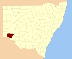
  • Wentworth County, New South Wales — Infobox Australian cadastral name = Wentworth state = New South Wales caption = Location in New South Wales near nw = Windeyer near n = Perry near ne = Manara near e = Taila near se = Taila near s = Karkarooc (Vic) near sw = Millewa (Vic) near w …   Wikipedia

  • Wentworth (electoral district) — Wentworth was a federal electoral district represented in the Canadian House of Commons from 1904 to 1968. It was located near the City of Hamilton in the province of Ontario. This riding was first created in 1903 from parts of Wentworth North… …   Wikipedia

  • Wentworth Woodhouse — is a Grade I listed country house near the village of Wentworth, in the vicinity of Rotherham, South Yorkshire, England. One of the great Whig political palaces , [M. J. Charlesworth, The Wentworths: Family and Political Rivalry in the English… …   Wikipedia

  • Wentworth Cheswell — (11 April 1746 – 8 March 1817) was an African American teacher, coroner, scrivener, assessor, auditor, moderator, selectman and Justice of the Peace. He was the only child born to Hopestill and Catherine (Keniston) Cheswell, in Newmarket, New… …   Wikipedia

  • Wentworth's Location, New Hampshire — Wentworth s Location is a township in Coos County, New Hampshire, United States. The population was 44 at the 2000 census. It is part of the Berlin, NH ndash;VT Micropolitan Statistical Area.In New Hampshire, locations, grants, townships (which… …   Wikipedia

  • Wentworth Beaumont, 1st Baron Allendale — Wentworth Blackett Beaumont, 1st Baron Allendale (11 April 1829 13 February 1907), was a British industrialist and Liberal politician.Allendale was the eldest son of Thomas Beaumont and his wife Henrietta Jane Emma, daughter of John Atkinson, and …   Wikipedia

  • Wentworth, Wisconsin — Wentworth is an unincorporated community, in Douglas County, in the town of Amnicon, in the northwestern part of the U.S. state of Wisconsin. U.S. Route 2 serves as a main arterial route in the community. [Rand McNally. The Road Atlas 07. Chicago …   Wikipedia

  • Wentworth, Quebec — Wentworth is a township in the Canadian province of Quebec, located within the Argenteuil Regional County Municipality. The township had a population of 483 in the Canada 2006 Census …   Wikipedia

  • Wentworth Military Academy and College — Infobox University name = Wentworth Military Academy established = 1880 motto = Achieve the Honorable type = Military junior college and High school head label = Superintendent head = Captain Basil Read city = Lexington state = MO country = USA… …   Wikipedia

Share the article and excerpts

Direct link
Do a right-click on the link above
and select “Copy Link”