- Bathurst County
-
Bathurst
New South Wales
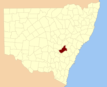
Location in New South WalesLands administrative divisions around Bathurst Ashburnham Wellington Roxburgh Forbes Bathurst Westmoreland Monteagle King Georgiana Bathurst County was one of the original Nineteen Counties in New South Wales and is now one of the 141 Cadastral divisions of New South Wales. It includes the area to the south west of Bathurst to Cowra and Orange. The Lachlan River is the boundary to the south-west, the Belubula River forms part of the northern boundary, with the Fish River on the northeastern boundary. Blayney is located roughly in the middle.
Bathurst County was named in honour of Henry Bathurst, 3rd Earl between (1762–1834).[1]. The Electoral district of Bathurst (County) was the first state electoral district for the area, between 1856 and 1859.
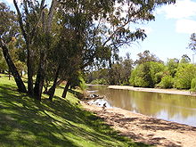
In 1852 it had an area of 1,196,400 acres (4,842 km2) and population of 6,405. At this time it was described as having some of the best wool in the colony, with excellent farming land.[2]
Parishes within this county
A full list of parishes found within this county; their current LGA and mapping coordinates to the approximate centre of each location is as follows:
References
- ^ Geographical Names Board of NSW
- ^ "Old Welsh Books with English Translations", The Land of Gold: the Companion for the Welsh Emigrant to Australia, 1852
Categories:- Counties of New South Wales

Wikimedia Foundation. 2010.