Georgiana County

Georgiana County
Georgiana
New South Wales
Georgiana NSW.PNG
Location in New South Wales
Lands administrative divisions around Georgiana
Bathurst Bathurst Westmoreland
King Georgiana Westmoreland
King Argyle Argyle

Georgiana County was one of the original Nineteen Counties in New South Wales and is now one of the 141 Cadastral divisions of New South Wales. It lies in the area about halfway between Bathurst and Goulburn. The Lachlan River is the western boundary, with the Crookwell River the southern boundary. It includes Bigga, and the area surrounding the Abercrombie River. It was part of the Electoral district of King and Georgiana from 1856 to 1859.

Georgiana County was named in honour of Georgiana Cavendish, Duchess of Devonshire (1757-1806).[1]

Parishes within this county

A full list of parishes found within this county; their current LGA and mapping coordinates to the approximate centre of each location is as follows:

Parish LGA Coordinates
Abercrombie Bathurst Regional Council 33°5454S 149°1504E / 33.915°S 149.25111°E / -33.915; 149.25111 (Abercrombie)
Ballyroe Oberon Shire 34°0154S 149°3204E / 34.03167°S 149.53444°E / -34.03167; 149.53444 (Ballyroe)
Beemarang Oberon Shire 33°5454S 149°4404E / 33.915°S 149.73444°E / -33.915; 149.73444 (Beemarang)
Belmore Upper Lachlan Shire 34°2054S 149°2804E / 34.34833°S 149.46778°E / -34.34833; 149.46778 (Belmore)
Bigga Upper Lachlan Shire 34°0254S 149°0904E / 34.04833°S 149.15111°E / -34.04833; 149.15111 (Bigga)
Binda Upper Lachlan Shire 34°2054S 149°2404E / 34.34833°S 149.40111°E / -34.34833; 149.40111 (Binda)
Bingham Upper Lachlan Shire 34°0354S 149°3004E / 34.065°S 149.50111°E / -34.065; 149.50111 (Bingham)
Blackman Upper Lachlan Shire 34°0754S 149°1634E / 34.13167°S 149.27611°E / -34.13167; 149.27611 (Blackman)
Bolong Upper Lachlan Shire 34°1424S 149°3504E / 34.24°S 149.58444°E / -34.24; 149.58444 (Bolong)
Bombah Bathurst Regional Council 33°5554S 149°2004E / 33.93167°S 149.33444°E / -33.93167; 149.33444 (Bombah)
Bubalahla Upper Lachlan Shire 34°1254S 149°4804E / 34.215°S 149.80111°E / -34.215; 149.80111 (Bubalahla)
Bucumba Oberon Shire 33°5354S 149°2804E / 33.89833°S 149.46778°E / -33.89833; 149.46778 (Bucumba)
Bummaroo Oberon Shire 34°0854S 149°4204E / 34.14833°S 149.70111°E / -34.14833; 149.70111 (Bummaroo)
Burraga Oberon Shire 33°5354S 149°3404E / 33.89833°S 149.56778°E / -33.89833; 149.56778 (Burraga)
Burridgee Upper Lachlan Shire 34°0754S 149°3204E / 34.13167°S 149.53444°E / -34.13167; 149.53444 (Burridgee)
Carrawa Bathurst Regional Council 33°4354S 149°2304E / 33.73167°S 149.38444°E / -33.73167; 149.38444 (Carrawa)
Copperhannia Bathurst Regional Council 33°5054S 149°1504E / 33.84833°S 149.25111°E / -33.84833; 149.25111 (Copperhannia)
Cuddyong Upper Lachlan Shire 34°1354S 149°2504E / 34.23167°S 149.41778°E / -34.23167; 149.41778 (Cuddyong)
Finley Oberon Shire 34°0354S 149°4204E / 34.065°S 149.70111°E / -34.065; 149.70111 (Finley)
Garrynian Oberon Shire 33°5854S 149°4504E / 33.98167°S 149.75111°E / -33.98167; 149.75111 (Garrynian)
Gillindich Upper Lachlan Shire 34°1124S 149°1934E / 34.19°S 149.32611°E / -34.19; 149.32611 (Gillindich)
Gilmandyke Oberon Shire 33°4954S 149°3004E / 33.83167°S 149.50111°E / -33.83167; 149.50111 (Gilmandyke)
Glengarry Upper Lachlan Shire 34°0854S 149°0404E / 34.14833°S 149.06778°E / -34.14833; 149.06778 (Glengarry)
Grabine Upper Lachlan Shire 33°5554S 149°0534E / 33.93167°S 149.09278°E / -33.93167; 149.09278 (Grabine)
Groveland Bathurst Regional Council 33°4854S 149°2604E / 33.815°S 149.43444°E / -33.815; 149.43444 (Groveland)
Gurnang Oberon Shire 34°0054S 149°4904E / 34.015°S 149.81778°E / -34.015; 149.81778 (Gurnang)
Hillas Upper Lachlan Shire 34°1854S 149°4004E / 34.315°S 149.66778°E / -34.315; 149.66778 (Hillas)
Isabella Oberon Shire 33°5754S 149°4104E / 33.965°S 149.68444°E / -33.965; 149.68444 (Isabella)
Jeremy Oberon Shire 33°5954S 149°3504E / 33.99833°S 149.58444°E / -33.99833; 149.58444 (Jeremy)
Jerrong Oberon Shire 34°0854S 149°4804E / 34.14833°S 149.80111°E / -34.14833; 149.80111 (Jerrong)
Julong Upper Lachlan Shire 34°1654S 149°1704E / 34.28167°S 149.28444°E / -34.28167; 149.28444 (Julong)
Kangaloolah Upper Lachlan Shire 34°0754S 149°2304E / 34.13167°S 149.38444°E / -34.13167; 149.38444 (Kangaloolah)
Kempfield Bathurst Regional Council 33°4554S 149°1704E / 33.765°S 149.28444°E / -33.765; 149.28444 (Kempfield)
Keverstone Upper Lachlan Shire 34°0754S 149°0904E / 34.13167°S 149.15111°E / -34.13167; 149.15111 (Keverstone)
Kiamma Upper Lachlan Shire 34°2554S 149°3004E / 34.43167°S 149.50111°E / -34.43167; 149.50111 (Kiamma)
Laggan Upper Lachlan Shire 34°2054S 149°3504E / 34.34833°S 149.58444°E / -34.34833; 149.58444 (Laggan)
Leighwood Upper Lachlan Shire 34°1154S 149°3804E / 34.19833°S 149.63444°E / -34.19833; 149.63444 (Leighwood)
Markdale Upper Lachlan Shire 34°1254S 149°1404E / 34.215°S 149.23444°E / -34.215; 149.23444 (Markdale)
Meglo Upper Lachlan Shire 34°0354S 149°1604E / 34.065°S 149.26778°E / -34.065; 149.26778 (Meglo)
Mount Lawson Oberon Shire 33°5054S 149°3404E / 33.84833°S 149.56778°E / -33.84833; 149.56778 (Mount Lawson)
Mulgowrie Upper Lachlan Shire 34°1454S 149°0904E / 34.24833°S 149.15111°E / -34.24833; 149.15111 (Mulgowrie)
Mulgunnia Bathurst Regional Council 33°4854S 149°2104E / 33.815°S 149.35111°E / -33.815; 149.35111 (Mulgunnia)
Retreat Oberon Shire 34°0354S 149°3704E / 34.065°S 149.61778°E / -34.065; 149.61778 (Retreat)
Rockley Oberon Shire 33°4254S 149°3004E / 33.715°S 149.50111°E / -33.715; 149.50111 (Rockley)
Sherwood Upper Lachlan Shire 34°1354S 149°3404E / 34.23167°S 149.56778°E / -34.23167; 149.56778 (Sherwood)
Stoke Bathurst Regional Council 33°5454S 149°1004E / 33.915°S 149.16778°E / -33.915; 149.16778 (Stoke)
Thalaba Upper Lachlan Shire 34°1654S 149°3004E / 34.28167°S 149.50111°E / -34.28167; 149.50111 (Thalaba)
Thompson Upper Lachlan Shire 33°5954S 149°3004E / 33.99833°S 149.50111°E / -33.99833; 149.50111 (Thompson)
Tuena Upper Lachlan Shire 34°0154S 149°2304E / 34.03167°S 149.38444°E / -34.03167; 149.38444 (Tuena)
Tyrl Tyrl Upper Lachlan Shire 34°2654S 149°3804E / 34.44833°S 149.63444°E / -34.44833; 149.63444 (Tyrl Tyrl)
Walbrook Oberon Shire 30°5154S 149°3804E / 30.865°S 149.63444°E / -30.865; 149.63444 (Walbrook)
Wangalo Upper Lachlan Shire 34°0854S 149°2704E / 34.14833°S 149.45111°E / -34.14833; 149.45111 (Wangalo)
Werong Oberon Shire 34°0854S 149°5404E / 34.14833°S 149.90111°E / -34.14833; 149.90111 (Werong)
Wiarborough Upper Lachlan Shire 34°1254S 149°5304E / 34.215°S 149.88444°E / -34.215; 149.88444 (Wiarborough)
Wowagin Upper Lachlan Shire 34°1954S 149°4604E / 34.33167°S 149.76778°E / -34.33167; 149.76778 (Wowagin)
Wyndham Oberon Shire 34°0454S 149°4434E / 34.08167°S 149.74278°E / -34.08167; 149.74278 (Wyndham)
Yalbraith Upper Lachlan Shire 34°1454S 149°5004E / 34.24833°S 149.83444°E / -34.24833; 149.83444 (Yalbraith)
Yarraman Upper Lachlan Shire 33°5554S 149°1604E / 33.93167°S 149.26778°E / -33.93167; 149.26778 (Yarraman)
Yewrangara Upper Lachlan Shire 34°0254S 149°0404E / 34.04833°S 149.06778°E / -34.04833; 149.06778 (Yewrangara)

References

  1. ^ Geographical Names Board of NSW


Wikimedia Foundation. 2010.

Игры ⚽ Поможем сделать НИР

Look at other dictionaries:

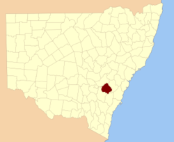
  • Georgiana County, New South Wales — Infobox Australian cadastral name = Georgiana state = New South Wales caption = Location in New South Wales near nw = Bathurst near n = Bathurst near ne = Westmoreland near w = King near e = Westmoreland near sw = King near s = Argyle near se =… …   Wikipedia

  • Georgiana — Infobox Given Name Revised name = Georgiana imagesize= caption= pronunciation= gender = Female meaning = Greek word Γεωργιος, meaning farmer. region = origin = related names = George, Georgia, Georgina footnotes = Georgiana is a Russian name. It… …   Wikipedia

  • Georgiana Bruce Kirby Preparatory School — is a non profit independent school, located in Harvey West, Santa Cruz, California, USA, and named after pioneer Georgiana Bruce Kirby. The school educates in grades 6 12 and the Head of School is M Joshua Karter. It serves 260 students in the… …   Wikipedia

  • Georgiana (disambiguation) — Georgiana may refer to:*SS Georgiana, Civil War blockade runner wrecked March 19, 1863 *Georgiana, Alabama, town in Butler County, Alabama, USA …   Wikipedia

  • Georgiana — steht für: SS Georgiana, Kriegsschiff (Blockadebrecher) im Amerikanischen Bürgerkrieg Georgiana (Alabama), Ort im Butler County, Alabama, USA einen weiblichen Vornamen, Variante des Namens Georgia (Vorname) Siehe auch: Georgia (Begriffsklärung) …   Deutsch Wikipedia

  • Georgiana, Alabama — Infobox Settlement official name = Georgiana, Alabama settlement type = Town imagesize = image caption = image imagesize = image caption = image mapsize = 250px map caption = Location in Butler County and the state of Alabama mapsize1 = map… …   Wikipedia

  • Georgiana Buller — Dame Audrey Charlotte Georgiana Buller, DBE, RRC (4 August 1884 ndash;22 June 1953), best known as Georgiana Buller, was a British hospital administrator and the founder of the first school dedicated to occupational therapy in the United… …   Wikipedia

  • National Register of Historic Places listings in Hood River County, Oregon — Location of Hood River County in Oregon The following list presents the full set of National Register of Historic Places listings in Hood River County, Oregon, and offers brief descriptive information about each of them. The National Register of… …   Wikipedia

  • Butler County, Alabama — Verwaltung US Bundesstaat: Alabama Verwaltungssitz: Greenville Adresse des Verwaltungssitzes: Butler County Clerk 700 Court Square P.O. Box 756 Greenville, AL 36037 Gründung …   Deutsch Wikipedia

  • Butler County, Alabama — Infobox U.S. County county = Butler County state = Alabama map size = 150 founded = December 13, 1819 seat = Greenville | largest city = Greenville area total sq mi =778 area land sq mi =777 area water sq mi =1 area percentage = 0.13% census yr …   Wikipedia

Share the article and excerpts

Direct link
https://en-academic.com/dic.nsf/enwiki/11583853 Do a right-click on the link above
and select “Copy Link”