Gipps County

Gipps County
Gipps
New South Wales
Gipps NSW.PNG
Location in New South Wales
Lands administrative divisions around Gipps
Blaxland Cunningham Ashburnham
Dowling Gipps Forbes
Cooper Bourke Bland

Gipps County is one of the 141 Cadastral divisions of New South Wales.

Gipps County was named in honour of the Governor of New South Wales, Sir George Gipps (1791-1847.[1]

Parishes within this county

A full list of parishes found within this county; their current LGA and mapping coordinates to the approximate centre of each location is as follows:

Parish LGA Coordinates
Banar Lachlan Shire Council 33°15′54″S 147°04′04″E / 33.265°S 147.06778°E / -33.265; 147.06778 (Banar)
Bena Lachlan Shire Council 33°21′54″S 147°16′04″E / 33.365°S 147.26778°E / -33.365; 147.26778 (Bena)
Bibbijolee Bland Shire Council 33°40′54″S 146°53′04″E / 33.68167°S 146.88444°E / -33.68167; 146.88444 (Bibbijolee)
Bimbeen Bland Shire Council 33°39′54″S 147°06′04″E / 33.665°S 147.10111°E / -33.665; 147.10111 (Bimbeen)
Blow Clear Bland Shire Council 33°41′54″S 147°13′04″E / 33.69833°S 147.21778°E / -33.69833; 147.21778 (Blow Clear)
Bogandillon Lachlan Shire Council 33°17′54″S 147°18′04″E / 33.29833°S 147.30111°E / -33.29833; 147.30111 (Bogandillon)
Bolagamy Bland Shire Council 33°42′54″S 147°01′04″E / 33.715°S 147.01778°E / -33.715; 147.01778 (Bolagamy)
Brolga Bland Shire Council 33°51′54″S 146°50′04″E / 33.865°S 146.83444°E / -33.865; 146.83444 (Brolga)
Bygalorie Lachlan Shire Council 33°27′54″S 146°47′04″E / 33.465°S 146.78444°E / -33.465; 146.78444 (Bygalorie)
Cadalgulee Forbes Shire Council 33°36′54″S 147°33′04″E / 33.615°S 147.55111°E / -33.615; 147.55111 (Cadalgulee)
Cadow Lachlan Shire Council 33°18′54″S 147°28′04″E / 33.315°S 147.46778°E / -33.315; 147.46778 (Cadow)
Caragabal Weddin Shire Council 33°47′41″S 147°38′59″E / 33.79472°S 147.64972°E / -33.79472; 147.64972 (Caragabal)
Carawandool Forbes Shire Council 33°33′54″S 147°41′04″E / 33.565°S 147.68444°E / -33.565; 147.68444 (Carawandool)
Clear Ridge Bland Shire Council 33°43′54″S 147°17′04″E / 33.73167°S 147.28444°E / -33.73167; 147.28444 (Clear Ridge)
Cookaburragong Lachlan Shire Council 33°20′54″S 147°04′04″E / 33.34833°S 147.06778°E / -33.34833; 147.06778 (Cookaburragong)
Corringle Bland Shire Council 33°38′54″S 147°22′04″E / 33.64833°S 147.36778°E / -33.64833; 147.36778 (Corringle)
Cowal Bland Shire Council 33°42′54″S 147°24′04″E / 33.715°S 147.40111°E / -33.715; 147.40111 (Cowal)
Crown Camp Lachlan Shire Council 33°24′54″S 147°01′04″E / 33.415°S 147.01778°E / -33.415; 147.01778 (Crown Camp)
Currah Lachlan Shire Council 33°25′54″S 147°02′04″E / 33.43167°S 147.03444°E / -33.43167; 147.03444 (Currah)
Currah Lachlan Shire Council 33°29′54″S 147°00′04″E / 33.49833°S 147.00111°E / -33.49833; 147.00111 (Currah)
Euglo Lachlan Shire Council 33°25′54″S 147°10′04″E / 33.43167°S 147.16778°E / -33.43167; 147.16778 (Euglo)
Euglo South Lachlan Shire Council 33°27′54″S 147°10′04″E / 33.465°S 147.16778°E / -33.465; 147.16778 (Euglo South)
Gibrigal Forbes Shire Council 33°31′54″S 147°33′04″E / 33.53167°S 147.55111°E / -33.53167; 147.55111 (Gibrigal)
Goobothery Lachlan Shire Council 33°08′54″S 146°49′04″E / 33.14833°S 146.81778°E / -33.14833; 146.81778 (Goobothery)
Gormans Hill Lachlan Shire Council 33°24′54″S 146°48′04″E / 33.415°S 146.80111°E / -33.415; 146.80111 (Gormans Hill)
Hiawatha Bland Shire Council 33°48′54″S 147°13′04″E / 33.815°S 147.21778°E / -33.815; 147.21778 (Hiawatha)
Ilgindrie Lachlan Shire Council 33°15′54″S 147°11′04″E / 33.265°S 147.18444°E / -33.265; 147.18444 (Ilgindrie)
Ina Lachlan Shire Council 33°23′54″S 147°27′04″E / 33.39833°S 147.45111°E / -33.39833; 147.45111 (Ina)
Jemalong West Forbes Shire Council 33°30′54″S 147°43′04″E / 33.515°S 147.71778°E / -33.515; 147.71778 (Jemalong West)
Kalingan Bland Shire Council 33°35′54″S 147°09′04″E / 33.59833°S 147.15111°E / -33.59833; 147.15111 (Kalingan)
Lake Forbes Shire Council 33°36′54″S 147°30′04″E / 33.615°S 147.50111°E / -33.615; 147.50111 (Lake)
Livingstone Lachlan Shire Council 33°31′54″S 147°12′04″E / 33.53167°S 147.20111°E / -33.53167; 147.20111 (Livingstone)
Manna Lachlan Shire Council 33°23′54″S 147°22′04″E / 33.39833°S 147.36778°E / -33.39833; 147.36778 (Manna)
Marsden Weddin Shire Council 33°44′54″S 147°32′04″E / 33.74833°S 147.53444°E / -33.74833; 147.53444 (Marsden)
Merribooka Lachlan Shire Council 33°20′54″S 146°55′04″E / 33.34833°S 146.91778°E / -33.34833; 146.91778 (Merribooka)
Merrimarotherie Lachlan Shire Council 33°15′54″S 147°01′04″E / 33.265°S 147.01778°E / -33.265; 147.01778 (Merrimarotherie)
Milbee Lachlan Shire Council 33°17′54″S 147°01′04″E / 33.29833°S 147.01778°E / -33.29833; 147.01778 (Milbee)
Mildil Bland Shire Council 33°51′54″S 147°00′04″E / 33.865°S 147.00111°E / -33.865; 147.00111 (Mildil)
Moonbia Lachlan Shire Council 33°17′54″S 147°23′04″E / 33.29833°S 147.38444°E / -33.29833; 147.38444 (Moonbia)
Moora Moora Lachlan Shire Council 33°27′54″S 147°27′04″E / 33.465°S 147.45111°E / -33.465; 147.45111 (Moora Moora)
Mulga Bland Shire Council 33°53′54″S 147°04′04″E / 33.89833°S 147.06778°E / -33.89833; 147.06778 (Mulga)
Murrengreen Bland Shire Council 33°43′54″S 146°51′04″E / 33.73167°S 146.85111°E / -33.73167; 146.85111 (Murrengreen)
Nerang Cowal Lachlan Shire Council 33°27′54″S 147°20′04″E / 33.465°S 147.33444°E / -33.465; 147.33444 (Nerang Cowal)
Pullabooka Weddin Shire Council 33°47′54″S 147°45′04″E / 33.79833°S 147.75111°E / -33.79833; 147.75111 (Pullabooka)
Pulligal Lachlan Shire Council 33°20′54″S 146°49′04″E / 33.34833°S 146.81778°E / -33.34833; 146.81778 (Pulligal)
South Borambil Lachlan Shire Council 33°14′54″S 147°17′04″E / 33.24833°S 147.28444°E / -33.24833; 147.28444 (South Borambil)
South Condobolin Lachlan Shire Council 33°08′54″S 147°07′04″E / 33.14833°S 147.11778°E / -33.14833; 147.11778 (South Condobolin)
South Gulgo Lachlan Shire Council 33°07′54″S 147°02′04″E / 33.13167°S 147.03444°E / -33.13167; 147.03444 (South Gulgo)
South Micabil Lachlan Shire Council 33°06′54″S 146°54′04″E / 33.115°S 146.90111°E / -33.115; 146.90111 (South Micabil)
Thulloo Bland Shire Council 33°42′54″S 146°46′04″E / 33.715°S 146.76778°E / -33.715; 146.76778 (Thulloo)
Tirranna Weddin Shire Council 33°45′54″S 147°40′04″E / 33.765°S 147.66778°E / -33.765; 147.66778 (Tirranna)
Towyal Forbes Shire Council 33°24′54″S 147°39′04″E / 33.415°S 147.65111°E / -33.415; 147.65111 (Towyal)
Trigalana Weddin Shire Council 33°38′54″S 147°37′04″E / 33.64833°S 147.61778°E / -33.64833; 147.61778 (Trigalana)
Udah Bland Shire Council 33°47′54″S 147°05′04″E / 33.79833°S 147.08444°E / -33.79833; 147.08444 (Udah)
Ugalong Lachlan Shire Council 33°31′54″S 147°04′04″E / 33.53167°S 147.06778°E / -33.53167; 147.06778 (Ugalong)
Ungarie Bland Shire Council 33°38′54″S 147°02′04″E / 33.64833°S 147.03444°E / -33.64833; 147.03444 (Ungarie)
Wallaroi Lachlan Shire Council 33°11′54″S 146°54′04″E / 33.19833°S 146.90111°E / -33.19833; 146.90111 (Wallaroi)
Wamboyne Bland Shire Council 33°36′54″S 147°13′04″E / 33.615°S 147.21778°E / -33.615; 147.21778 (Wamboyne)
Warangla Forbes Shire Council 33°38′54″S 147°44′04″E / 33.64833°S 147.73444°E / -33.64833; 147.73444 (Warangla)
Wardry Lachlan Shire Council 33°13′54″S 146°50′04″E / 33.23167°S 146.83444°E / -33.23167; 146.83444 (Wardry)
Warroo Forbes Shire Council 33°22′54″S 147°33′04″E / 33.38167°S 147.55111°E / -33.38167; 147.55111 (Warroo)
Weelah Lachlan Shire Council 33°23′54″S 147°15′04″E / 33.39833°S 147.25111°E / -33.39833; 147.25111 (Weelah)
West Plains Forbes Shire Council 33°31′54″S 147°39′04″E / 33.53167°S 147.65111°E / -33.53167; 147.65111 (West Plains)
Wheoga Forbes Shire Council 33°41′54″S 148°00′04″E / 33.69833°S 148.00111°E / -33.69833; 148.00111 (Wheoga)
Wilbertroy Forbes Shire Council 33°27′54″S 147°33′04″E / 33.465°S 147.55111°E / -33.465; 147.55111 (Wilbertroy)
Wilga Lachlan Shire Council 33°22′45″S 146°54′40″E / 33.37917°S 146.91111°E / -33.37917; 146.91111 (Wilga)
Wilga South Lachlan Shire Council 33°27′54″S 146°54′04″E / 33.465°S 146.90111°E / -33.465; 146.90111 (Wilga South)
Wollongough Bland Shire Council 33°33′31″S 146°54′09″E / 33.55861°S 146.9025°E / -33.55861; 146.9025 (Wollongough)
Wyalong Bland Shire Council 33°54′54″S 147°10′04″E / 33.915°S 147.16778°E / -33.915; 147.16778 (Wyalong)
Yarnel Lachlan Shire Council 33°20′54″S 147°10′04″E / 33.34833°S 147.16778°E / -33.34833; 147.16778 (Yarnel)
Younga Plain Bland Shire Council 33°43′54″S 147°06′04″E / 33.73167°S 147.10111°E / -33.73167; 147.10111 (Younga Plain)
Youngareen Bland Shire Council 33°38′54″S 146°46′04″E / 33.64833°S 146.76778°E / -33.64833; 146.76778 (Youngareen)

References

  1. ^ Geographical Names Board of NSW

Wikimedia Foundation. 2010.

Игры ⚽ Поможем решить контрольную работу

Look at other dictionaries:

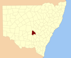
  • Gipps County, New South Wales — Infobox Australian cadastral name = Gipps state = New South Wales caption = Location in New South Wales near nw = Blaxland near n = Cunningham near ne = Ashburnham near e = Forbes near se = Bland near s = Bourke near sw = Cooper near w =… …   Wikipedia

  • County of Croajingolong — Croajingolong Victoria Location in Victoria Established: 24 February 1871 Area: 8830 km² …   Wikipedia

  • County of Buln Buln — Buln Buln Victoria Location in Victoria Lands administrative divisions around Buln Buln …   Wikipedia

  • Yancowinna County — Map of all coordinates from Google Map of all coordinates from Bing Export all coordinates as KML …   Wikipedia

  • Bland County, New South Wales — Infobox Australian cadastral name = Bland state = New South Wales caption = Location in New South Wales near nw = Gipps near n = Gipps near ne = Forbes near w = Bourke near e = Monteagle near sw = Bourke near s = Clarendon near se = HardenBland… …   Wikipedia

  • Bourke County, New South Wales — Infobox Australian cadastral name = Bourke state = New South Wales caption = Location in New South Wales near nw = Dowling near n = Gipps near ne = Bland near e = Clarendon near se = Wynyard near s = Mitchell near sw = Mitchell near w =… …   Wikipedia

  • Cooper County, New South Wales — Map of all coordinates from Google Map of all coordinates from Bing Export all coordinates as KML …   Wikipedia

  • Ashburnham County, New South Wales — Infobox Australian cadastral name = Ashburnham state = New South Wales caption = Location in New South Wales near nw = Kennedy near n = Gordon near ne = Wellington near w = Cunningham near e = Bathurst near sw = Gipps near s = Forbes near se =… …   Wikipedia

  • Blaxland County, New South Wales — Infobox Australian cadastral name = Blaxland state = New South Wales caption = Location in New South Wales near nw = Mouramba near n = Mouramba near ne = Flinders near e = Cunningham near se = Gipps near s = Dowling near sw = Franklin near w =… …   Wikipedia

  • Cunningham County, New South Wales — Infobox Australian cadastral name = Cunningham state = New South Wales caption = Location in New South Wales near nw = Flinders near n = Kennedy near ne = Kennedy near e = Ashburnham near se = Forbes near s = Gipps near sw = Dowling near w =… …   Wikipedia

Share the article and excerpts

Direct link
Do a right-click on the link above
and select “Copy Link”