Lyndhurst, New South Wales
- Lyndhurst, New South Wales
Infobox Australian Place | type = town
name = Lyndhurst
state = nsw
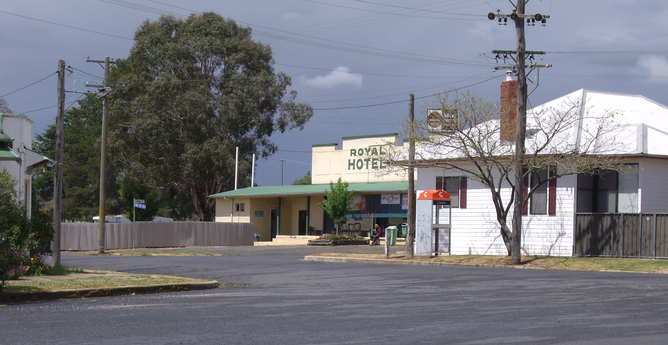
caption = Lyndhurst with Royal Hotel in the background
lga = Blayney Shire
fedgov = Calare
postcode = 2797
est =
pop =
elevation=
maxtemp =
mintemp =
rainfall =
stategov = Bathurst
dist1 = 269
location1= Sydney
dist2 = 63
location2= BathurstLyndhurst is a small village in New South Wales, Australia in Blayney Shire. It is 4 kilometres west of Mandurama or about 269 km west of Sydney and 63 km south-west of Bathurst just off the Mid-Western Highway New South Wales. Once serving as the major centre for basic goods and needs to the nearby Junction Reefs goldfields - which is still a working mine.
Lyndhurst is in fact most significant for being one of the ten areas (including Albury, Armidale, Bombala, Dalgety, Lake George, Orange, Tooma, Tumut and Yass-Canberra) shortlisted in 1908 as a site for the Australian Capital Territory [ [http://www.bbc.co.uk/dna/h2g2/A2787564 BBC Canberra, Australian Capital Territory, Australia UPDATE] ] .
Lyndhurst Today
Lyndhurst today boasts the still functioning Royal Hotel, the Post Office which resides in the old bakery building, a service station, and general store. The Lyndhurst Rodeo is held annually in February at the Lyndhurst Sports Ground.
References
Wikimedia Foundation.
2010.
Look at other dictionaries:
Electoral district of Lyndhurst (New South Wales) — Lyndhurst was a former electoral district of the Legislative Assembly in the Australian state of New South Wales, created in 1913, partly replacing Blayney and Belubula, and named after and including Lyndhurst. It was abolished in 1920 with the… … Wikipedia
New South Wales 48 class locomotive — New South Wales 48 class GrainCorp s 48203 at the Junee Roundhouse Power type Diesel electric Builder A. E. Goodwin under licence from American Locomotive Company … Wikipedia
New South Wales Legislative Assembly electoral districts — The New South Wales Legislative Assembly is elected from 93 single member electorates called districts. Current districts This is a list of districts for the 2007 general election.* Albury * Auburn * Ballina * Balmain (1880 1894: Balmain; 1894… … Wikipedia
Mandurama, New South Wales — Mandurama New South Wales Olive Street, the main street of Mandurama, looking north … Wikipedia
Dungog, New South Wales — Dungog New South Wales View of Dungog from Hospital Road … Wikipedia
Glebe, New South Wales — Infobox Australian Place | type = suburb name = Glebe city = Sydney state = nsw caption = Nags Head Hotel lga = City of Sydney postcode = 2037 pop = 10,872 (2001 census) area = 1.8 est = propval = stategov = Balmain fedgov = Sydney dist1 = 3 dir1 … Wikipedia
Millthorpe, New South Wales — Millthorpe New South Wales Main Street of Millthorpe … Wikipedia
Neville, New South Wales — Neville is a small village in the south east of New South Wales, Australia, in Blayney Shire. It is 60km south of Bathurst or about 16 km south east of Mandurama. It is 940 metres above sea level and currently has a population of about 100.… … Wikipedia
Stanmore, New South Wales — Stanmore Sydney, New South Wales Percival Street and Salisbury Road intersection Population … Wikipedia
Newbridge, New South Wales — Newbridge is a village of about 100 residents in New South Wales, Australia in Blayney Shire. It is approximately 30 km from Bathurst and 15 km from Blayney in the Central Tablelands of NSW. At the 2006 census, Newbridge had a… … Wikipedia