- Dalgety, New South Wales
-
Dalgety
New South Wales
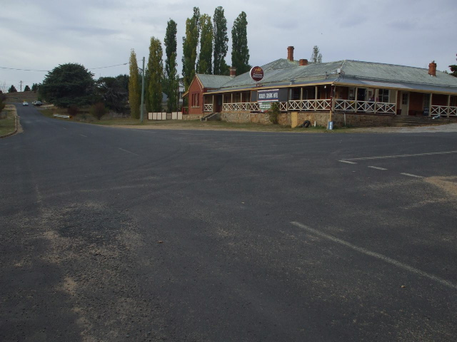
Main street of Dalgety and the Buckley's Crossing Hotel
 Dalgety
Population: 75 Established: 1832 Postcode: 2628 Elevation: 760 m (2,493 ft) Location: - 51 km (32 mi) from Cooma
- 452 km (281 mi) from Sydney
LGA: Snowy River Shire State District: Monaro Federal Division: Eden-Monaro Mean max temp Mean min temp Annual rainfall 15 °C
59 °F-18 °C
-0 °F630 mm
24.8 inDalgety is a small town in New South Wales Australia, on the banks of the Snowy River between Melbourne and Sydney.
The town is located at what was once an important river crossing along the Travelling Stock route from Gippsland to the Snowy Mountains High Country dating from the 1840s.
Contents
History
The first settlement was originally known as Buckley's Crossing after Edward Buckley who established a farm near the river crossing in 1832.[1] It was renamed Barnes Crossing in 1848,[1] by which time it had become an important waypoint on the stock route between Gippsland in Victoria and the Snowy Mountains in New South Wales. In 1874 the town was formally surveyed and named Dalgety after the maiden name of the wife of surveyor J. R. Campbell.[2]
At the time of the survey the population was 23 and it was recorded that a punt was operating across the river. A Catholic school opened in 1874 to cater for the children of Irish gold prospectors, and the first bridge over the river was constructed in 1888.[1]
The town also became a meeting place between white settlers and local Aborigines (who would camp along the river bank on the way to the Snowy Mountains.[3] The Thaua people and Ngarigo people lived in this area seasonally. [4]
Location for National Capital
In 1903 a Federal Royal Commission named Dalgety as the location for Australia's national capital city. The choice was based on criteria including climate, food supply, land ownership and ability to support major industries,[5] and was formalised in the Seat of Government Act 1904. In an early demonstration of Sydney-Melbourne rivalry, the decision was immediately opposed by the Parliament of New South Wales which argued that Dalgety was too close to Melbourne and too far from Sydney.[6] A more practical objection was the distance to the main Sydney-Melbourne railway line and the expense involved in constructing a spur to the proposed capital.[7]
These objections were resolved with the passage of the Seat of Government Act 1908 which passed over Dalgety in favour of Canberra.[3]
Geography
Situated on the Monaro Plains and in the rain shadow of the Snowy Mountains, Dalgety is a relatively dry area of rolling hills with granite boulders scattered across the landscape.
The town depends on the Snowy River for water supplies. In October 2007 the New South Wales Department of Water and Energy recommended a cut in river flows through the nearby Lake Jindabyne, to a level which may require Dalgety to import drinking water.[8]
References
- ^ a b c "Travel:Dalgety". Sydney Morning Herald. 2004-02-08. http://www.smh.com.au/news/New-South-Wales/Dalgety/2005/02/17/1108500193461.html. Retrieved 2007-11-09.
- ^ "Geographical Names Register:Dalgety". Geographical Names Board of New South Wales. September 1992. http://www.gnb.nsw.gov.au/name_search/extract?id=JPYbjzrXan. Retrieved 2007-11-09.
- ^ a b "Dalgety". Tourism New South Wales. November 2007. http://www.visitnsw.com.au/Destination.aspx?DProductID=9002111. Retrieved 2007-11-09.
- ^ Tindale, Norman (1974) "Thaua" in his Catalogue of Australian Aboriginal Tribes. South Australian Museum. Quote: the Bemerigal or mountain people at Cooma belonged to the Ngarigo.
- ^ "A Guide to NSW State Archives relating to Federation". State Records New South Wales. October 2001. Archived from the original on 2007-09-27. http://web.archive.org/web/20070927201045/http://www.records.nsw.gov.au/publications/federation/page12.htm#_ftn1. Retrieved 2007-11-09.
- ^ Pegrum, Roger (1983). The Bush Capital:How Australia chose Canberra as its federal city. Hale & Iremonger. ISBN 9780868060666. http://books.google.com.au/books?id=ADRgAAAACAAJ&dq=The+Bush+Capital.
- ^ Welsh, Frank (2005). Great Southern Land: A New History of Australia. Penguin Books. ISBN 0713994509. http://books.google.com.au/books?id=LriNAAAACAAJ&dq=Great+Southern+land.
- ^ "Dalgety residents fear cut to Snowy flows". Australian Broadcasting Corporation. 2007-10-29. http://www.abc.net.au/news/stories/2007/10/29/2073100.htm?site=southeastnsw. Retrieved 2007-11-09.
Coordinates: 36°30′S 148°50′E / 36.5°S 148.833°E
External links
Categories:- Towns in New South Wales

Wikimedia Foundation. 2010.