- Corny Point, South Australia
-
Corny Point
South Australia
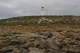
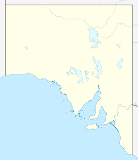
The lighthouse at Corny PointPopulation: 154[1] Established: 1881[2] Postcode: 5575[3] Coordinates: 34°55′34″S 137°04′55″E / 34.926°S 137.082°ECoordinates: 34°55′34″S 137°04′55″E / 34.926°S 137.082°E LGA: Yorke Peninsula State District: Goyder Federal Division: Wakefield Localities around Corny Point: Spencer Gulf Spencer Gulf Spencer Gulf Spencer Gulf Corny Point Point Turton Innes National Park Marion Bay Warooka Corny Point is a settlement in South Australia[4] at the north-western tip of the "boot" of Yorke Peninsula. It was named this by Matthew Flinders in March 1802 because it appeared to be a growth on the toe of Yorke Peninsula.[5] A lighthouse was built in 1882. The first pastoral lease was taken up in 1846.[6] The site is notable for outcrops of Palaeoproterozoic gneisses[7] of the Lincoln Complex on the wave cut platform at the base of the low limestone cliffs.[citation needed]
See also
References
- ^ Australian Bureau of Statistics (25 October 2007). "Corny Point (State Suburb)". 2006 Census QuickStats. http://www.censusdata.abs.gov.au/ABSNavigation/prenav/LocationSearch?collection=Census&period=2006&areacode=SSC43431&producttype=QuickStats&breadcrumb=PL&action=401. Retrieved 2009-12-09.
- ^ "Post Office List - PPA". https://www.premierpostal.com/cgi-bin/wsProd.sh/Viewpocd.w?. Retrieved 2009-12-09.
- ^ "Australia Post: Postcode Search". http://www1.auspost.com.au/postcodes/index.asp?Locality=Corny+Point&sub=1&State=&Postcode=&submit1=Search. Retrieved 2009-12-09.
- ^ "2905.0 - Statistical Geography: Volume 2 -- Census Geographic Areas, Australia, 2006". Australian Bureau of Statistics. http://www.abs.gov.au/AUSSTATS/abs@.nsf/Latestproducts/2905.0Appendix82006?opendocument&tabname=Notes&prodno=2905.0&issue=2006&num=&view=. Retrieved 8 December 2009.
- ^ "Corny Point". http://www.samemory.sa.gov.au/site/page.cfm?u=1227. Retrieved 2009-12-15.
- ^ "South Australia - Corny Point". http://www.southaustralia.com/9006057.aspx. Retrieved 2009-12-15.
- ^ YORKE PENINSULA (MOONTA SUBDOMAIN) PRE-NEOPROTEROZOIC BASEMENT GEOLOGY. Australian Government : Geoscience Australia. September 2003. http://www.ga.gov.au/image_cache/GA4110.pdf. Retrieved 2009-12-15.
External links
Yorke Peninsula, South Australia Major Townships Ardrossan · Bute · Kadina · Maitland · Minlaton · Moonta · Paskeville · Port Broughton · Wallaroo · YorketownCouncils Islands Goose Island · Wardang IslandSouth Australia Topics History · Government · Flag · Culture · Transport · Rail transport · Education · Geography · Geology · South Australian English · Sport · Country Fire Service
Regions Cities and towns Adelaide · Port Augusta · Mount Gambier · Murray Bridge · Port Lincoln · Port Pirie · Victor Harbor · WhyallaSouth Australia portal Categories:- Towns in South Australia
- Yorke Peninsula
- Coastal towns in South Australia
- South Australia geography stubs
Wikimedia Foundation. 2010.


