- Cormeen
-
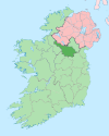
Cormeen is a townland in the Parish of Kildallan, Barony of Tullyhunco, County Cavan, Ireland. The townland name is an anglicisation of the Gaelic placename “Cor Mín” which means ‘Smooth Hill’. The earliest surviving mention of the townland is on the 1609 Ulster Plantation map of the Barony of Loughtee, where it is spelled ‘Corume’. In the 1655 Down Survey map it is spelled “Cormeen”. It is bounded on the north by Lecharrownahone townland, on the east by Agharaskilly townland, on the south by Killarah townland and on the west by Crossmakelagher townland. One would expect Cormeen to belong to Templeport parish and Tullyhaw barony as do the other surrounding townlands which lie on the west bank of the Shannon-Erne Waterway. However at the time of the fixing of parish and barony boundaries, the river ran along the northern boundary of the townland which would have placed Cormeen to the east of the river which was later diverted along the southern boundary, placing Cormeen on the west bank. Its chief geographical features are the Shannon-Erne Waterway which flows north along its southern and eastern boundaries, and several small drumlin hills reaching to an altitude of 265 feet above sea-level.
Cormeen is traversed by the Laher road, some minor lanes and the disused Cavan and Leitrim Railway.
The townland covers 196 acres, including 3 acres of water. In an Inquisition of King Charles I held at Cavan on 20 September 1630 it stated that James Talbott of Beallaconnell owned the townland of ‘Cormyny alias Ardagh, containing one poll’, having received it as part of the Ballyconnell estate on the death of his father Walter Talbot on 26 June 1625. Talbot’s land was confiscated in the Cromwellian Settlement and on 6 November 1666 the lands of ‘Cormeene’ containing 78 acres &1 rood was granted to Sir Tristram Beresford, 1st Baronet at an annual rent of £1-1s-1½d. By a grant from King Charles II to said Sir Tristram Beresford the said lands of ‘Cormeene’ were created as part of the Manor of Beresford. Griffith's Valuation of 1857 lists the landlords of the townland as Beresford and Veitch & the tenants as Veitch, Kells and Maguire, so the townland had remained in the ownership of the Beresfords for two hundred years [1]. In the 1911 census of Ireland, there are eight families listed in the townland.[2]
The historic sites and objects in the townland are (1) Two medieval ringforts, one of which has since been levelled, (Site number 404 & 405, page 61, Cormeen townland, in “Archaeological Inventory of County Cavan”, Patrick O’Donovan, 1995) (2) A medieval enclosure, since levelled (Site number 1307, page 158, Cormeen townland, in “Archaeological Inventory of County Cavan”, Patrick O’Donovan, 1995). (3) During the excavation of the Woodford canal in the 1840s, an 8th century copper-alloy brooch-pin was found called the Cormeen Brooch which is now in the Royal Irish Academy.[3] (4) Again during the excavation of the Woodford canal in the 1840s, a Bronze Age socketed-axe was found 4 feet below the bed of the canal in Cormeen. It is now in the National Museum of Ireland.[4] (5) A Celtic carved stone head was found digging potatoes in the townland and is now in the possession of the McGovern family of Cormeen.
References
- ^ http://www.askaboutireland.ie/griffith-valuation/index.xml?action=doNameSearch&PlaceID=192968&county=Cavan&barony=Tullyhunco&parish=Kildallan&townland=Cormeen
- ^ http://www.census.nationalarchives.ie/pages/1911/Cavan/Lissanover/Cormeen/
- ^ http://ams2-aai-web-1.anu.net/reading-room/arts-literature/the-virtual-museum/digitisation-in-depth/early-medieval-period/
- ^ http://books.google.co.uk/books?id=b7NnYHHhcDYC&pg=PA141&dq=cavan+cormeen&hl=en&ei=UrX7TJ29H8PChAeur9iUCw&sa=X&oi=book_result&ct=result&resnum=3&ved=0CDEQ6AEwAg#v=onepage&q=cormeen&f=false
External links
Places in County Cavan County town: Cavan Towns Villages Agharaskilly • Aghavoher • Arvagh • Ballinagh (Bellananagh) • Ballyconnell • Ballyhaise • Ballymagauran • Ballymagovern • Bawnboy • Berrymount • Blacklion • Butlersbridge • Canningstown • Cavanagh • Cloncollow • Crossdoney • Cullyleenan • Derryginny • Dowra • Kilcogy • Killashandra • Kilnacreeva • Kilnaleck • Lisnahederna • Milltown • Mountnugent • Mullagh • Mullaghduff • Rakeelan • Redhills • Stradone • SwanlinbarLandforms Black Pig's Dyke • Dún na Rí Forest Park • Glengevlin • Lough Gowna • Lough Oughter • Lough Ramor • Lough Sillan • Magh Slécht • Shannon Cave • Shannon Pot • Slieve Cuilcagh • Slieve RushenCategory:Geography of County Cavan Categories:- Townlands of County Cavan
Wikimedia Foundation. 2010.

