- Coquihalla Mountain
-
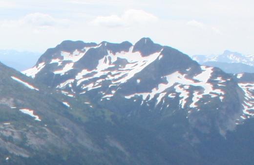
Coquihalla Mountain 
Northern flank of Coquihalla MountainElevation 2,157 m (7,077 ft) Prominence 816 m (2,677 ft) Listing List of volcanoes in Canada List of Cascade volcanoes Location Location British Columbia, Canada Range Bedded Range Coordinates 49°31′30.0″N 121°03′36.0″W / 49.525°N 121.06°W Topo map NTS 92H/11 Geology Type Stratovolcano Age of rock 22 million years Volcanic arc/belt Cascade Volcanic Arc Pemberton Volcanic Belt Last eruption 21 million years Coquihalla Mountain is an extinct stratovolcano in Similkameen Country, southwestern British Columbia, Canada, located 10 km (6.2 mi) south of Falls Lake and 22 km (14 mi) west of Tulameen between the Coquihalla and Tulameen rivers. With a topographic prominence of 816 m (2,677 ft), it towers above adjacent mountain ridges. It is the highest mountain in the Bedded Range of the northern Canadian Cascades with an elevation of 2,157 m (7,077 ft) and lies near the physiographic boundaries with the Coast Mountains on the west and the Interior Plateau on the east.
Contents
Geology
Coquihalla Mountain is a major preserved feature in the Miocene age Pemberton Volcanic Belt that was erupting about 21 to 22 million years ago.[1] Like the Pemberton Volcanic Belt, Coquihalla Mountain formed as result of Cascadia subduction.
See also
- Jim Kelly Peak
- Volcanism of Canada
- Volcanism of Western Canada
- List of volcanoes in Canada
- Garibaldi Volcanic Belt
References
External links
- "Coquihalla Mountain". Geographical Names Data Base. Natural Resources Canada. http://geonames.nrcan.gc.ca/search/unique_e.php?id=JAXHG&output=xml. Retrieved 2010-06-02.
- "Coquihalla Mountain". Bivouac.com. http://www.bivouac.com/MtnPg.asp?MtnId=1131. Retrieved 2010-06-02.
- "Coquihalla Mountain, British Columbia". Peakbagger.com. http://www.peakbagger.com/peak.aspx?pid=1663. Retrieved 2010-06-02.
- Geology of the Coquihalla Volcanic Complex, southwestern British Columbia
Categories:- Volcanoes of British Columbia
- Mountains of British Columbia
- Stratovolcanoes
- Cascade Volcanoes
- Subduction volcanoes
- Extinct volcanoes
- Canadian Cascades
- Miocene volcanoes
- Polygenetic volcanoes
- British Columbia geography stubs
Wikimedia Foundation. 2010.