Coquihalla River

Coquihalla River
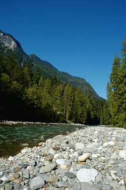
The Coquihalla River, just outside Hope, British Columbia

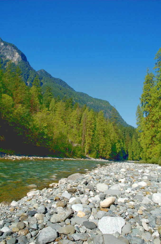
The Coquihalla River (pronounced /ˌkɒkɪˈhælə/, especially locally; euphemistically /ˌkoʊkɪˈhælə/) is located in the Cascade Mountains near the town of Hope, British Columbia. It originates in the Coquihalla Lakes and empties into the Fraser River at Hope.

The Coquihalla River divides two portions of the Cascades, the Skagit Range and the Hozameen Range. The river flows through a deep, narrow valley, dropping 3,400 feet (1,000 m) in 33 miles (53 km), a tumultuous course that creates an incessant roar.[1]

Kw'ikw'iya:la in the Halq'emeylem language of the Stó:lō, is a place name meaning "stingy container". It refers specifically to a fishing rock near the mouth of what is now known as the Coquihalla River. This rock is a good platform for spearing salmon. According to Stó:lō oral history, the skw'exweq (water babies, underwater people) who inhabit a pool close by the rock, would swim out and pull the salmon off the spears, allowing only certain fisherman to catch the salmon.

The Coquihalla Highway, which runs from Hope to Kamloops, derives its name from running alongside this river between Hope and the toll booth about 50 km away. It is the more widespread use of the name via that highway that is responsible for the euphemistic pronunciation.

Portions of the motion picture First Blood were filmed there.

See also

  • List of British Columbia rivers
  • Zoa Peak

References

  1. ^ Beckey, Fred (2009). Cascade Alpine Guide: Climbing and High Routes: Rainy Pass to Fraser River (3rd ed.). The Mountaineers. pp. 185. ISBN 9780898864236. 

External links

Coordinates: 49°24′N 121°26′W / 49.4°N 121.433°W / 49.4; -121.433


Wikimedia Foundation. 2010.

Игры ⚽ Поможем написать курсовую

Look at other dictionaries:

  • Coquihalla River — Coquihalla 49°24′N 121°26′W / 49.4, 121.433 Coquihalla …   Wikipédia en Français

  • Coquihalla River — Coquihalla RiverVorlage:Infobox Fluss/GKZ fehlt Lage British Columbia, Kanada Flusssystem Fraser RiverVorlage:Infobox Fluss/FLUSSSYSTEM falsch Vorlage:Infobox Fluss/ABFLUSSWEG fehltVorlage:Infobox Fluss/QUELL …   Deutsch Wikipedia

  • Coquihalla River Provincial Park — is a provincial park in British Columbia, Canada, located 25km north of the town of Hope on BC Highway 5 adjacent to the Coquihalla River.[1] References ^ BC Parks: Coquihalla River Provincial Park Co …   Wikipedia

  • Coquihalla Pass — Coquihalla Summit Elevation 1,244 m (4,081 ft) Traversed by Highway 5 (Coquihalla Highway) …   Wikipedia

  • Coquihalla — may refer to: British Columbia Highway 5, also known as Coquihalla highway Coquihalla River Coquihalla Pass Okanagan Coquihalla, a federal electoral district in British Columbia Coquihalla Canyon Provincial Park Coquihalla River Provincial Park …   Wikipedia

  • Coquihalla — steht für Coquihalla Highway, eine Straße in British Columbia (Kanada) Coquihalla River, einen Fluss in British Columbia (Kanada) Coquihalla Pass, eine Bergkuppe entlang des Coquihalla Highways Okanagan Coquihalla, ein Bezirk in British Columbia …   Deutsch Wikipedia

  • Coquihalla — 49°24′N 121°26′W / 49.4, 121.433 …   Wikipédia en Français

  • Coquihalla Canyon Provincial Park — Coquihalla Canyon Provincial Park, popularly called The Othello Tunnels is a provincial park located near Hope, British Columbia focused on the canyon of the Coquihalla River and a decommissioned railway grade, now a walking trail, leading… …   Wikipedia

  • Coquihalla Range — The Coquihalla Range is an informally named mountain range in British Columbia that lies between the Coquihalla River and the Fraser Canyon. It is part of the Canadian Cascades, which are officially named the Cascade Mountains[1] and are the… …   Wikipedia

  • Parc provincial de Coquihalla Canyon — Othello Tunnels Catégorie UICN III (monument naturel) Pays …   Wikipédia en Français

Share the article and excerpts

Direct link
Do a right-click on the link above
and select “Copy Link”