- St George's Church, Stalybridge
-
St George's Church, Stalybridge 
St George's Church, StalybridgeCoordinates: 53°29′15″N 2°03′28″W / 53.4874°N 2.0579°W OS grid reference SJ 963 990 Location Church Walk, Stalybridge,
Greater ManchesterCountry England Denomination Anglican Website St George, Stalybridge History Founded 3 September 1838 Dedication Saint George Consecrated 24 June 1840 Architecture Status Parish church Functional status Active Heritage designation Grade II Designated 6 February 1986 Architect(s) Edmund Sharpe Architectural type Church Style Gothic Revival Groundbreaking 1838 Completed 1840 Construction cost £4,012
(£280,000 as of 2011)[1]Specifications Materials Stone, slate roof Administration Parish St George, Stalybridge Deanery Ashton-under-Lyne Archdeaconry Rochdale Diocese Manchester Province York Clergy Vicar(s) Rev Ian Stubbs St George's Church, Stalybridge, stands in Church Walk, Stalybridge, Greater Manchester, England. It is an active Anglican parish church in the deanery of Ashton-under-Lyne, the archdeaconry of Rochdale and the diocese of Manchester.[2] The church has been designated by English Heritage as a Grade II listed building.[3]
Contents
History
Since 1776 there has been a chapel of ease dedicated to Saint George on the north bank of the River Tame overlooking its main crossing point. This replaced and earlier chapel of ease that had been damaged by a landslip in 1774. In the early part of the 19th century the fabric of the church had deteriorated and it was considered to be unsafe. In 1835 the incumbent approached Lord Stamford, the patron of the living, to provide land for a new church on a different site. Land was found for this about 0.25 miles (0.4 km) to the northwest.[4]
The foundation stone was laid on 3 September 1838, the same day as the foundation stone for Sharpe's St John's Church at Dukinfield, by Lord Viscount Combermere, a former Grand Master of the local Masonic Lodge. It was consecrated on 24 June 1840 by the Bishop of Chester.[4] The new church was also dedicated to Saint George. It was a Commissioners' church designed by the Lancaster architect Edmund Sharpe.[5] It cost £4,012 (£280,000 as of 2011)[1] to build and £2,712 of this was met by a grant from the Church Building Commission.[6]
However the congregation of the old St George's Church did not want to leave their building for the new church, and successfully petitioned for the old church to be retained rather than demolished. It re-opened on 29 September 1843 with a new incumbent, separate from that of the new church. Nonetheless there was serious tension between the two churches, which was not resolved until the incumbent of the new church died suddenly in 1847.[4]
In 1881 the north and south galleries were removed from the church. The west gallery was not removed until 1976 when the interior of the church was divided by a brick wall. The portion to the east of the wall continued in use as a church, and the portion to the west was modified "for parochial, social, educational, and recreational facilities".[4]
Architecture
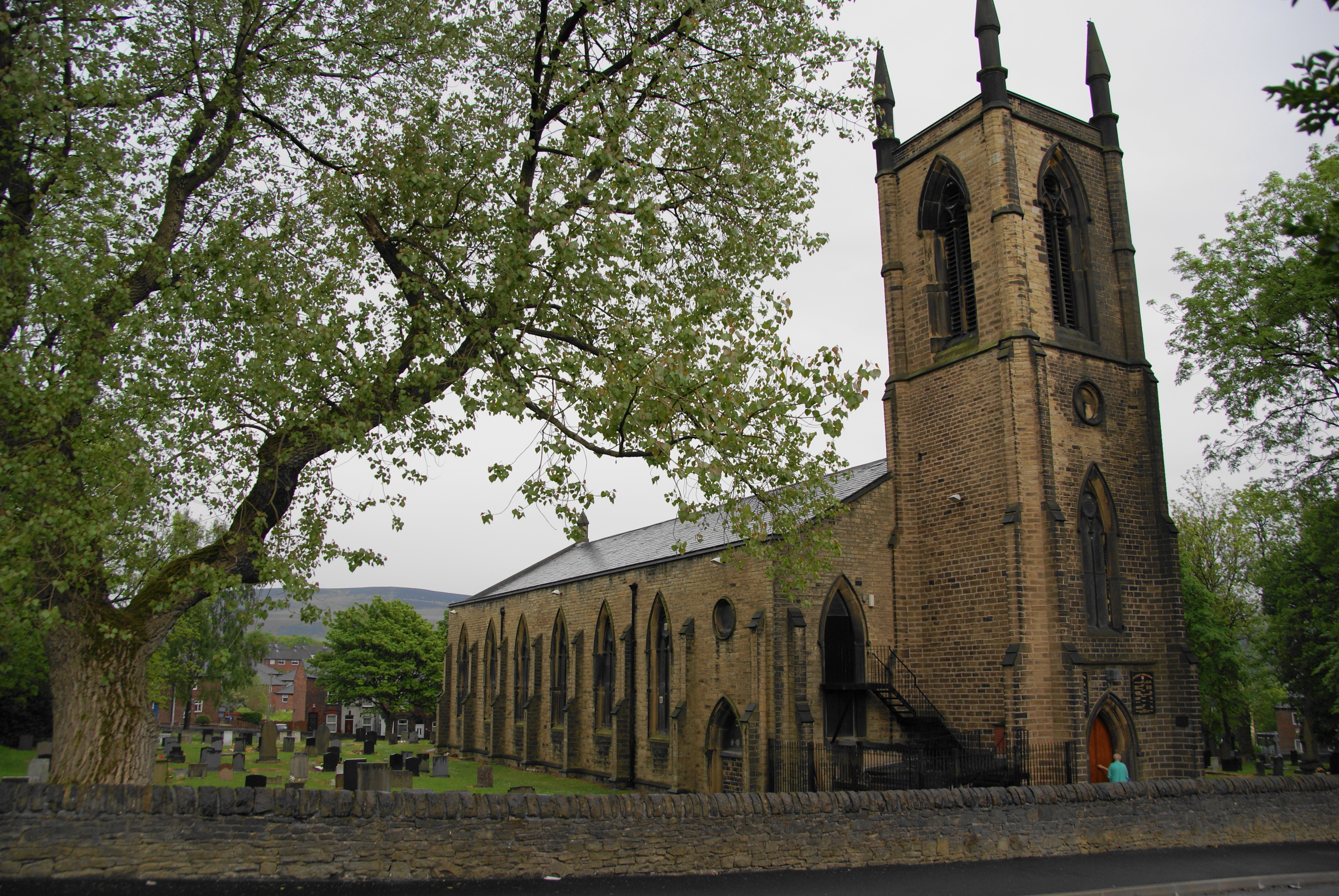
The church is built in stone with a slate roof. Its plan consists of a seven-bay nave with north and south aisles under one roof, a small single-bay chancel and a west tower. The tower is in three stages with corner buttresses rising to pinnacles.[3] The windows are thin lancet windows, containing Geometrical tracery. The east window consists of two pairs of lancet windows, each surmounted by a round window, with another round window above them.[4] The interior of the church has been divided. The arcades are carried on octagonal piers. The alabaster font is in the form of an angel holding a shell. The stained glass is by Lightfoot.[3] The three-manual organ was built by Renn & Wadsworth.[7]
See also
- List of architectural works by Edmund Sharpe
- List of Commissioners' churches in Northeast and Northwest England
References
- ^ a b UK CPI inflation numbers based on data available from Lawrence H. Officer (2010) "What Were the UK Earnings and Prices Then?" MeasuringWorth.
- ^ Stalybridge, St George, Church of England, http://www.achurchnearyou.com/stalybridge-st-george/, retrieved 25 March 2010
- ^ a b c "Church of St George, Stalybridge", The National Heritage List for England (English Heritage), 2011, http://list.english-heritage.org.uk/resultsingle.aspx?uid=1162957, retrieved 26 July 2011
- ^ a b c d e Hughes, John M. (2010), Edmund Sharpe: Man of Lancaster, John M. Hughes, pp. 163–164, 166
- ^ Pevsner, Nikolaus; Edward Hubbard (2003) [1971]. The Buildings of England: Cheshire. New Haven and London: Yale University Press. p. 336. ISBN 0 300 09588 0.
- ^ Port, M. H. (2006), 600 New Churches: The Church Building Commission 1818-1856 (2nd ed.), Reading: Spire Books, p. 331, ISBN 978-1-904965-08-4
- ^ Cheshire, Stalybridge, St George, British Institute of Organ Studies, http://www.npor.org.uk/cgi-bin/Rsearch.cgi?Fn=Rsearch&rec_index=N02082, retrieved 25 March 2010
External links
Categories:- Church of England churches in Greater Manchester
- Grade II listed churches
- Grade II listed buildings in Greater Manchester
- Gothic Revival architecture in England
- Religious buildings completed in 1840
- 19th-century Church of England church buildings
- Anglican congregations established in the 19th century
- Anglican Diocese of Manchester
- Edmund Sharpe buildings
- Commissioners' churches
Wikimedia Foundation. 2010.