- Grizzly Flats, California
-
Grizzly Flats — census-designated place — Location in California
 Grizzly Flats
Coordinates: 38°38′11″N 120°31′39″W / 38.63639°N 120.5275°WCoordinates: 38°38′11″N 120°31′39″W / 38.63639°N 120.5275°W Country  United States
State  California
County El Dorado County Area[1] - Total 6.629 sq mi (17.169 km2) - Land 6.629 sq mi (17.169 km2) - Water 0 sq mi (0 km2) 0% Elevation[2] 3,868 ft (1,179 m) Population (2010) - Total 1,066 - Density 160.8/sq mi (62.1/km2) ZIP code 95636 Area code(s) 530 GNIS feature IDs 1658675; 2628736 U.S. Geological Survey Geographic Names Information System: Grizzly Flats, California; U.S. Geological Survey Geographic Names Information System: Grizzly Flats, California Grizzly Flats (formerly, Grizzly Flat and Chickenmasee)[3] is a census-designated place[4] in El Dorado County, California.[2] It is located on the Southern Pacific Railroad 11 miles (18 km) southeast of Camino,[3] at an elevation of 3868 feet (1179 m).[2] The population at the 2010 census was 1,066.
The name was given by miners who were surprised by a grizzly bear in 1850.[3] A post office opened at Grizzly Flats in 1855.[3]
Contents
Demographics
2010
The 2010 United States Census[5] reported that Grizzly Flats had a population of 1,066. The population density was 160.8 people per square mile (62.1/km²). The racial makeup of Grizzly Flats was 954 (89.5%) White, 6 (0.6%) African American, 14 (1.3%) Native American, 7 (0.7%) Asian, 2 (0.2%) Pacific Islander, 19 (1.8%) from other races, and 64 (6.0%) from two or more races. Hispanic or Latino of any race were 96 persons (9.0%).
The Census reported that 1,066 people (100% of the population) lived in households, 0 (0%) lived in non-institutionalized group quarters, and 0 (0%) were institutionalized.
There were 432 households, out of which 111 (25.7%) had children under the age of 18 living in them, 259 (60.0%) were opposite-sex married couples living together, 17 (3.9%) had a female householder with no husband present, 23 (5.3%) had a male householder with no wife present. There were 22 (5.1%) unmarried opposite-sex partnerships, and 8 (1.9%) same-sex married couples or partnerships. 104 households (24.1%) were made up of individuals and 39 (9.0%) had someone living alone who was 65 years of age or older. The average household size was 2.47. There were 299 families (69.2% of all households); the average family size was 2.94.
The population was spread out with 235 people (22.0%) under the age of 18, 54 people (5.1%) aged 18 to 24, 215 people (20.2%) aged 25 to 44, 386 people (36.2%) aged 45 to 64, and 176 people (16.5%) who were 65 years of age or older. The median age was 46.8 years. For every 100 females there were 109.4 males. For every 100 females age 18 and over, there were 106.2 males.
There were 645 housing units at an average density of 97.3 per square mile (37.6/km²), of which 370 (85.6%) were owner-occupied, and 62 (14.4%) were occupied by renters. The homeowner vacancy rate was 3.1%; the rental vacancy rate was 8.8%. 901 people (84.5% of the population) lived in owner-occupied housing units and 165 people (15.5%) lived in rental housing units.
2000
As of 2000, there were 647 people residing in the area[6], with 346 males and 301 females. The population density was 70.5 people per square mile (27.2/km²). The average household size was 1.8[7] and the median age 44.1. The median income for a household was $40,526, with 28% of the population over 25 years of age having a college degree.
External links
References
- ^ U.S. Census
- ^ a b c U.S. Geological Survey Geographic Names Information System: Grizzly Flats, California
- ^ a b c d Durham, David L. (1998). California's Geographic Names: A Gazetteer of Historic and Modern Names of the State. Quill Driver Books. p. 495. ISBN 9781884995149.
- ^ U.S. Geological Survey Geographic Names Information System: Grizzly Flats, California
- ^ All data are derived from the United States Census Bureau reports from the 2010 United States Census, and are accessible on-line here. The data on unmarried partnerships and same-sex married couples are from the Census report DEC_10_SF1_PCT15. All other housing and population data are from Census report DEC_10_DP_DPDP1. Both reports are viewable online or downloadable in a zip file containing a comma-delimited data file. The area data, from which densities are calculated, are available on-line here. Percentage totals may not add to 100% due to rounding. The Census Bureau defines families as a household containing one or more people related to the householder by birth, opposite-sex marriage, or adoption. People living in group quarters are tabulated by the Census Bureau as neither owners nor renters. For further details, see the text files accompanying the data files containing the Census reports mentioned above.
- ^ http://www.fizber.com/sale-by-owner-home-services/california-city-grizzly-flats-profile.html
- ^ http://www.publicschoolreview.com/town_schools/stateid/CA/townid/1613
Municipalities and communities of El Dorado County, California Cities 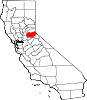
CDPs Auburn Lake Trails | Cameron Park | Camino | Cold Springs | Coloma | Diamond Springs | El Dorado Hills | Georgetown | Grizzly Flats | Pollock Pines | Shingle Springs | Tahoma‡
Unincorporated
communitiesApex | Arroyo Vista | Aukum | Avinsino Corner | Balderson Station | Bonetti | Brandon Corner | Brela | Briarwood Canyon | Bryants | Buckeye | Buffalo Hill | Bullard | Caldor | Cambridge Oaks | Cameron Airpark Estates | Camino Heights | Camp Richardson | Campana | Cedar Grove | Clarksville | Claussenius | Cool | Coyoteville | Crescent Ridge Village | Croft | Crown Village | Darlington | Deer Park | Deer View | Ditch Camp Five | Dugan | Echo Lake | El Dorado | Emerald Bay | Equestrian Village | Fair Play | Fairbanks | Fallen Leaf | Five Mile Terrace | Flonellis | Fornis | Fountain Place | Franciscan Village | Frenchtown | Fresh Pond | Garden Valley | Gilberts | Glenridge Park | Gold Hill | Gold Ridge | Gold Trail Park | Governors Village | Green Springs Ranch | Green Springs Valley | Green Valley Acres | Greenwood | Griminger | Grizzly Peak | Happy Valley | Hickok Ranch | Hidden Valley | Highland Village | Jayhawk | Jones Place | Kelsey | Kingsville | Kiva Beach | Kyburz | La Cresta Village | Lake Hills Estates | Lake Valley | Lakeridge Oaks | Lakewood Sierra | Latrobe | Leonardi | Little Norway | Lotus | Lower Forni | Manzanita Acres | Marble Mountain | Mariemont | Marina Village | McConnel Place | McManus | Meadow Brook | Meeks Bay | Meiss | Melsons Corner | Meyers | Morrison | Motor City | Nashville | Nebelhorn | Newtown | North Placerville | Oak Creek Hills | Oak Ridge Village | Oak Tree Village | Old Fort Jim | Old Pino | Omo Ranch | Outingdale | Pacific | Pacific House | Park Village | Perks Corner | Phillips | Pilliken | Pilot Hill | Pino Grande | Pleasant Valley | Pomins | Quintette | Raffetto | Rancho del Sol | Rescue | Ridgeview Village | Riverton | Saint Andrews Village | Sciots Camp | Short Place | Shrub | Sierra Springs | Skinners | Sly Park | Smithflat | Soapweed | Somerset | Spanish Flat | Sprekelsville | Spring Creek | Spring Valley | Springfield Meadows | Stonegate Village | Strawberry | Summit Village | Sweeneys Crossing | Tallac Village | Tiger Lily | Twin Bridges | Tylers Corner | Upper Forni | Van Vleck | Virner | Volcanoville | Voss | Waterford Village | White Hall | Winterhaven Village | Zee Estates
Former
settlementsAurum City | Bamom | Bennett | Buckeye Flat | Canton | Canyon | Cedar Creek Camp | Chicken Flat | Chili Bar | Cincinnati | Cummings | Dogtown | Dufftown | Euchre Diggings | Flora's | Fornis | Frosts | Golden | Green Springs | Green Valley | Greenwood Camp | Higgins Point | Hitchcock Ranch | Indak | Jacobsen | Jurgens | Koloma | Lava | Lawrenceberg | Live Oak Bar | Middletown | Missouri House | Mormon Tavern | Onchomo | Opok | Peru | Pleasant Flat | Powningville | River Hill | Rodwell | Rubicon | Rubicon Lodge | Rubicon Springs | Sailors Flat | Saint Lawrence | Salmon Falls | Siwim Pakan | Slatington | Snyders Bar | Sportsmans Hall | Stag Flat | Stony Bar | Swift | Texas Bar | Tchikimisi | Union Flat | Uniontown | Uno | Urban | Wentworth Springs | Yalisumni | Youngs | Zodoc
Footnotes ‡This CDP also has portions in an adjacent county or counties
Categories:- Census-designated places in El Dorado County, California
- Unincorporated communities in California


Wikimedia Foundation. 2010.