- Georgetown, California
Infobox Settlement
official_name = Georgetown, California
settlement_type = CDP
imagesize =
image_caption =
image_
imagesize =
image_caption =
image_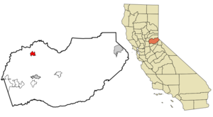
mapsize = 250x200px
map_caption = Location in El Dorado County and the state ofCalifornia
mapsize1 =
map_caption1 =
subdivision_type = Country
subdivision_type1 = State
subdivision_type2 = County
subdivision_name =United States
subdivision_name1 =California
subdivision_name2 = El Dorado
government_type =
leader_title =
leader_name =
established_date =
area_magnitude =
area_total_km2 = 10.7
area_total_sq_mi = 4.1
area_land_km2 = 10.7
area_land_sq_mi = 4.1
area_water_km2 = 0
area_water_sq_mi = 0
elevation_ft = 2654
elevation_m = 809
population_as_of = 2000
population_footnotes =
population_total = 962
population_metro =
population_density_km2 = 89.9
population_density_sq_mi = 234.6
timezone = Pacific (PST)
utc_offset = -8
latd = 38 |latm = 54 |lats = 30 |latNS = N
longd = 120 |longm = 50 |longs = 4 |longEW = W
timezone_DST = PDT
utc_offset_DST = -7
postal_code_type =ZIP code
postal_code = 95634
area_code = 530
blank_name = FIPS code
blank_info = 06-29350
blank1_name = GNIS feature ID
blank1_info = 1658606
footnotes =
website =Georgetown is a
census-designated place (CDP) in El Dorado County,California ,United States . It is part of the Sacramento–Arden-Arcade–Roseville Metropolitan Statistical Area. The population was 962 at the 2000 census. The town is registered asCalifornia Historical Landmark #484.History
Founded
August 7 ,1849 , byGeorge Phipps and party, Georgetown was nicknamed "Growlersburg" because of the heavy nuggets that "growled" in the miners' pans. After the disastrous fire of 1852 the old town was moved from the canyon in lower Main Street to its present site, and, unique in early-day planning, Main Street was laid out convert|100|ft|m wide, with side streets convert|60|ft|m. The hub of an immensely rich gold mining area, Georgetown had a population of about three thousand in 1854-56.Geography
According to the
United States Census Bureau , the CDP has a total area of 4.1 square miles (10.7 km²), of which, 4.1 square miles (10.7 km²) of it is land and 0.24% is water.Demographics
As of the
census GR|2 of 2000, there were 962 people, 389 households, and 266 families residing in the CDP. Thepopulation density was 233.4 people per square mile (90.2/km²). There were 423 housing units at an average density of 102.6/sq mi (39.6/km²). The racial makeup of the CDP was 95.11% White, 0.10% African American, 1.35% Native American, 1.35% Asian, 0.42% from other races, and 1.66% from two or more races. 3.74% of the population were Hispanic or Latino of any race.There were 389 households out of which 28.3% had children under the age of 18 living with them, 54.5% were married couples living together, 8.5% had a female householder with no husband present, and 31.4% were non-families. 25.7% of all households were made up of individuals and 11.1% had someone living alone who was 65 years of age or older. The average household size was 2.46 and the average family size was 2.92.
In the CDP the population was spread out with 23.6% under the age of 18, 8.2% from 18 to 24, 22.6% from 25 to 44, 28.9% from 45 to 64, and 16.7% who were 65 years of age or older. The median age was 42 years. For every 100 females there were 100.8 males. For every 100 females age 18 and over, there were 100.3 males.
The median income for a household in the CDP was $41,111, and the median income for a family was $42,609. Males had a median income of $39,934 versus $40,208 for females. The
per capita income for the CDP was $17,582. About 13.4% of families and 15.8% of the population were below thepoverty line , including 17.5% of those under age 18 and 5.2% of those age 65 or over.Politics
In the state legislature Georgetown is located in the 1st Senate District, represented by Republican
Dave Cox , and in the 4th Assembly District, represented by RepublicanTed Gaines . Federally, Georgetown is located inCalifornia's 4th congressional district , which has a Cook PVI of R +11 [cite web | title = Will Gerrymandered Districts Stem the Wave of Voter Unrest? | publisher = Campaign Legal Center Blog | url=http://www.clcblog.org/blog_item-85.html | accessdate = 2007-10-20] and is represented by RepublicanJohn Doolittle .References
External links
Wikimedia Foundation. 2010.