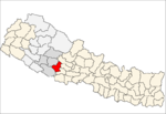
- Maranthana
-
Maranthana
मरन्ठाना— Village Development Committee — Location in Nepal Coordinates: 28°07′N 82°55′E / 28.11°N 82.91°ECoordinates: 28°07′N 82°55′E / 28.11°N 82.91°E Country  Nepal
NepalRegion Mid-Western Zone Rapti Zone District Pyuthan District VDC Maranthana Wards Population (2001 Census[1]) - Total 4,747 922 households Time zone Nepal Time (UTC+5:45) Maranthana is a town and Village Development Committee in Pyuthan, a Middle Hills district of Rapti Zone, western Nepal.
Villages in this VDC[2]
Ward Lat. Lon Elev. Amdanda आमडाँडा 28°07'N 82°54'E 1,070m Anp Pata आँप पाटा 28°06'N 82°56'E 1,120 Antar Tol अन्तर टोल 28°07'N 82°56'E 1,490 Badara बडारा 28°07'N 82°53'E 802 Balde बल्दे 28°06'N 82°55'E 1,370 Bhandari Pakhara भँडारी पखरा 28°08'N 82°55'E 1,210 Bhedikhor भेडीखोर 28°06'N 82°57'E 1,530 Bhusbang भुसबाङ 28°07'N 82°55'E 950 Chhepane छेपाने 5 28°06'N 82°55'E 1,315 Chyaukot च्याउकोट 28°05'N 82°56'E 1,330 Dubichaur दुबीचौर 28°07'N 82°54'E 1,165 Gahatero गहतेरो 28°05'N 82°54'E 1,410 Gandapani गाँडापानी 28°06'N 82°56'E 1,270 Gurigaun गुरीगाउँ 28°07'N 82°55'E 950 Handigaira हाँडीगैरा 28°07'N 82°54'E 850 Jahane Pokhara जहने पोखरा 28°08'N 82°55'E 1,319 Jaikharka जैखर्क 28°07'N 82°54'E 1,358 Jaisi Dhage जैसी धागे 28°07'N 82°56'E 1,290 Kalleri कल्लेरी 28°06'N 82°56'E 1,205 Kaphal Thuto काफल ठुटो 28°06'N 82°55'E 1,179 Kauchhe काउछे 28°06'N 82°56'E 1,125 Kharibot खरीबोट 28°07'N 82°54'E 855 Kholabistagaun खोलाबिष्टगाउँ 28°05'N 82°57'E 1,290 Kochyan कोच्यान 28°07'N 82°53'E 1,138 Kolchhapa कोलछापा 28°08'N 82°55'E 870 Kotdharo कोटधारो 28°06'N 82°55'E 1,121 Kotgaun कोटगाउँ 28°06'N 82°54'E 1,571 Moreng मोरेङ 4 28°06'N 82°56'E 1,510 Nepane नेपाने 7 28°06'N 82°54'E 1,325 Paharpakha पाहारपाखा 28°07'N 82°55'E 910 Pakhachiti पाखाचिटी 8 28°06'N 82°56'E 1,230 Patijhula पातीझूला 28°06'N 82°57'E 1,698 Pipalneta पिपलनेटा 28°06'N 82°55'E 1,620 Rotepani रोटेपानी 28°07'N 82°55'E 1,224 Saribang सरिबाङ 9 28°07'N 82°53'E 870 Sripale श्रीपाले 28°07'N 82°56'E 1,430 Subera सुबेरा 28°06'N 82°57'E 1,218 Syalpakha स्यालपाखा 28°07'N 82°54'E 918 Tallo Dhage तल्लो धगे 28°07'N 82°56'E 1,370 Thulasing ठूलासिङ 3 28°07'N 82°56'E 1,010 Thulo Gaira ठूलो गैरा 28°07'N 82°56'E 1,250 Todke टोड्के 28°07'N 82°54'E 1,300 Upallo Dhage उपल्लो धगे 28°07'N 82°56'E 1,410 References
- ^ "Nepal Census 2001". Nepal's Village Development Committees. Digital Himalaya. http://www.digitalhimalaya.com/collections/nepalcensus/form.php?selection=1. Retrieved 21 September 2008.
- ^ "Index of Geographical Names of Nepal, Volume IV: Mid Western Development Region, List of Settlements, Pyuthan". Government of Nepal, National Geographic Information Infrastructure Program. http://www.ngiip.gov.np/pdf/vol4pyuthan.pdf. Retrieved 2011-03-12.
External links
Arkha, Badikot, Bangesal, Baraula, Barjiwang, Belwaspur, Bhingri, Bijaya Nagar, Bijubar, Bijuli, Chuja, Dakhakuwadi Salghari, Damri, Dangwang, Dharamawati, Dharampani, Dhobaghat, Dhuwang, Dungegadi, Gothiwang, Hansapur, Jumrikanda, Khaira, Khawang, Khung, Kochiwang, Ligha, Liwang, Lung, Majhakot, Maranthana, Markawang, Narikot, Naya Gaun, Okharkot, Pakala,
Phopli, Puja, Rajbara, Ramdi, Ruspur Kot, Sari, Swargadwarikhal, Syauliwang, Tarwang, Tiram, Tusara, Wangemarkot Categories:
- Populated places in Pyuthan District
- Rapti Zone geography stubs
Wikimedia Foundation. 2010.

