- Dhobaghat
-
Dhobaghat (Udayapurkot)
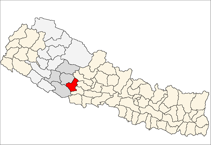
धोबाघाट (उदयपुरकोट)— Village Development Committee — Location in Nepal
 Dhobaghat (Udayapurkot)
Coordinates: 28°04′N 82°51′E / 28.07°N 82.85°ECoordinates: 28°04′N 82°51′E / 28.07°N 82.85°E Country  Nepal
NepalRegion Mid-Western Zone Rapti Zone District Pyuthan District VDC Dhobaghat (Udayapurkot) Wards Population (2001 Census[1]) – Total 2,157 396 households Time zone Nepal Time (UTC+5:45) Dhobaghat -- also called Udayapurkot --- is a village and Village Development Committee in Pyuthan, a Middle Hills district of Rapti Zone, western Nepal.
Contents
Etymology
dhoba (Nepali: धोबा) - washing clothing.
ghat (Nepali: घाट) - shore or bank of a river; stone platform or steps on a river bank
Thus: place by river for washing clothes.udaya (Nepali: उदय)- rising, ascent, dawning.
pur (Nepali: पुर)- town or city.
kot (Nepali: कोट)- guardroom, prison, police station.
Thus: Dawn city police postVillages in VDC[2]
Ward Lat. Lon Elev. Anpchaur आँपचौर 28°03'N 82°43'E 690m Banera Khajuri बनेरा खजुरी 28°04'N 82°44'E 1,515 Bhanyerchaur भँयेरचौर 28°03'N 82°41'E 781 Bhedabari भेडाबारी 28°04'N 82°45'E 1,250 Burdi बुर्दी 28°02'N 82°44'E 630 Charpani चारपानी 28°04'N 82°42'E 1,310 Dhobaghat धोबाघाट 3 28°04'N 82°44'E 1,250 Gorule गोरुले 28°03'N 82°43'E 639 Mas Pokhari मास पोखरी 28°03'N 82°44'E 1,470 Mukhchaur मुखचौर 6 28°03'N 82°42'E 710 Rithekholagaun रिठेखोलागाउँ 28°04'N 82°42'E 1,470 Salli Kharka सल्ली खर्क 8 28°05'N 82°45'E 1,315 Sirbari सिरबारी 28°05'N 82°44'E 1,478 Udaypurkot उदयपुरकोट 9 28°03'N 82°45'E 1,430 References
- ^ "Nepal Census 2001". Nepal's Village Development Committees. Digital Himalaya. http://www.digitalhimalaya.com/collections/nepalcensus/form.php?selection=1. Retrieved 21 September 2008.
- ^ "Index of Geographical Names of Nepal, Volume IV: Mid Western Development Region, List of Settlements, Pyuthan". Government of Nepal, National Geographic Information Infrastructure Program. http://www.ngiip.gov.np/pdf/vol4pyuthan.pdf. Retrieved 2011-03-12.
External links
Arkha, Badikot, Bangesal, Baraula, Barjiwang, Belwaspur, Bhingri, Bijaya Nagar, Bijubar, Bijuli, Chuja, Dakhakuwadi Salghari, Damri, Dangwang, Dharamawati, Dharampani, Dhobaghat, Dhuwang, Dungegadi, Gothiwang, Hansapur, Jumrikanda, Khaira, Khawang, Khung, Kochiwang, Ligha, Liwang, Lung, Majhakot, Maranthana, Markawang, Narikot, Naya Gaun, Okharkot, Pakala,
Phopli, Puja, Rajbara, Ramdi, Ruspur Kot, Sari, Swargadwarikhal, Syauliwang, Tarwang, Tiram, Tusara, Wangemarkot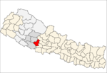 Categories:
- Populated places in Pyuthan District
- Rapti Zone geography stubs

Wikimedia Foundation. 2010.