- Highlands East, Ontario
-
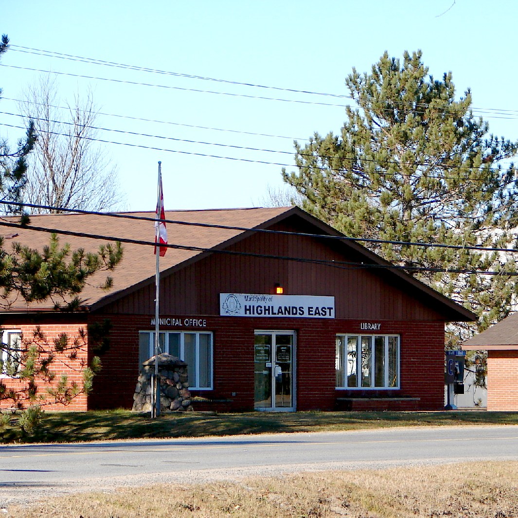
Municipality of Highlands East — Township — Town hall in Cardiff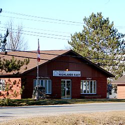
Coordinates: 44°58′N 78°15′W / 44.967°N 78.25°W Country  Canada
Province  Ontario
District Haliburton County Established 2001 Government – Type Township – Reeve Dave Burton – Governing Body Council of the Municipality of Highlands East – MP Barry Devolin (CPC) – MPP Rick Johnson (LIB) Population (2006)[1] – Total 3,089 Time zone EST (UTC-5) – Summer (DST) EDT (UTC-4) Postal code span K0L 3C0 Area code(s) 705 Website www.highlandseast.ca Highlands East (2006 population 3,089) is a township located in Haliburton County, Ontario, Canada.
Contents
History
The township was incorporated in 2001, upon the amalgamation of the former townships of Bicroft, Cardiff, Glamorgan and Monmouth.
Communities
Cardiff is a former mining community; the mines opened in 1956 and closed several years later. The chief mineral being mined in Cardiff was uranium. Cardiff is located on Highway 118 between the towns of Bancroft and Haliburton. The Cardiff Elementary School is a small school. The community also has a Royal Canadian Legion hall, a Catholic and United Church, as well as an outdoor pool which is popular during the summer. The entrance to the townsite, off of Highway 118, is marked by a large metal sculpture of a dragonfly.
Gooderham is bordered on the south by the Irondale River and Pine Lake to the north. It is located on a now defunct railway line, the IB&O Railroad, part of which has been since converted into a trail network. The village of Gooderham is at the intersection of the Monk Road from the east and the Buckhorn Road from the south. The origin of the name Gooderham is not known for sure although it is likely that it was named after a member of the distillery-owning Gooderham family donated money for a local church. In any case, it was called Gooderham by the time the first post office was established in 1873. The first mills were built by 1875 using the waterfall between Gooderham Lake and the Irondale River. Logging and farming were the original attractions of the Gooderham area and Gooderham still has an active lumber mill.
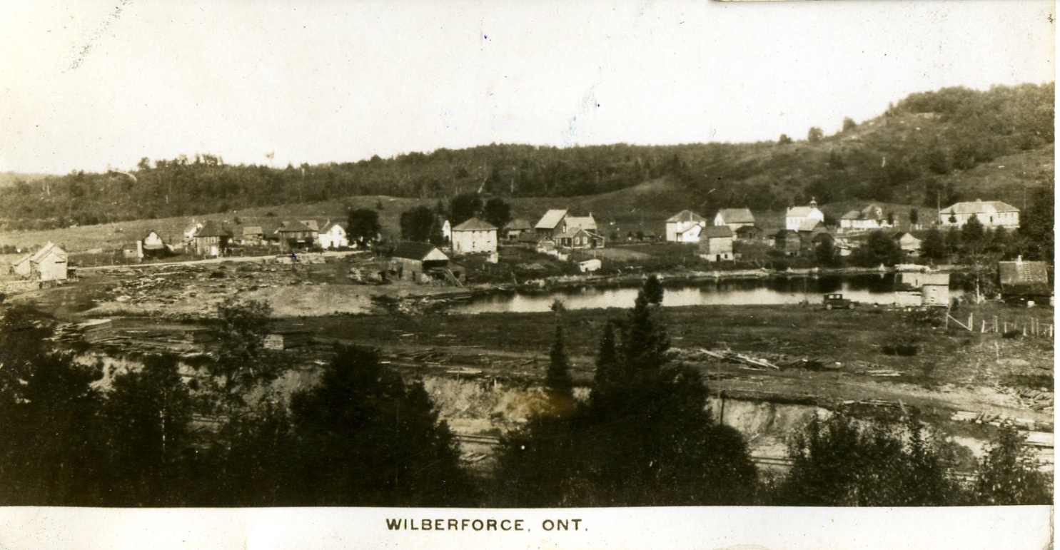
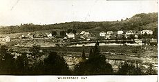 Wilberforce circa 1917
Wilberforce was established as "Pusey," a station on the Irondale, Bancroft and Ottawa Railway, and named for railway president Charles J. Pusey. This little railway had initially been built to carry iron ore from open pit mines at Irondale. Although the mines had closed, the railway had high hopes of extending to Bancroft and even higher hopes of reaching Ottawa. At Wilberforce where the railway skirted the southern shore of Pusey Lake, the Wilberforce Lumber Company put up a sawmill. In 1909 the Wilberforce mill was leased to James Lauder and Joseph Spears, of Toronto. The IB&O Railway was taken over by the Canadian Northern Railway in 1912. Messrs. Lauder and Spears along with Lucien B. Howland, (the former General Manager of the IB&O), looking for new business opportunities, acquired a sawmill on the new CNR line north of Parry Sound, Ontario. The three men eventually established the community of Lost Channel in the Parry Sound District, and went bankrupt in the process. Wilberforce is known among geocachers as the "Geocaching Capital of Canada."
The township also contains the smaller communities of Cheddar, Cope Falls, Deer Lake, Dyno Estates, Essonville, Harcourt, Highland Grove, Hotspur, Ironsides, Maxwells, Pusey, South Wilberforce, Tory Hill, Upper Paudash, Ursa and Ward.
Lakes
- Salerno Lake
- Paudash Lake
- Gooderham Lake previously Pine Lake
- Billings Lake previoulsy Wolf Lake
External links

Dysart et al Hastings Highlands Minden Hills 
Faraday  Highlands East

Galway-Cavendish and Harvey North Kawartha Categories:- Township municipalities in Ontario
- Municipalities in Haliburton County, Ontario
Wikimedia Foundation. 2010.