- Delmita, Texas
-
Delmita — Unincorporated community — Location within the state of Texas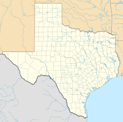
 Delmita
Coordinates: 26°40′48″N 98°24′45″W / 26.68°N 98.4125°WCoordinates: 26°40′48″N 98°24′45″W / 26.68°N 98.4125°W Country United States State Texas County Starr Elevation 272 ft (83 m) Time zone Central (CST) (UTC-6) – Summer (DST) CDT (UTC-5) ZIP codes 78536 FIPS code GNIS feature ID 1378207 Delmita is an unincorporated community in Starr County, Texas, United States. Its elevation is 272 feet (83 m).[1] Although Delmita is unincorporated, it has a post office, with the ZIP code of 78536.[2]
Originally founded as Zaragosa in 1919, the community's name was changed to Delmita on April 1, 1931 due to confusion with the Reeves County community of Saragosa. The community's first post office was established soon after the community itself, but a new post office was constructed in 1991. Delmita's importance has declined through the years; in 1940, it was the most important community in the northeastern part of the county, but it has since been overshadowed by San Isidro.[3]
References
- ^ U.S. Geological Survey Geographic Names Information System: Delmita, Texas
- ^ Zip Code Lookup
- ^ Delmita, Texas, Handbook of Texas Online, 2008-01-17. Accessed 2008-08-10.
External links
Municipalities and communities of Starr County, Texas Cities 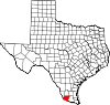
CDPs Alto Bonito | El Refugio | Falcon Heights | Falcon Village | Fronton | Garceno | La Casita-Garciasville | La Puerta | La Rosita | La Victoria | Las Lomas | Los Alvarez | Los Villareales | North Escobares | Roma Creek | Salineno | San Isidro | Santa Cruz
Unincorporated
communitiesDelmita | La Gloria | La Reforma | Santa Catarina | Santa Elena
Categories:- Populated places in Starr County, Texas
- Unincorporated communities in Texas


Wikimedia Foundation. 2010.