- Los Villareales, Texas
Infobox Settlement
official_name = Los Villareales, Texas
settlement_type = CDP
nickname =
motto =
imagesize =
image_caption =
image_
imagesize =
image_caption =
image_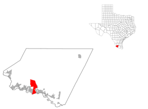
mapsize = 300px
map_caption =
mapsize1 =
map_caption1 =subdivision_type = Country
subdivision_name =United States
subdivision_type1 = State
subdivision_name1 =Texas
subdivision_type2 = County
subdivision_name2 = Starrgovernment_footnotes =
government_type =
leader_title =
leader_name =
leader_title1 =
leader_name1 =
established_title =
established_date =unit_pref = Imperial
area_footnotes =area_magnitude =
area_total_km2 = 53.1
area_land_km2 = 53.0
area_water_km2 = 0.1
area_total_sq_mi = 20.5
area_land_sq_mi = 20.5
area_water_sq_mi = 0.0population_as_of = 2000
population_footnotes =
population_total = 930
population_density_km2 = 17.5
population_density_sq_mi = 45.4timezone = Central (CST)
utc_offset = -6
timezone_DST = CDT
utc_offset_DST = -5
elevation_footnotes =
elevation_m = 66
elevation_ft = 217
latd = 26 |latm = 24 |lats = 6 |latNS = N
longd = 98 |longm = 52 |longs = 41 |longEW = Wpostal_code_type =
postal_code =
area_code =
blank_name = FIPS code
blank_info = 48-44168GR|2
blank1_name = GNIS feature ID
blank1_info = 1852734GR|3
website =
footnotes =Los Villareales is a
census-designated place (CDP) in Starr County,Texas ,United States . The population was 930 at the 2000 census.Geography
Los Villareales is located at coor dms|26|24|6|N|98|52|41|W|city (26.401720, -98.878187)GR|1.
According to the
United States Census Bureau , the CDP has a total area of 20.5square mile s (53.1km² ), of which, 20.5 square miles (53.0 km²) of it is land and 0.04 square miles (0.1 km²) of it (0.19%) is water.Demographics
As of the
census GR|2 of 2000, there were 930 people, 238 households, and 211 families residing in the CDP. Thepopulation density was 45.4 people per square mile (17.5/km²). There were 286 housing units at an average density of 14.0/sq mi (5.4/km²). The racial makeup of the CDP was 75.59% White, 23.23% from other races, and 1.18% from two or more races. Hispanic or Latino of any race were 96.45% of the population.There were 238 households out of which 58.4% had children under the age of 18 living with them, 70.6% were married couples living together, 14.7% had a female householder with no husband present, and 11.3% were non-families. 10.9% of all households were made up of individuals and 5.5% had someone living alone who was 65 years of age or older. The average household size was 3.91 and the average family size was 4.23.
In the CDP the population was spread out with 40.3% under the age of 18, 11.3% from 18 to 24, 26.5% from 25 to 44, 15.6% from 45 to 64, and 6.3% who were 65 years of age or older. The median age was 24 years. For every 100 females there were 93.3 males. For every 100 females age 18 and over, there were 85.0 males.
The median income for a household in the CDP was $18,352, and the median income for a family was $20,063. Males had a median income of $16,250 versus $33,594 for females. The
per capita income for the CDP was $5,763. About 39.5% of families and 45.6% of the population were below thepoverty line , including 49.3% of those under age 18 and 31.6% of those age 65 or over.Education
Los Villareales is served by the
Rio Grande City Consolidated Independent School District .References
External links
Wikimedia Foundation. 2010.