- North Escobares, Texas
-
North Escobares, Texas — CDP — 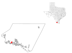
Coordinates: 26°24′55″N 98°58′45″W / 26.41528°N 98.97917°WCoordinates: 26°24′55″N 98°58′45″W / 26.41528°N 98.97917°W Country United States State Texas County Starr Area – Total 2.7 sq mi (6.9 km2) – Land 2.7 sq mi (6.9 km2) – Water 0.0 sq mi (0.0 km2) Elevation 184 ft (56 m) Population (2000) – Total 1,692 – Density 638.3/sq mi (246.5/km2) Time zone Central (CST) (UTC-6) – Summer (DST) CDT (UTC-5) FIPS code 48-52068[1] GNIS feature ID 1852745[2] North Escobares is a census-designated place (CDP) in Starr County, Texas, United States. The population was 1,692 at the 2000 census.
Contents
Geography
North Escobares is located at 26°24′55″N 98°58′45″W / 26.41528°N 98.97917°W (26.415328, -98.979029)[3].
According to the United States Census Bureau, the CDP has a total area of 2.7 square miles (6.9 km²), all of it land.
Demographics
As of the census[1] of 2000, there were 1,692 people, 412 households, and 390 families residing in the CDP. The population density was 638.3 people per square mile (246.5/km²). There were 505 housing units at an average density of 190.5/sq mi (73.6/km²). The racial makeup of the CDP was 99.47% White, 0.06% African American, 0.12% from other races, and 0.35% from two or more races. Hispanic or Latino of any race were 94.44% of the population.
There were 412 households out of which 72.8% had children under the age of 18 living with them, 68.4% were married couples living together, 23.5% had a female householder with no husband present, and 5.3% were non-families. 4.9% of all households were made up of individuals and 1.5% had someone living alone who was 65 years of age or older. The average household size was 4.11 and the average family size was 4.26.
In the CDP the population was spread out with 46.6% under the age of 18, 9.9% from 18 to 24, 28.8% from 25 to 44, 10.7% from 45 to 64, and 4.0% who were 65 years of age or older. The median age was 20 years. For every 100 females there were 88.6 males. For every 100 females age 18 and over, there were 82.4 males.
The median income for a household in the CDP was $15,958, and the median income for a family was $16,750. Males had a median income of $16,071 versus $6,250 for females. The per capita income for the CDP was $4,562. About 59.7% of families and 61.4% of the population were below the poverty line, including 67.1% of those under age 18 and 15.8% of those age 65 or over.
Education
Public education in the community of North Escobares is provided by the Roma Independent School District. Zoned campuses include Anna S. Canavan Elementary School (pre-kindergarten), either Ynes B. Elementary School or Emma Vera Elementary School (grades K-5), Ramiro Barrera Middle School (grades 6-8), and Roma High School [1] (grades 9-12).[4][5]
References
- ^ a b "American FactFinder". United States Census Bureau. http://factfinder.census.gov. Retrieved 2008-01-31.
- ^ "US Board on Geographic Names". United States Geological Survey. 2007-10-25. http://geonames.usgs.gov. Retrieved 2008-01-31.
- ^ "US Gazetteer files: 2010, 2000, and 1990". United States Census Bureau. 2011-02-12. http://www.census.gov/geo/www/gazetteer/gazette.html. Retrieved 2011-04-23.
- ^ "2009-2010 Roma ISD Elementary Boundaries". Roma Independent School District. http://www.romaisd.com/www/romaisd/site/hosting/Zoning/Roma_ISD_Elem_09_10.pdf. Retrieved 2009-10-13.
- ^ "2009-2010 Roma ISD Middle School Boundaries". Roma Independent School District. http://www.romaisd.com/www/romaisd/site/hosting/Zoning/Roma_Middle_school_boundaries_0910.pdf. Retrieved 2009-10-13.
Municipalities and communities of Starr County, Texas Cities 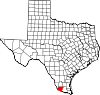
CDPs Alto Bonito | El Refugio | Falcon Heights | Falcon Village | Fronton | Garceno | La Casita-Garciasville | La Puerta | La Rosita | La Victoria | Las Lomas | Los Alvarez | Los Villareales | North Escobares | Roma Creek | Salineno | San Isidro | Santa Cruz
Unincorporated
communitiesDelmita | La Gloria | La Reforma | Santa Catarina | Santa Elena
Categories:- Populated places in Starr County, Texas
- Census-designated places in Texas
- Populated places in Texas with Hispanic majority populations


Wikimedia Foundation. 2010.