- Asaita
-
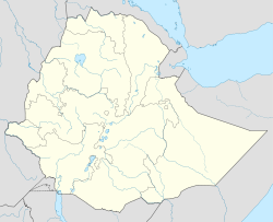
Asaita Location in Ethiopia Location within Ethiopia Coordinates: 11°34′N 41°26′E / 11.567°N 41.433°E Country  Ethiopia
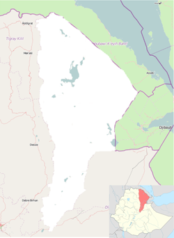
Region Afar Region Zone Administrative Zone 1 Elevation 300 m (984 ft) Population (2005) - Total 22,718 (est) Asaita is a town in northeastern Ethiopia, and before 2007 was the capital of the Afar Region of Ethiopia. Located in the Afambo woreda, part of the Region's Administrative Zone 1, this town has a latitude and longitude of 11°34′N 41°26′E / 11.567°N 41.433°ECoordinates: 11°34′N 41°26′E / 11.567°N 41.433°E and an elevation of 300 meters.
Asaita was the seat of the Aussa Sultanate, the chief Afar monarchy, but is 50 kilometers south by unpaved road from Awash - Asseb highway. A telephone line from Kombolcha to Asaita was in operation in 1964.[1] The town of Semera, a planned settlement situated squarely on this highway, at some point before 2007 became the new Regional capital.
To the southeast of Asaita, located at the southern edge of the Danakil Desert, are a group of twenty salt lakes which cover the territory to the border with neighboring Djibouti. These lakes include Lake Gummare, known for its flamingos, and Lake Abbe, the final destination of the Awash River.
Based on figures from the Central Statistical Agency in 2005, this town has an estimated total population of 22,718, of whom 12,722 were males and were 9,996 females.[2] According to the 1994 national census, this town had a population of 15,475.
History
Asaita was flooded by the Awash River in August 1954, and again in September, 1998.[1]
In late June 1971 a fight during the market between the Afar and highland people left 16 workers dead and 34 wounded. Of more than 1,000 small farmers who had moved from the highlands to Awsa there were only 250-300 still living in Asaita after the violence.[1]
In March 1975 the Derg nationalized all rural lands, including those of Ras Bitwoded Alimirah Hanfadhe, Sultan of the Afar. When they offered to fly him to Addis Ababa to negotiate the transfer of his lands, he refused the offer. That June, the Derg dispatched a battalion of troops to capture the sultan. Although the Ottaways note their sources agree that the ensuing two-day battle was a "massacre", they differ in the details:
- The sultan claimed that the army killed as many as 1,000 Afar in the attack and alleged that airplanes and armoured cars had been used. The government said that the massacre was carried out by the sultan's forces which incited the Afar to turn against non-Afar highland plantation workers at Dit Bahari, killing 221 persons. Probably the death toll lay somewhere between the two figures and the victims included both Afar and highlanders.[3]
Jon Kalb, who was working in the Afar region at the time, provides a narrative which reconciles the two accounts. According to Kalb, Ras Alimirah had fled in May across the border to Djibouti, where his brother-in-law was in charge.
- Apparently the flight coincided with a preemptive strike by the Afar on several key bridges and military garrisons to aid the Sultan's [Alimirah] escape. The ensuing attack on the Tendaho Plantation by the Afar, and the killing of the several hundred highlanders, may have also been a spontaneous reaction by the Awsa population to the news that the Sultan had been forced to flee. Whatever the cause, the retaliation by the military was predictably brutal. A battalion of troops was sent to Awsa... [and] a two-day battle ensued, during which a reported 1000 Afar were killed in and around Aysaita.[4]
Following the fall of the Derg, Ras Alimirah, who had in the meantime founded the Afar Liberation Front (ALF), returned to Asaita with his son, Hanfadhe Alimirah. However on 8 November 1995, Ethiopian People's Revolutionary Democratic Front (EPRDF) troops surrounded their family residence in Assayita, then after exchanging gunfire overpowered Alimirah's guards, and entered the residence, where they confiscated weapons and other items. According to observers, this action against the Sultan and the ALF was another effort to reduce his influence in the Afar Region. Despite the EPRDF's persistent efforts to bring the group under its control, the ALF is said to have remained independent.[5]
Notes
- ^ a b c "Local History in Ethiopia" (pdf) The Nordic Africa Institute website (accessed 21 November 2007)
- ^ CSA 2005 National Statistics, Table B.3
- ^ Marina and David Ottaway, Ethiopia: Empire in Revolution (New York: Africana, 1978), pp. 95f
- ^ Jon Kalb, Adventures in the Bone Trade (New York: Copernicus Books, 2001), p. 175
- ^ "EPRDF Troops Stormed Ali Mirah's Residence", Ethiopian Review, vol. 6 issue 1 (31 January, 1996), p. 10 (accessed 15 August 2009 from Ethnic NewsWatch, Document ID: 494389831)
Cities of Ethiopia Adama (Nazret) · Addis Ababa · Adigrat · Adwa · Ambo · Arba Minch · Asella · Awasa · Axum · Bahir Dar · Debre Berhan · Debre Marqos · Debre Tabor · Debre Zeyit · Degehabur · Dembidolo · Dessie · Dila · Dire Dawa · Gambela · Goba · Gode · Gondar · Harar · Irgalem · Jijiga · Jimma · Kebri Dahar · Kombolcha · Mek'ele · Negele Arsi · Negele Boran · Nekemte · Shashamane · Sodo · Weldiya · Wukro · Ziway
Categories:- Populated places in the Afar Region
Wikimedia Foundation. 2010.


