- Degehabur
-
Degehabur View of Degehbur from Sheigosh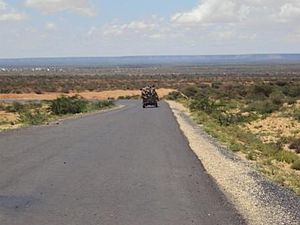 Location within Ethiopia
 Degehabur
Coordinates: 8°13′N 43°34′E / 8.217°N 43.567°E Country Ethiopia Region Somali Zone Degehabur Elevation 1,044 m (3,425 ft) Population (2005) – Total 42,815 Time zone EAT (UTC+3) Degehabur (Somali: Dhagaxbuur) is a town in the eastern part of Ethiopia known as the Ogaden. Located in the Degehabur Zone of the Somali Region on the Jerer River, it sits at 1044 meters above sea level. The town is the administrative center of Degehabur woreda.
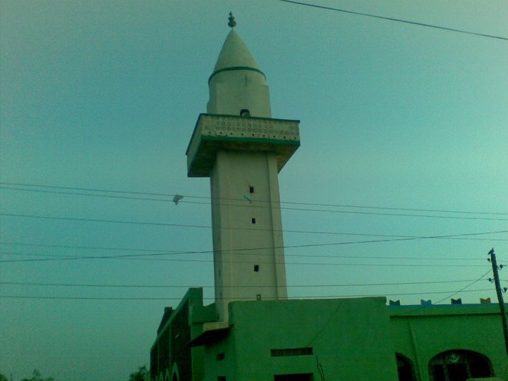
Local landmarks include the Church of St. George, and the white mosque of Degehabur, which Anthony Mockler described as "the most important in the Ogaden."[1] The NGO Doctors without Borders operates a clinic in Degehabur.[2] The upgrade of the 165-kilometer road between Degahabur and the Regional capital, Jijiga, to an all-weather asphalt road was announced to be almost complete 31 October 2007, with the remaining 40 kilometers awaiting completion.[3] Construction of an 106-kilometer asphalt road between Degehabur and the town of Shekosh was underway by March 2009. Local inhabitants constitute half of the 1,100 workers employed by the project.[4]
History
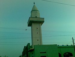 The White Mosque
During the nineteenth century, Degehabur was an important stopping point for caravans crossing the Haud for Hargeisa and Berbera, but when Major H.G.C. Swayne travelled through the area in 1893, he found it abandoned and uses it as an example of the destruction caused by "the insecurity resulting from inter-tribal feuds." According to Swayne, at the time of his visit "there were formerly many square miles of jowdri cultivation, which have been abandoned within the last few years, and now there is only left an immense area of stubble and the ruins of the village. Dagahbur used to be a thriving settlement of one thousand five hundred inhabitants ... now not a hut is left."[5] In the 1920s Degehabur started to recover. It was said that there were some two hundred villages within the distance of a day's travel and that these used the market at Degehabur. By 1931 there were motorable roads in five directions out from the town. Wealthy inhabitants had started erecting two-story buildings.[6]
Due to its strategic location, Degehabur used as by Dejazmach Nasibu Emmanual as his headquarters at the beginning of the Second Italo-Abyssinian War. Despite the construction of a series of fortifications south of the town, the Italians under General Rodolfo Graziani defeated the Ethiopian defenders in the Battle of the Ogaden, and occupied Degehabur 30 April 1936.[7] The Nigerian Brigade drove the Italians from the town in March, 1941.[8]
Degahabur was fiercely defended by the 11th Brigade of the Ethiopian Army at the beginning of the Ogaden War, until the unit was ordered at the end of July 1977 to withdraw to Jijiga.[9] It was recaptured by the 69th Brigade and the Third Cuban Tank Brigade 6 March 1978.[10] Haji Abdinur Sheikh Mumin, imam of the Degehabur mosque, was one of those arrested in 1994 for supporting the Ogaden National Liberation Front (ONLF). Amnesty international reported in 1996 that he was still in prison waiting for court trial.[6]
On 28 May 2007, during the celebration of Ginbot 20 (celebrating the downfall of the Derg), Degehabur and Jijiga were the scenes of attacks on civilians and government officials. At least 16 people were killed and 67 injured; one of the injured was Abdulahi Hassan Mohammed, president of the Somali Region, who was speaking at the ceremony. The Ethiopian government blamed the attack on the ONLF, who afterwards denied responsibility for the attack.[11]
Partly in response to this attack, the Ethiopian Army began confiscating commercial vehicles that moved goods into the conflict-affected zones of Somali Region. In May 2007 the last major trade convoy left Hargeysa, consisting of 18 trucks stocked with food items and clothing. This convoy stopped near Degehabur and all 18 trucks were confiscated by the army and taken to the military base in that town. At the end of September 2007, four months later, according to their owners all 18 trucks were still impounded at the military base.[12]
Demographics
Based on figures from the Central Statistical Agency in 2007, Degehabur has an estimated total population of 30,027 of whom 16,474 are men and 13,553 are women.[13] The 1997 census reported this town had a total population of 28,708 of whom 14,976 were men and 13,732 women. The largest two ethnic groups reported in this town were the Somali (95.92%), and the Amhara (2.53%); all other ethnic groups made up the remaining 1.55% of the residents.[14]
Notes
- ^ Anthony Mockler, Haile Selassie's War (New York: Olive Branch, 2003), p. 70
- ^ "Field News: Somali Region, Ethiopia: Thousands of IDPs in Search of Food and Water", MSF website (accessed 24 February 2009)
- ^ "Jijjiga-Degehabur asphalt road enables to strengthen development" (accessed 29 April 2009)
- ^ "Stakeholders voice continued support to ongoing Degehabour- Shikosh road project", Ethiopian News Agency website (accessed 14 April 2009)
- ^ Swayne, Seventeen Trips through Somaliland and a Visit to Abyssinia, third edition (London: Rowland Ward, 1903), pp. 25, 198
- ^ a b "Local History in Ethiopia" The Nordic Africa Institute website (accessed 20 November 2007)
- ^ Mockler, pp. 127-9
- ^ Mockler, p. 365
- ^ Gebru Tareke, "The Ethiopia-Somalia War of 1977 Revisited", International Journal of African Historical Studies, 2000 (33, #3), pp. 635ff at p. 645. (accessed 13 May 2009)
- ^ Gebru Tareke, "The Ethiopia-Somalia War", pp. 659, 660.
- ^ Many killed in Ethiopia attacks (al Jazeera)
- ^ "Collective Punishment: 'Economic war': Confiscation of Livestock, the Trade Embargo, and Other Restrictions", Human Rights Watch, 11 June 2008 (accessed 24 February 2009)
- ^ CSA 2007 National Statistics, Table 2.2
- ^ 2007 Population and Housing Census of Ethiopia: Results for Somali Region, Vol. 1 Tables 2.4, 2.13, 2.14 (accessed 28 February 2011.
Cities of Ethiopia Adama (Nazret) · Addis Ababa · Adigrat · Adwa · Ambo · Arba Minch · Asella · Awasa · Axum · Bahir Dar · Debre Berhan · Debre Marqos · Debre Tabor · Debre Zeyit · Degehabur · Dembidolo · Dessie · Dila · Dire Dawa · Gambela · Goba · Gode · Gondar · Harar · Irgalem · Jijiga · Jimma · Kebri Dahar · Kombolcha · Mek'ele · Negele Arsi · Negele Boran · Nekemte · Shashamane · Sodo · Weldiya · Wukro · Ziway
Categories:- Populated places in the Somali Region


Wikimedia Foundation. 2010.