- Normangee, Texas
-
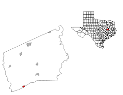
Normangee, Texas — Town — Location of Normangee, Texas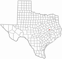
Coordinates: 31°1′45″N 96°7′4″W / 31.02917°N 96.11778°WCoordinates: 31°1′45″N 96°7′4″W / 31.02917°N 96.11778°W Country United States State Texas Counties Leon, Madison Area – Total 1.1 sq mi (2.9 km2) – Land 1.1 sq mi (2.9 km2) – Water 0.0 sq mi (0.0 km2) Elevation 377 ft (115 m) Population (2000) – Total 719 – Density 648.0/sq mi (250.2/km2) Time zone Central (CST) (UTC-6) – Summer (DST) CDT (UTC-5) ZIP code 77871 Area code(s) 936 FIPS code 48-51840[1] GNIS feature ID 1381022[2] Normangee is a town in Leon and Madison Counties in the U.S. state of Texas. The population was 719 at the 2000 census.
Contents
History
The Railroads were pushing the frontier westward and the Trinity and Brazos Valley (T&BV) and the Houston and Texas Central (H&TC) were built between Houston and Dallas in 1904-1905 but the passed through Robert Rogers land about two miles west of Rogers Prairie. So on January 26, 1907, S.B. Phillips filed for record a plat of the new town, Normangee, located in the Southwest corner of the Robert Rogers land grant at the junction of the Old San Antonio Road and the two new railroads. When the Houston & Texas Central Railroad was being built through this region, the railroad officials placed a town every 8 miles. A small community known as Roger's Prairie existed two miles east of where the railroad line was built. Norman G. Kittrell was the County Judge of Leon County at the time. The railroad named the new town after Judge Kittrell. Since there was already a Norman, OK, the town renamed itself Normangee.
Geography
Normangee is located at 31°1′45″N 96°7′4″W / 31.02917°N 96.11778°W (31.029054, -96.117712)[3].
According to the United States Census Bureau, the town has a total area of 1.1 square miles (2.9 km²), all of it land. Normangee is incorporated in Leon County, where most of it lies; only a small part extends into Madison County.
Demographics
As of the census[1] of 2000, there were 719 people, 277 households, and 185 families residing in the town. The population density was 648.0 people per square mile (250.1/km²). There were 358 housing units at an average density of 322.6 per square mile (124.5/km²). The racial makeup of the town was 73.71% White, 20.45% African American, 0.42% Native American, 0.14% Pacific Islander, 3.48% from other races, and 1.81% from two or more races. Hispanic or Latino of any race were 8.07% of the population.
There were 277 households out of which 35.0% had children under the age of 18 living with them, 43.3% were married couples living together, 19.1% had a female householder with no husband present, and 33.2% were non-families. 28.9% of all households were made up of individuals and 16.2% had someone living alone who was 65 years of age or older. The average household size was 2.60 and the average family size was 3.22.
In the town the population was spread out with 30.7% under the age of 18, 6.5% from 18 to 24, 28.7% from 25 to 44, 17.9% from 45 to 64, and 16.1% who were 65 years of age or older. The median age was 36 years. For every 100 females there were 88.2 males. For every 100 females age 18 and over, there were 81.1 males.
The median income for a household in the town was $28,594, and the median income for a family was $34,444. Males had a median income of $29,375 versus $16,042 for females. The per capita income for the town was $18,336. About 16.1% of families and 17.6% of the population were below the poverty line, including 22.2% of those under age 18 and 17.6% of those age 65 or over.
Education
The Town of Normangee is served by the Normangee Independent School District.
Economy
The local economy consists of over 100 small businesses, including banking, groceries and staple goods, antique and thrift stores, health care, as well as agricultural suppliers.
Normangee is often associated with tractors due to two of it's most recognized businesses, known throughout Texas and the United States, which are Normangee Tractor & Implement Co. and J5 Tractor company, who also operates a second location in Navasota, Texas.
Notable people
- Joseph Jones, Texas A&M basketball player
- R. Dean Lewis, 1995-2008 Dean, College of Business Administration, 2008-2009 Vice President of Finance, Sam Houston State University; former executive, Mitchum Industries
- William Womack Heath, ambassador to Sweden
- Chalie Dishongh, running back, Dallas Desire, Lingerie Football League
References
- ^ a b "American FactFinder". United States Census Bureau. http://factfinder.census.gov. Retrieved 2008-01-31.
- ^ "US Board on Geographic Names". United States Geological Survey. 2007-10-25. http://geonames.usgs.gov. Retrieved 2008-01-31.
- ^ "US Gazetteer files: 2010, 2000, and 1990". United States Census Bureau. 2011-02-12. http://www.census.gov/geo/www/gazetteer/gazette.html. Retrieved 2011-04-23.
Municipalities and communities of Leon County, Texas Cities Buffalo | Centerville | Jewett | Leona | Marquez
Towns Normangee‡ | Oakwood‡
Unincorporated
communitiesConcord | Flynn | Hilltop Lakes | Hopewell
Ghost town Egypt
Footnotes ‡This populated place also has portions in an adjacent county or counties
Municipalities and communities of Madison County, Texas Cities 
Town Normangee‡
Unincorporated
communityGhost towns Bucareli | Mecca | Zulch
Footnotes ‡This populated place also has portions in an adjacent county or counties
Categories:- Populated places in Leon County, Texas
- Populated places in Madison County, Texas
- Towns in Texas


Wikimedia Foundation. 2010.