- Eastphalia
-
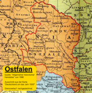
Eastphalia (German: Ostfalen; Eastphalian: Oostfalen) is a historical region in northern Germany, encompassing the eastern part of the historic Duchy of Saxony, between the Elbe, Leine, Saale and Unstrut rivers. Today, it covers the southeastern part of the state of Lower Saxony and the western part of Saxony-Anhalt.
Contents
Etymology
The name Ostfalen probably means "east plain". Falen is a Germanic word meaning "flat", "level" and "plain" and is related to the Old Swedish word fala, found today in place names such as Falbygden and Falun, as well as in the northern German town of Fallstedt.[1] The plains of Eastphalia and Westphalia, divided by the Weser into east and west, stand in contrast to the hilly region to the south, the Central Uplands. Unlike the name Westphalia, the name Eastphalia gradually fell out of use after the duchy of Saxony was dissolved in 1180.[1]
German linguists reintroduced the term in the 19th century in the course of researching the Eastphalian language as a West Low German dialect. With the rise of scientific racism in the 19th and early 20th century, mention began to be made[by whom?] of a "Phalian" (fälisch) subtype of an "Aryan race" according to the occult concept of Helena Blavatsky and her Ariosophic followers.
History
With Charlemagne's defeat and baptism of Duke Widukind in 785 during the Saxon Wars, his lands were integrated into the Frankish Empire and the Saxons were increasingly converted to Christianity.[2][3][4] The bishoprics of Halberstadt and Hildesheim were established in eastern Saxony, bounded by the Oker river, in 804 and 815 respectively. The medieval Duchy of Saxony was divided between the districts of Eastphalia (Ostfalahi), Westphalia and Engern.
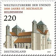
The Eastphalian territory at the Harz mountain range was the hereditary lands of Henry the Fowler, the first Saxon duke to become King of the Romans in 919, and his descendants of the Ottonian dynasty. They left several Romanesque abbeys and castles, a cultural landscape that today encompasses three World Heritage Sites with the medieval town of Goslar and Quedlinburg, as well as St. Mary's Cathedral and St. Michael's Church at Hildesheim.
After the duke Henry the Lion was placed under imperial ban in 1180, Eastphalia was increasingly subdivided into smaller states,[1] such as the duchy of Brunswick-Lüneburg, the imperial city of Goslar, the bishoprics of Hildesheim and Halberstadt, the Archbishopric of Magdeburg, Quedlinburg Abbey as well as the counties of Wernigerode and Blankenburg.
Subdivisions
Eastphalia consisted of several Gaue (shires). The exact list of Gaue is not known for sure and differs among authorities. From North to South, the Gaue were (where available, modernized names are used):
- Bardengau around Lüneburg (sometimes considered part of Engern, not Eastphalia)
- Drevani (a Slavic tribe)
- Choina (sometimes considered part of Drevani)
- Osterwalde (Salzwedel)
- Gretinge (Hohne)
- Mulbeze
- Balsamgau (Stendal)
- Flutwidde
- Astfala (Hildesheim)
- Derlingau (Evessen)
- Nordthüringgau
- Gudingau (Elze)
- Valothungo (sometimes considered part of Gudingau)
- Scotelingo (sometimes considered part of Gudingau)
- Aringo (sometimes considered part of Gudingau)
- Flenithi (sometimes considered part of Gudingau)
- Suilbergau
- Ambergau (sometimes considered part of Salzgau)
- Salzgau (Salzgitter)
- Densigau (sometimes considered part of Salzgau)
- Harzgau (Halberstadt)
- Schwabengau
- Hassegau (Mansfeld)
- Friesenfeld (sometimes considered part of Hassegau)
References
- ^ a b c Dieter Thierbach, Rätsel des Alltags: Jeder kennt Westfalen - gibt es auch Ostfalen?, RP-online.de (August 9, 2005). Retrieved February 2, 2011. (German)
- ^ Simon Speck, Paderborn als Stützpunkt der Sachsenmission − 4.2: Zwangschristianisierung Monograph, 22 pages. ISBN 978-3638665872 Retrieved October 12, 2009. (German)
- ^ "Ein Blick in die Geschichte unserer Region − Die Zeit der Franken" radio-unna.de Quote: "Nach der Zwangschristianisierung wird Sachsen in Gaue eingeteilt, die als weiterentwickeltes Stammesrecht (lex saxonum) von Gaugrafen verwaltet werden." Retrieved October 12, 2009. (German)
- ^ Zeittafel der germanischen Völkerwanderung Webarchiv. Quote: Blutgericht von Verden, Karl d.G. läßt 4.500 Sachsen enthaupten; 10.000 ins das [sic] Frankenreic [sic] deportieren, Zwangschristianisierung der Sachsen". Retrieved March 2, 2010. (German)
Regions and landscapes of Lower Saxony Altes Land | Ammerland | Brunswick Land | Calenberg Land | Eichsfeld | Elbe-Weser | Emsland | County of Bentheim | Land Hadeln | Land Wursten | Harz | Hildesheim Börde | Hümmling | Kehdingen | Leine Uplands | Lüneburg Heath | Middle Weser | Oldenburg Land | Oldenburg Münsterland | Osnabrück Land | Eastphalia | East Frisia | Schaumburg Land | Solling | South Lower Saxony | Wendland | Weser Uplands | Wümme Depression

Altmark | Anhalt-Wittenberg | Chemical Triangle | Elbe-Börde Heath | Harz | Eastphalia | Mansfelder Land |
Saale-Unstrut Region Categories:
- Ancient Germanic peoples
- Regions of Lower Saxony
- Regions of Saxony-Anhalt
- Germany geography stubs
- German history stubs
Wikimedia Foundation. 2010.


