- Mansfeld
-
Mansfeld 
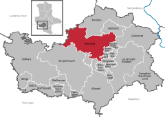
Coordinates 51°35′39″N 11°27′17″E / 51.59417°N 11.45472°ECoordinates: 51°35′39″N 11°27′17″E / 51.59417°N 11.45472°E Administration Country Germany State Saxony-Anhalt District Mansfeld-Südharz Mayor Dietmar Sauer (SPD) Basic statistics Area 143.78 km2 (55.51 sq mi) Elevation 255 m (837 ft) Population 9,770 (31 December 2010)[1] - Density 68 /km2 (176 /sq mi) Other information Time zone CET/CEST (UTC+1/+2) Licence plate MSH Postal code 06343 Area code 034782 Website www.stadt-mansfeld.de For other uses, see Mansfeld (disambiguation).Mansfeld is a town in the Mansfeld-Südharz district, in Saxony-Anhalt, Germany. It is situated on the river Wipper, 10 km northwest of Eisleben.
Protestantism's pioneer Martin Luther grew up in Mansfeld, and in the 1990s Mansfeld became one of sixteen places to be designated a "Lutherstadt" for this reason.
History
Mansfeld received town priviliges in 1400, and grew through the development of copper and silver mining, an activities in which Hans Luder, father to Martin Luther, was employed in a senior position. Luther himself attended the local school between 1488 and 1496, although the building known as "Luther's School" had to be torn down and rebuilt in 2000 due to structural problems.
References
- ^ "Bevölkerung der Gemeinden nach Landkreisen" (in German). Statistisches Landesamt Sachsen-Anhalt. 31 December 2010. http://www.statistik.sachsen-anhalt.de/download/stat_berichte/6A102_hj_2010_02.pdf.
- This article incorporates information from the German Wikipedia.
Ahlsdorf | Allstedt | Arnstein | Benndorf | Berga | Blankenheim | Bornstedt | Brücken-Hackpfüffel | Edersleben | Eisleben | Gerbstedt | Helbra | Hergisdorf | Hettstedt | Kelbra | Klostermansfeld | Mansfeld | Sangerhausen | Seegebiet Mansfelder Land | Südharz | Wallhausen | Wimmelburg |Categories:- Towns in Saxony-Anhalt
- Martin Luther
- Towns in the Harz
- Mansfeld-Südharz geography stubs
Wikimedia Foundation. 2010.


