- Nounsley
-
Coordinates: 51°45′51″N 0°36′25″E / 51.76424°N 0.60703°E
Nounsley 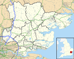
 Nounsley
Nounsley shown within EssexOS grid reference TL800105 Shire county Essex Region East Country England Sovereign state United Kingdom Post town Chelmsford Postcode district CM3 Police Essex Fire Essex Ambulance East of England EU Parliament East of England UK Parliament Braintree List of places: UK • England • Essex Nounsley is a hamlet in the parish of the larger Essex village of Hatfield Peverel to which it is connected by a hill and footpaths. In the very hard winter of 1961/62, snow on Nounsley Hill cut the village off to wheeled traffic for 3 days.
There is one public house, The Sportsman's Arms and a ford across the River Ter.
Other businesses based in Nounsley include Boon's Calibre Travel, Franklins Fire and Safety.
The hamlet has only 7 roads: Ulting Road, Sportsman Road, Nounsley Road, Manor Road, Priory Farm Road, Priory Close and Peverel Avenue.
Hatfield Peverel Parish Council manage the small playing field and play area in the hamlet. There is a village notice board for events from all of the Parish. There is a telephone and post box in the village.
The number 73 bus (provided by First) passes through the village travelling from Chelmsford to Maldon stopping at the corner of Ulting Road and Nounsley Road.
Categories:- Hamlets in Essex
- Essex geography stubs

Wikimedia Foundation. 2010.