- Davis, West Virginia
-
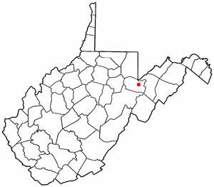
Davis, West Virginia — Town — William Avenue (Route 32) in Davis in 2006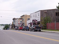 Location of Davis, West Virginia
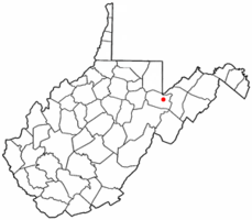
Coordinates: 39°7′52″N 79°27′59″W / 39.13111°N 79.46639°WCoordinates: 39°7′52″N 79°27′59″W / 39.13111°N 79.46639°W Country United States State West Virginia County Tucker Area – Total 1.1 sq mi (3.0 km2) – Land 1.1 sq mi (3.0 km2) – Water 0.0 sq mi (0.0 km2) Elevation 3,100 ft (945 m) Population (2000) – Total 624 – Density 546.0/sq mi (210.8/km2) Time zone Eastern (EST) (UTC-5) – Summer (DST) EDT (UTC-4) ZIP code 26260 Area code(s) 304 FIPS code 54-20428[1] GNIS feature ID 1550876[2] Davis is a town in Tucker County, West Virginia, along the Blackwater River.[3] The population was 624 at the 2000 census.
Contents
History
Davis was named either for Henry Gassaway Davis, or for his family generally.[4]
The Herman August Meyer House was listed on the National Register of Historic Places in 2010.[5]
Geography
Davis is located at 39°07′52″N 79°27′59″W / 39.131110°N 79.466318°W (39.131110, -79.466318).[6] It is located in the northern portion of the Canaan Valley, West Virginia near the Canaan Valley State Resort Park, and is partially surrounded by the Monongahela National Forest including scenic Blackwater Falls.
According to the United States Census Bureau, the town has a total area of 1.1 square miles (3.0 km2), all land.
Demographics
As of the census[1] of 2000, there were 624 people, 290 households, and 176 families residing in the town. The population density was 546.0 inhabitants per square mile (211.3/km2). There were 380 housing units at an average density of 332.5 per square mile (128.7/km2). The racial makeup of the town was 97.92% White, 0.16% Native American, and 1.92% from two or more races. Hispanic or Latino of any race were 0.32% of the population.
There were 290 households out of which 26.2% had children under the age of 18 living with them, 44.5% were married couples living together, 11.7% had a female householder with no husband present, and 39.3% were non-families. 36.9% of all households were made up of individuals and 20.0% had someone living alone who was 65 years of age or older. The average household size was 2.15 and the average family size was 2.76.
In the town the population was spread out with 22.0% under the age of 18, 6.1% from 18 to 24, 26.6% from 25 to 44, 23.4% from 45 to 64, and 22.0% who were 65 years of age or older. The median age was 42 years. For every 100 females there were 84.6 males. For every 100 females age 18 and over, there were 88.0 males.
The median income for a household in the town was $25,221, and the median income for a family was $31,333. Males had a median income of $21,607 versus $17,250 for females. The per capita income for the town was $22,399. About 14.6% of families and 14.6% of the population were below the poverty line, including 19.4% of those under age 18 and 10.9% of those age 65 or over.
Notable native
- Frankie Yankovic, known as "America's Polka King"
References
- ^ a b "American FactFinder". United States Census Bureau. http://factfinder.census.gov. Retrieved 2008-01-31.
- ^ "US Board on Geographic Names". United States Geological Survey. 2007-10-25. http://geonames.usgs.gov. Retrieved 2008-01-31.
- ^ West Virginia Atlas & Gazetteer. Yarmouth, Me.: DeLorme. 1997. pp. 38. ISBN 0-89933-246-3.
- ^ Kenny, Hamill (1945). West Virginia Place Names: Their Origin and Meaning, Including the Nomenclature of the Streams and Mountains. Piedmont, West Virginia: The Place Name Press. pp. 200–201.
- ^ "National Register of Historic Places Listings". Weekly List of Actions Taken on Properties: 7/12/10 through 7/16/10. National Park Service. 2010-07-23. http://www.nps.gov/history/nr/listings/20100723.htm.
- ^ "US Gazetteer files: 2010, 2000, and 1990". United States Census Bureau. 2011-02-12. http://www.census.gov/geo/www/gazetteer/gazette.html. Retrieved 2011-04-23.
Municipalities and communities of Tucker County, West Virginia Cities 
Towns Unincorporated
communitiesAuvil | Benbush | Bretz | Canaan Heights | Coketon | Cortland | Douglas | Elk | Gladwin | Hannahsville | Holly Meadows | Hovatter | Jenningston | Laneville | Lead Mine | Location | Mackeyville | Moore | Pierce | Pleasant Run | Pleasant Vale | Porterwood | Red Creek | St. George | Shafer | William
Ghost town Categories:- Towns in West Virginia
- Populated places in Tucker County, West Virginia


Wikimedia Foundation. 2010.