- Matoaka, West Virginia
-
Matoaka, West Virginia — Town — Location within the state of West Virginia

Coordinates: 37°25′7″N 81°14′31″W / 37.41861°N 81.24194°WCoordinates: 37°25′7″N 81°14′31″W / 37.41861°N 81.24194°W Country United States State West Virginia County Mercer Area – Total 0.3 sq mi (0.7 km2) – Land 0.3 sq mi (0.7 km2) – Water 0.0 sq mi (0.0 km2) Elevation 2,359 ft (719 m) Population (2000) – Total 317 – Density 1,181.9/sq mi (456.3/km2) Time zone Eastern (EST) (UTC-5) – Summer (DST) EDT (UTC-4) ZIP code 24736 Area code(s) 304 FIPS code 54-52420[1] GNIS feature ID 1542868[2] Matoaka is a small town in Mercer County, West Virginia, United States. The population was 317 at the 2000 census. It is part of the Bluefield, WV-VA micropolitan area which has a population of 107,578. The town is named for Matoaka, daughter of the chief of the Powhatan, and better known as Pocahontas.
Geography
Matoaka is located at 37°25′7″N 81°14′31″W / 37.41861°N 81.24194°W (37.418741, -81.242028)[3].
According to the United States Census Bureau, the town has a total area of 0.3 square miles (0.7 km²), all land.
Demographics
As of the census[1] of 2000, there were 317 people, 125 households, and 93 families residing in the town. The population density was 1,181.9 inhabitants per square mile (453.3/km²). There were 155 housing units at an average density of 577.9 per square mile (221.7/km²). The racial makeup of the town was 98.74% White, 0.32% Asian, and 0.95% from two or more races.
There were 125 households out of which 30.4% had children under the age of 18 living with them, 48.0% were married couples living together, 20.0% had a female householder with no husband present, and 25.6% were non-families. 23.2% of all households were made up of individuals and 16.8% had someone living alone who was 65 years of age or older. The average household size was 2.49 and the average family size was 2.89.
In the town the population was spread out with 26.8% under the age of 18, 5.4% from 18 to 24, 26.2% from 25 to 44, 21.8% from 45 to 64, and 19.9% who were 65 years of age or older. The median age was 36 years. For every 100 females there were 77.1 males. For every 100 females age 18 and over, there were 82.7 males.
The median income for a household in the town was $17,159, and the median income for a family was $19,792. Males had a median income of $25,000 versus $13,750 for females. The per capita income for the town was $9,522. About 28.0% of families and 29.5% of the population were below the poverty line, including 43.9% of those under age 18 and 14.9% of those age 65 or over.
References
- ^ a b "American FactFinder". United States Census Bureau. http://factfinder.census.gov. Retrieved 2008-01-31.
- ^ "US Board on Geographic Names". United States Geological Survey. 2007-10-25. http://geonames.usgs.gov. Retrieved 2008-01-31.
- ^ "US Gazetteer files: 2010, 2000, and 1990". United States Census Bureau. 2011-02-12. http://www.census.gov/geo/www/gazetteer/gazette.html. Retrieved 2011-04-23.
Municipalities and communities of Mercer County, West Virginia Cities 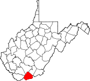
Towns CDPs Other
communitiesAda | Arista | Beeson | Black‡ | Bluestone | Brush Fork | Camp Creek | Cashers Hill | Ceres | Chestnut Knob | Coaldale | Crystal | Dott | Duhring | Dunns | Eads Mill | Edison | Egeria‡ | Elgood | Flat Top | Flipping | Gardner | Gardner Junction | Giatto | Glenwood | Godfrey | Goodwill | Green Valley | Hardy | Hatcher | Hiawatha | Ingleside | Johnston Town | Kale | Kegley | Kellysville | Lake Shawnee | Lamar‡ | Lerona | Lilly Grove | Littlesburg | Lorton Lick | Lovern | Maple Acre | Maple View | McComas | Melrose | Micajah | Midway | Mount Olive | Nemours | New Hope | Oak Grove | Piedmont | Pinoak | Rock | Sandlick | Spanishburg | Speedway | Wolfe | Yards‡
Footnotes ‡This populated place also has portions in an adjacent county or counties
Categories:- Populated places in Mercer County, West Virginia
- Towns in West Virginia
- Bluefield micropolitan area


Wikimedia Foundation. 2010.