- Chapmanville, West Virginia
-
Chapmanville, West Virginia — Town — Location of Chapmanville, West Virginia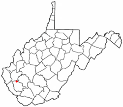
Coordinates: 37°58′18″N 82°1′12″W / 37.97167°N 82.02°WCoordinates: 37°58′18″N 82°1′12″W / 37.97167°N 82.02°W Country United States State West Virginia County Logan Area – Total 0.7 sq mi (1.8 km2) – Land 0.7 sq mi (1.7 km2) – Water 0.0 sq mi (0.1 km2) Elevation 640 ft (195 m) Population (2000) – Total 1,211 – Density 1,797.4/sq mi (694.0/km2) Time zone Eastern (EST) (UTC-5) – Summer (DST) EDT (UTC-4) ZIP code 25508 Area code(s) 304 FIPS code 54-14524[1] GNIS feature ID 1537207[2] Chapmanville is a town in Logan County, West Virginia, in the United States. The population was 1,211 at the 2000 census. Chapmanville was founded in 1800 and named for an early settler named Ned Chapman, who owned a store and ran the post office.[3] It was incorporated in 1947.[4]
Contents
Geography
Chapmanville is located at 37°58′18″N 82°1′12″W / 37.97167°N 82.02°W (37.971615, -82.020017),[5] along the Guyandotte River.[6]
According to the United States Census Bureau, the town has a total area of 0.7 square miles (1.8 km²). 0.7 square miles (1.7 km²) of it is land and 0.04 square miles (0.1 km²) of it (2.90%) is water.
Demographics
Historical populations Census Pop. %± 1990 1,110 — 2000 1,211 9.1% Est. 2009 1,110 −8.3% As of the census[1] of 2000, there were 1,211 people, 581 households, and 330 families residing in the town. The population density was 1,797.4 inhabitants per square mile (697.9/km²). There were 658 housing units at an average density of 976.6 per square mile (379.2/km²). The racial makeup of the town was 98.84% White, 0.74% Asian, and 0.41% from two or more races. Hispanic or Latino of any race were 0.41% of the population.
There were 581 households out of which 23.1% had children under the age of 18 living with them, 40.8% were married couples living together, 13.8% had a female householder with no husband present, and 43.2% were non-families. 40.3% of all households were made up of individuals and 20.0% had someone living alone who was 65 years of age or older. The average household size was 2.08 and the average family size was 2.82.
In the town the population was spread out with 19.0% under the age of 18, 9.5% from 18 to 24, 26.5% from 25 to 44, 25.1% from 45 to 64, and 19.9% who were 65 years of age or older. The median age was 41 years. For every 100 females there were 77.0 males. For every 100 females age 18 and over, there were 76.4 males.
The median income for a household in the town was $23,077, and the median income for a family was $38,250. Males had a median income of $28,500 versus $20,769 for females. The per capita income for the town was $15,581. About 12.1% of families and 20.3% of the population were below the poverty line, including 31.7% of those under age 18 and 16.4% of those age 65 or over.
Education
Chapmanville is home to one High School housing grades 9-12, one middle school housing grades 5-8, and two elementary schools housing grades PreK-4. Chapmanville hosts the second largest student population in the county. All schools in the city use one mascot as their school identities. The mascot of choice is the Tiger and or Tiger cub. The high school in the city is one of very few regional high schools in the state. The student body consist of students from a consolidation agreement with the West Virginia Department of Education, West Virginia School Building Authority, Lincoln County Schools and Logan County Schools to consolidate Harts High School and Chapmanville High School to form the Chapmanville Regional High School. It opened on June 1, 2007 and is currently under the leadership of principal Terry Elkins.
Notable residents
- Shane Burton, retired American football defensive tackle
- Danny Godby — Major League Baseball player
- Earl Ray Tomblin - Governor of West Virginia
- Landau Eugene Murphy, Jr. - 2011 Winner of Americas Got Talent
References
- ^ a b "American FactFinder". United States Census Bureau. http://factfinder.census.gov. Retrieved 2008-01-31.
- ^ "US Board on Geographic Names". United States Geological Survey. 2007-10-25. http://geonames.usgs.gov. Retrieved 2008-01-31.
- ^ Kenny, Hamill (1945). West Virginia Place Names: Their Origin and Meaning, Including the Nomenclature of the Streams and Mountains. Piedmont, West Virginia: The Place Name Press. pp. 164.
- ^ West Virginia Blue Book. Published annually by the Clerk's Office of the West Virginia Senate.
- ^ "US Gazetteer files: 2010, 2000, and 1990". United States Census Bureau. 2011-02-12. http://www.census.gov/geo/www/gazetteer/gazette.html. Retrieved 2011-04-23.
- ^ West Virginia Atlas & Gazetteer. Yarmouth, Me.: DeLorme. 1997. pp. 51. ISBN 0-89933-246-3.
- The Charleston Daily Ver. 1613 May 6, 1999.
Municipalities and communities of Logan County, West Virginia City 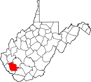
Towns Chapmanville | Man | Mitchell Heights | West Logan
CDPs Unincorporated
communitiesArgyle | Baber | Baisden | Barnabus | Becco | Beebe | Blair | Bradshaw | Braeholm | Claypool | Combs Addition | Cora | Craneco | Crites | Crown | Crystal Block | Dabney | Davin | Dehue | Diamond | Earling | Emmett | Ethel | Gillman Bottom | Greenville | Huff Junction | Lake | Landville | Latrobe | Lorado | Lundale | Lyburn | Melville | Micco | Mineral City | Monitor | Mountain View | Pardee | Peach Creek | Pecks Mill | Phico | Ridgeview | Saunders | Sharples | Shively | Stirrat | Stowe | Sulphur Springs | Superior Bottom | Taplin | Upper Whitman | Whites Addition | Whitman | Wilkinson | Yolyn
Categories:- Populated places in Logan County, West Virginia
- Towns in West Virginia
- Guyandotte River
- Populated places established in 1800


Wikimedia Foundation. 2010.