- McConnell, West Virginia
-
McConnell — Census-designated place — Location within the state of West Virginia
 McConnell
Coordinates: 37°49′32″N 81°58′0″W / 37.82556°N 81.966667°WCoordinates: 37°49′32″N 81°58′0″W / 37.82556°N 81.966667°W Country United States State West Virginia County Logan Area[1] – Total 0.336 sq mi (0.9 km2) – Land 0.314 sq mi (0.8 km2) – Water 0.022 sq mi (0.1 km2) Population (2010)[2] – Total 514 – Density 1,529.8/sq mi (590.6/km2) Time zone Eastern (EST) (UTC-5) – Summer (DST) EDT (UTC-4) ZIP codes FIPS code GNIS feature ID McConnell is an unincorporated census-designated place in Logan County, West Virginia, United States, on the Guyandotte River. As of the 2010 census, its population was 514.[2] It was established in 1933.
References
- ^ "US Gazetteer files: 2010, 2000, and 1990". United States Census Bureau. 2011-02-12. http://www.census.gov/geo/www/gazetteer/gazette.html. Retrieved 2011-04-23.
- ^ a b "American FactFinder". United States Census Bureau. http://factfinder2.census.gov. Retrieved 2011-05-14.
Municipalities and communities of Logan County, West Virginia City 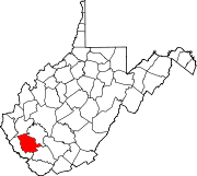
Towns CDPs Unincorporated
communitiesArgyle | Baber | Baisden | Barnabus | Becco | Beebe | Blair | Bradshaw | Braeholm | Claypool | Combs Addition | Cora | Craneco | Crites | Crown | Crystal Block | Dabney | Davin | Dehue | Diamond | Earling | Emmett | Ethel | Gillman Bottom | Greenville | Huff Junction | Lake | Landville | Latrobe | Lorado | Lundale | Lyburn | Melville | Micco | Mineral City | Monitor | Mountain View | Pardee | Peach Creek | Pecks Mill | Phico | Ridgeview | Saunders | Sharples | Shively | Stirrat | Stowe | Sulphur Springs | Superior Bottom | Taplin | Upper Whitman | Whites Addition | Whitman | Wilkinson | Yolyn
Categories:- Metro Valley geography stubs
- Populated places in Logan County, West Virginia
- Census-designated places in West Virginia


Wikimedia Foundation. 2010.