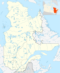
- Champneuf, Quebec
-
Champneuf — Municipality — Coordinates: 48°35′N 77°30′W / 48.583°N 77.5°WCoordinates: 48°35′N 77°30′W / 48.583°N 77.5°W Country  Canada
Province  Quebec
Region Abitibi-Témiscamingue Regional county Abitibi Settled 1938 Incorporated January 1, 1964 Government[1] - Mayor Rosaire Guénette - Federal riding Abitibi—Témiscamingue - Prov. riding Abitibi-Ouest Area[2] - Land 242.39 km2 (93.6 sq mi) Population (2006)[2] - Total 130 - Density 0.8/km2 (2.1/sq mi) Time zone EST (UTC-5) - Summer (DST) EDT (UTC-4) Postal Code J0Y 1E0 Area code(s) 819 Champneuf is a municipality in the Canadian province of Quebec, located in the Abitibi Regional County Municipality. It is the smallest incorporated place in terms of population in the Abitibi-Témiscamingue region.
Contents
History
In 1938, the settlement was founded, first called Colonie Bertrand, after its first parish priest Achille-Augustin Bertrand. In 1941, it was renamed to Champneufs (French for "new fields"), but also known by the parish name of Saint-François-d'Assise-de-Champneufs during the 1950s. At one point and for unknown reasons, the name was changed from the plural to the singular Champneuf. In 1964, the place was incorporated as a municipality.[3]
Demographics
Population trend:[4]
- Population in 2006: 130 (2001 to 2006 population change: -17.2 %)
- Population in 2001: 157
- Population in 1996: 169
- Population in 1991: 187
Private dwellings occupied by usual residents: 52 (total dwellings: 56)
Mother tongue:[2]
- English as first language: 0 %
- French as first language: 100 %
- English and French as first language: 0 %
- Other as first language: 0 %
Municipal council
- Mayor: Rosaire Guénette
- Councillors: Manon Beaudet, Joseph Blais, Émile Bourassa, Léopold Leduc, Stéphane Leduc, Jean-Baptiste Rioux
References
- ^ "Champneuf" (in French). Répertoire des municipalités. Ministère des Affaires Municipales, Régions et Occupation du territoire. http://www.mamrot.gouv.qc.ca/repertoire-des-municipalites/fiche/municipalite/88005/. Retrieved 2011-01-12.
- ^ a b c "Champneuf community profile". 2006 Census data. Statistics Canada. http://www12.statcan.gc.ca/census-recensement/2006/dp-pd/prof/92-591/details/page.cfm?Lang=E&Geo1=CSD&Code1=2488005&Geo2=PR&Code2=24&Data=Count&SearchText=Champneuf&SearchType=Begins&SearchPR=01&B1=All&Custom=. Retrieved 2011-01-12.
- ^ "Champneuf (Municipalité)" (in French). Commission de toponymie du Québec. http://www.toponymie.gouv.qc.ca/ct/ToposWeb/fiche.aspx?no_seq=12223. Retrieved 2011-01-12.
- ^ Statistics Canada: 1996, 2001, 2006 census

Rochebaucourt 
La Morandière
Barraute
Lac-Despinassy
Senneterre (parish) Champneuf

Belcourt Subdivisions of Abitibi Regional County Municipality Towns Municipalities Barraute • Berry • Champneuf • La Corne • La Morandière • La Motte • Preissac • Rochebaucourt • Saint-Dominique-du-Rosaire • Sainte-Gertrude-Manneville • Saint-Félix-de-Dalquier • Saint-Mathieu-d'HarricanaTownships Parishes Unorganized territories Other RCMs in Abitibi-Témiscamingue: Abitibi-Ouest • La Vallée-de-l'Or • Témiscamingue • Rouyn-Noranda (Independent city) Categories:- Municipalities in Quebec
- Incorporated places in Abitibi-Témiscamingue
- Abitibi-Témiscamingue geography stubs
Wikimedia Foundation. 2010.

