- Nemegos, Ontario
-
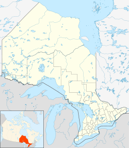
Nemegos Settlement Name origin: Named for the Nemegosenda River Country Canada Province Ontario Region Northeastern Ontario District Sudbury Part Sudbury, Unorganized, North Elevation 436 m (1,430 ft) Coordinates 47°43′32″N 83°12′13″W / 47.72556°N 83.20361°W Founded 1890s Timezone Eastern Time Zone (UTC-5) - summer (DST) Eastern Time Zone (UTC-4) Postal code FSA P0M Area code 705, 249 Nemegos is an unincorporated place and community in geographic Halsey Township[1] in the Unorganized North Part of Sudbury District in Northeastern Ontario, Canada.[2] It is on the Nemegosenda River in the James Bay drainage basin, and also is on the Canadian Pacific Railway transcontinental main line,[3] between the railway points of Devon to the west and Tophet to the east.
Contents
History
Nemegos was established in the 1890s as a sectional point on the CPR between the divisional points of Chapleau to the west and Cartier to the east.[4][5] The residents were a mix of native and European settlers, primarily Finnish people. The post office was opened in 1912 by S.A. Hatch. There was a store, hotel, bunkhouses and a one-room school. Some of the men worked on the CPR; however, most were logging contractors, producing axe ties under contract to Austin, Nicholson Ltd. of nearby Chapleau.[5]
Transportation
Nemegos railway station is served by the Via Rail Sudbury – White River train.
References
- ^ "Halsey" (PDF). Geology Ontario - Historic Claim Maps. Ontario Ministry of Northern Development, Mines and Forestry. http://www.geologyontario.mndmf.gov.on.ca/website/historic_claim_maps/H/Halsey.pdf. Retrieved 2011-09-10.
- ^ "Nemegos". Geographical Names Data Base. Natural Resources Canada. http://geonames.nrcan.gc.ca/search/unique_e.php?id=FDMZO&output=xml. Retrieved 2011-09-11.
- ^ Ministry of Transportation of Ontario (2010-01-01) (PDF). Map 12 (Map). 1 : 1,600,000, Official road map of Ontario. http://www.mto.gov.on.ca/english/traveller/map/images/pdf/northont/sheets/Map12.pdf. Retrieved 2011-09-11.
- ^ Natural Resources Canada (1913). "Ontario and Quebec Railway Territories" from the 2nd Edition, 1915, Atlas of Canada (Map). 1 : 2,217,600, . http://atlas.nrcan.gc.ca/site/english/maps/archives/2ndedition/economic/transportationandcommunications/page43_44. Retrieved 2011-09-11.
- ^ a b Charbonneau, Yvan (2010-10-02). "History". Nemegos. Ontairo Ghost Towns. http://www.ghosttownpix.com/ontario/towns/nemego.html. Retrieved 2011-09-11.
External links
- Nemegos at Ontario Ghost Towns; includes photos
Categories:- Communities in Sudbury District, Ontario
- Ghost towns in Ontario
- Northern Ontario geography stubs
- Canada ghost town stubs
Wikimedia Foundation. 2010.

