- Mercersville, Maryland
-
Coordinates: 39°29′57″N 77°45′59″W / 39.49917°N 77.76639°W Mercersville is an unincorporated community in Washington County, Maryland. It lies at an elevation of 341 feet (104 m).
References
Municipalities and communities of Washington County, Maryland County seat: Hagerstown City 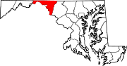
Towns Boonsboro | Clear Spring | Funkstown | Hancock | Keedysville | Sharpsburg | Smithsburg | Williamsport
CDPs Other
communitiesAntietam | Beaver Creek | Benevola | Big Pool | Broadfording | Brownsville | Burtner | Cearfoss | Cedar Grove | Dargan | Downsville | Eakles Mills | Fairplay | Fairview | Gapland | Huyett | Indian Springs | Jugtown | Mapleville | Mercersville | Park Hall | Pecktonville | Pen Mar | Pinesburg | Ringgold | Samples Manor | Sandy Hook | Spielman | Trego | Van Lear | Weverton | Woodmont
Categories:- Populated places in Washington County, Maryland
- Unincorporated communities in Maryland
- Maryland geography stubs

Wikimedia Foundation. 2010.