- Funkstown, Maryland
Infobox Settlement
official_name = Town of Funkstown, Maryland
settlement_type =Town
nickname =
motto =
imagesize =
image_caption =
image_
imagesize =
image_caption =
image_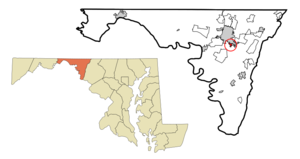
mapsize = 250x200px
map_caption = Location of Funkstown, Maryland
mapsize1 =
map_caption1 =subdivision_type = Country
subdivision_name =United States
subdivision_type1 = State
subdivision_name1 =Maryland
subdivision_type2 = County
subdivision_name2 = Washington
government_footnotes =
government_type =
leader_title =
leader_name =
leader_title1 =
leader_name1 =
established_title =
established_date =unit_pref = Imperial
area_footnotes =area_magnitude =
area_total_km2 = 0.9
area_land_km2 = 0.9
area_water_km2 = 0.0
area_total_sq_mi = 0.3
area_land_sq_mi = 0.3
area_water_sq_mi = 0.0population_as_of = 2000
population_footnotes =
population_total = 983
population_density_km2 = 1112.1
population_density_sq_mi = 2880.3timezone = Eastern (EST)
utc_offset = -5
timezone_DST = EDT
utc_offset_DST = -4
elevation_footnotes =
elevation_m = 151
elevation_ft = 495
latd = 39 |latm = 36 |lats = 33 |latNS = N
longd = 77 |longm = 42 |longs = 27 |longEW = Wpostal_code_type =
ZIP code
postal_code = 21734
area_code = 301
blank_name = FIPS code
blank_info = 24-31100
blank1_name = GNIS feature ID
blank1_info = 0590264
website =
footnotes =Funkstown is a town in Washington County,
Maryland ,United States . The population was 983 at the2000 census.History
Originally 88 acres were sold to Henry Funk by Frederick Calvert in
1754 and settled as "Jerusalem". [Morse, Jedidiah; "The American Gazetteer", Thomas & Andrews, 1810] [ [http://www.mdmunicipal.org/cities/index.cfm?townname=Funkstown&page=home Municipal History] ]The Civil War
Battle of Funkstown took place July 10, 1863, during theGettysburg Campaign asRobert E. Lee 'sArmy of Northern Virginia retreated towardVirginia in the week following theBattle of Gettysburg .Geography
Funkstown is located at coor dms|39|36|33|N|77|42|27|W|city (39.609096, -77.707527)GR|1, on
Antietam Creek , south of Hagerstown.According to the
United States Census Bureau , the town has a total area of 0.3square mile s (0.9km² ), all of it land.Demographics
As of the
census GR|2 of 2000, there were 983 people, 441 households, and 253 families residing in the town. Thepopulation density was 2,880.3 people per square mile (1,116.3/km²). There were 464 housing units at an average density of 1,359.6/sq mi (526.9/km²). The racial makeup of the town was 97.76% White, 0.61% African American, 0.31% Asian, 0.51% Pacific Islander, 0.71% from other races, and 0.10% from two or more races. Hispanic or Latino of any race were 0.71% of the population.There were 441 households out of which 25.4% had children under the age of 18 living with them, 43.8% were married couples living together, 9.8% had a female householder with no husband present, and 42.6% were non-families. 33.1% of all households were made up of individuals and 10.9% had someone living alone who was 65 years of age or older. The average household size was 2.20 and the average family size was 2.81.
In the town the population was spread out with 19.8% under the age of 18, 9.3% from 18 to 24, 30.9% from 25 to 44, 24.8% from 45 to 64, and 15.2% who were 65 years of age or older. The median age was 39 years. For every 100 females there were 97.0 males. For every 100 females age 18 and over, there were 96.0 males.
The median income for a household in the town was $35,278, and the median income for a family was $45,197. Males had a median income of $30,438 versus $21,000 for females. The
per capita income for the town was $17,544. About 8.4% of families and 10.4% of the population were below thepoverty line , including 15.7% of those under age 18 and 7.5% of those age 65 or over.Notes
External links
* [http://www.mdmunicipal.org/cities/index.cfm?townname=Funkstown&page=home Municipal history]
Wikimedia Foundation. 2010.