- Dugway, Utah
-
Dugway, Utah — CDP — Location of Dugway, Utah
Coordinates: 40°13′52″N 112°45′5″W / 40.23111°N 112.75139°WCoordinates: 40°13′52″N 112°45′5″W / 40.23111°N 112.75139°W Country United States State Utah County Tooele Established 1942 Area – Total 5.2 sq mi (13.5 km2) – Land 5.2 sq mi (13.5 km2) – Water 0.0 sq mi (0.0 km2) Population (2000) – Total 2,016 – Density 387.4/sq mi (149.6/km2) Time zone Mountain (MST) (UTC-7) – Summer (DST) MDT (UTC-6) ZIP code 84022 Area code(s) 435 FIPS code 49-20450[1] Dugway is a census-designated place (CDP) in Tooele County, Utah, United States. The population was 2,016, at the 2000 census, a modest increase over the 1990 figure of 1,761. "Dugway" is synonymous with the United States Army's giant testing facility, Dugway Proving Ground. The housing area designated for military and civilian personnel is referred to as "English Village."
The name "Dugway" comes from a technique to dig a trench along a hillside to keep a wagon from tipping.[2]
Geography
Dugway is located at 40°13′52″N 112°45′5″W / 40.23111°N 112.75139°W (40.231175, -112.751309).[3]
According to the United States Census Bureau, the CDP has a total area of 5.2 square miles (13.5 km²), all of it land.
Demographics
Historical populations Census Pop. %± 1970 2,357 — 1980 1,646 −30.2% 1990 1,761 7.0% 2000 2,016 14.5% source:[4] As of the census[1] of 2000, there were 2,016 people, 343 households, and 263 families residing in the CDP. The population density was 387.4 people per square mile (149.7/km²). There were 572 housing units at an average density of 109.9/sq mi (42.5/km²). The racial makeup of the CDP was 63.10% White, 15.03% African American, 8.43% Native American, 2.83% Asian, 0.50% Pacific Islander, 1.88% from other races, and 8.23% from two or more races. Hispanic or Latino of any race were 5.75% of the population.
There were 343 households out of which 51.0% had children under the age of 18 living with them, 66.5% were married couples living together, 6.1% had a female householder with no husband present, and 23.3% were non-families. 21.9% of all households were made up of individuals and 0.9% had someone living alone who was 65 years of age or older. The average household size was 3.01 and the average family size was 3.59.
In the CDP the population was spread out with 34.4% under the age of 18, 33.4% from 18 to 24, 21.6% from 25 to 44, 10.1% from 45 to 64, and 0.5% who were 65 years of age or older. The median age was 20 years. For every 100 females there were 47.0 males. For every 100 females age 18 and over, there were 48.5 males.
The median income for a household in the CDP was $49,306, and the median income for a family was $53,148. Males had a median income of $40,565 versus $17,695 for females. The per capita income for the CDP was $11,023. About 5.4% of families and 10.0% of the population were below the poverty line, including 15.7% of those under age 18 and none of those age 65 or over.
References
- ^ a b "American FactFinder". United States Census Bureau. http://factfinder.census.gov. Retrieved 2008-01-31.
- ^ Van Cott, J. W., 1990, Utah Place Names, ISBN 0-87480-345-4
- ^ "US Gazetteer files: 2010, 2000, and 1990". United States Census Bureau. 2011-02-12. http://www.census.gov/geo/www/gazetteer/gazette.html. Retrieved 2011-04-23.
- ^ "CENSUS OF POPULATION AND HOUSING (1790-2000)". U.S. Census Bureau. http://www.census.gov/prod/www/abs/decennial/index.html. Retrieved 2010-07-31.
Municipalities and communities of Tooele County, Utah Cities 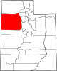
Towns Ophir | Rush Valley | Stockton | Vernon
CDPs Dugway | Erda | Stansbury Park
Unincorporated
communitiesBurmester | Ibapah | Lake Point
Ghost towns Categories:- Populated places in Tooele County, Utah
- Census-designated places in Utah
- Salt Lake City metropolitan area
- Populated places established in 1942

Wikimedia Foundation. 2010.