- Matraville, New South Wales
-
Matraville
Sydney, New South Wales
Eastern Suburbs Memorial ParkPopulation: 8,645 Established: 1904 Postcode: 2036 Location: 9 km (6 mi) south-east of Sydney CBD LGA: City of Randwick State District: Maroubra Federal Division: Kingsford Smith Suburbs around Matraville: Hillsdale Eastgardens Maroubra Banksmeadow Matraville Malabar Port Botany Phillip Bay Chifley Matraville is an older established area of the lower Eastern Suburbs of Sydney, in the state of New South Wales, Australia. Matraville is located approximately 9 kilometres by road [1] south-east of the Sydney central business district, in the local government area of the City of Randwick.[2]
Contents
History
Matraville is a suburb that fairly reeks of history. It was just a couple of kilometres down the road, near Botany Bay’s north headland, that the Frenchman Jean-Francois de Galaup, Comte de La Perouse, put the wind right up the English when he commanded the ships Boussole and Astrolabe to weigh anchor at the entrance to the bay... just two days after the First Fleet had arrived a couple of kilometres to the north in Port Jackson. Cast a glance across the entrance to the bay and you are looking directly at the spot where Captain James Cook planted the flag in 1770.
Matraville is named in honour of James Matra (1746–1806), sailor and diplomat, who was a midshipman on the voyage by Captain James Cook to Botany Bay in 1770. Matra was born in New York, but later settled in England. Cook wrote his name as Magra, as this was the spelling Matra used early in his life. Magra entered the Royal Navy as 'Captain's Servant' in May 1761 and served in European waters until the end of the Seven Years War. In July 1764, having returned to New York, he became a midshipman in the Hawke. This and other ships in which he later served undertook peacetime patrols on the eastern coast of North America and around the British Isles. On 25 July 1768 Magra joined the Endeavour and sailed on James Cook's first great voyage of Pacific exploration. During this voyage, Magra became acquainted with (Sir) Joseph Banks, and their friendship lasted until his death. The Endeavour returned to England in July 1771. Circumstantial evidence has identified Magra as the anonymous author of A Journal of a Voyage Round the World, which appeared two months later, and which offered some details of Cook's voyage not found in other accounts. Matra had walked over the area with Cook and his close friend, botanist Joseph Banks. Matra had also proposed to the British government that it establish a colony at Botany Bay in 1783, which he envisaged could be a place that American loyalists could also settle. Matra died on 29 March 1806 at Tangier.
 English explorer James Cook with sailor and diplomat James Matra
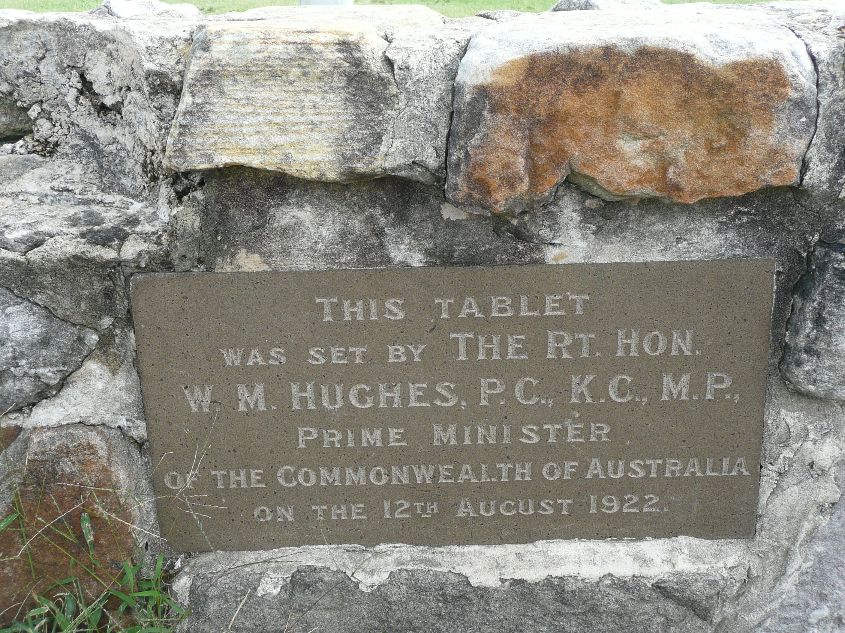
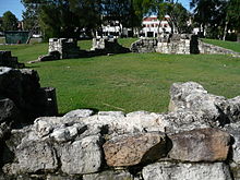 Sandstone wall at the site of the soldiers' settlement
Matraville was originally reserved for the Church and Schools Corporation with income generated intended to support clergy and teachers. The school was established in 1904, thanks to the efforts of John Rowland Dacey, the state member for Botany, who had nearby suburb of Daceyville named after him. The school was originally known as Cross Roads but Dacey suggested that the name Matra would be more appropriate in honour of James Matra [3] who Dacey's suggestion was accepted by the Department of Education and the school and suburb became Matraville. The land at Matraville reverted to the crown in 1917 and 72.5 acres (293,000 m2) were allocated for a settlement for soldiers returning from World War I. This parcel became one of the first large residential developments in the area - between 1918 and 1925. The Voluntary Workers Association was formed to build homes for soldiers and their families at the intersection of Anzac Parade and Beauchamp Road. The first cottage at the settlement was completed in 1919 and the residential area became known as Matraville Soldiers Garden Village.[4] A total of ninety-three cottages were built between 1918 and 1925. They were eventually taken over as State Government public housing. In 1977, all the cottages except one were demolished in spite of public protest; the one remaining cottage can still be seen in Somme Way. All that is left of the other cottages is a park with sections of sandstone walls and foundation stones laid by a number of people, including then Prime Minister William Morris Hughes.[5] Matraville was gazetted as a postal area in 1911.
Matraville is a suburb steeped in Anzac history. Matraville Soldiers' Settlement Public School is surrounded by roads commemorating the battlefields of World War I. These include Amiens, Ypres, Pozieres, Beauchamp, Menin, Flanders, Amiens, Bullecourt, Bapaume, Hamel, Armentieres inter alia. One street is Lone Pine Pde, referring to the bloody battle at Gallipoli where more than 2000 Australians died. Pozieres Ave, commemorates the battle during World War I, where Australia lost as many men in six weeks as they did in the whole of the Gallipoli campaign. Other streets in the area are named after rivers, Torrens, Franklin, Namoi, Hunter, Clarence and also early Australian explorers, Cunningham, Blaxland, Lawson and Oxley. HMAS Oxley was an Oberon class submarine in the Royal Australian Navy.
Matraville was split between Randwick and Botany Councils. When problems arose from the division in 1961, Botany Council decided to rename its portion Gilmore, to honour Australian poet Dame Mary Gilmore (1864–1962). After the post masters general office pointed out that there already was a Gilmore, New South Wales (near Tumut), the council chose Hillsdale to honour Patrick Darcy Hills, who was the New South Wales minister for local government. It was a controversial choice since most residents believed that a name should have been chosen that reflected Australia's history.
Matraville was one of the last bastions of traditional Chinese market gardens which is listed on the State Heritage Register. Until 1859 market gardens in the district were owned and tended by Europeans. After the main wave of gold rushes in the 1850s Chinese workers moved into the district. By the 1920s Chinese market gardens across NSW were being squeezed out by larger scale, more modern agriculture. The gardens at Matraville continued into the 1970s when leases were rescinded by the Crown. Despite opposition from Randwick Council and local residents the gardens were bulldozed to make way for housing development.[6]
Matraville was once home to a coal fired power plant, which was demolished in the 1980s to make way for further Port Botany expansion and a State Transit Authority bus depot, which provides services from the peninsula to the city. The only remaining part of the Bunnerong power station is called 'the Sucko', due to the 'sucking' inlet valve for water to cool the power plant. It is a popular swimming spot. In 1934 the fourth section of the La Perouse tramline was built to the power station which helped to encourage residential and industrial growth in the area.
Commercial areas
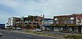
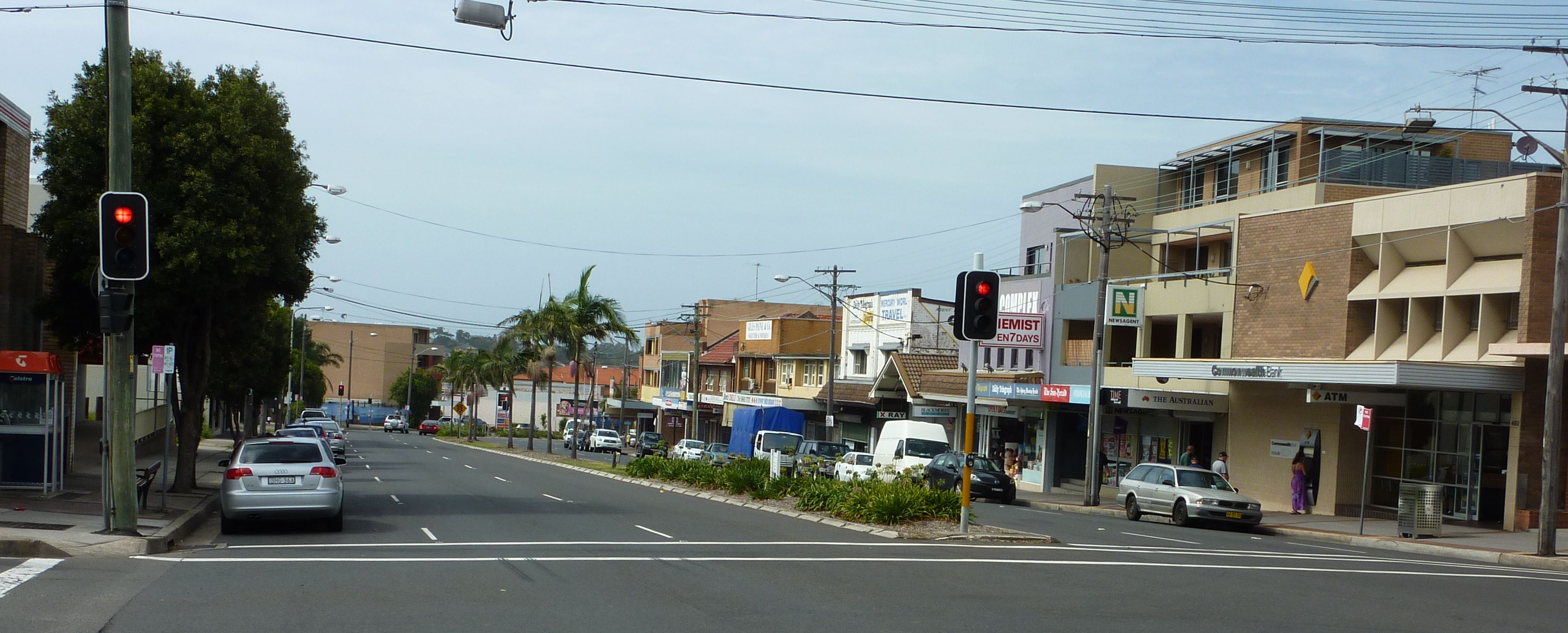
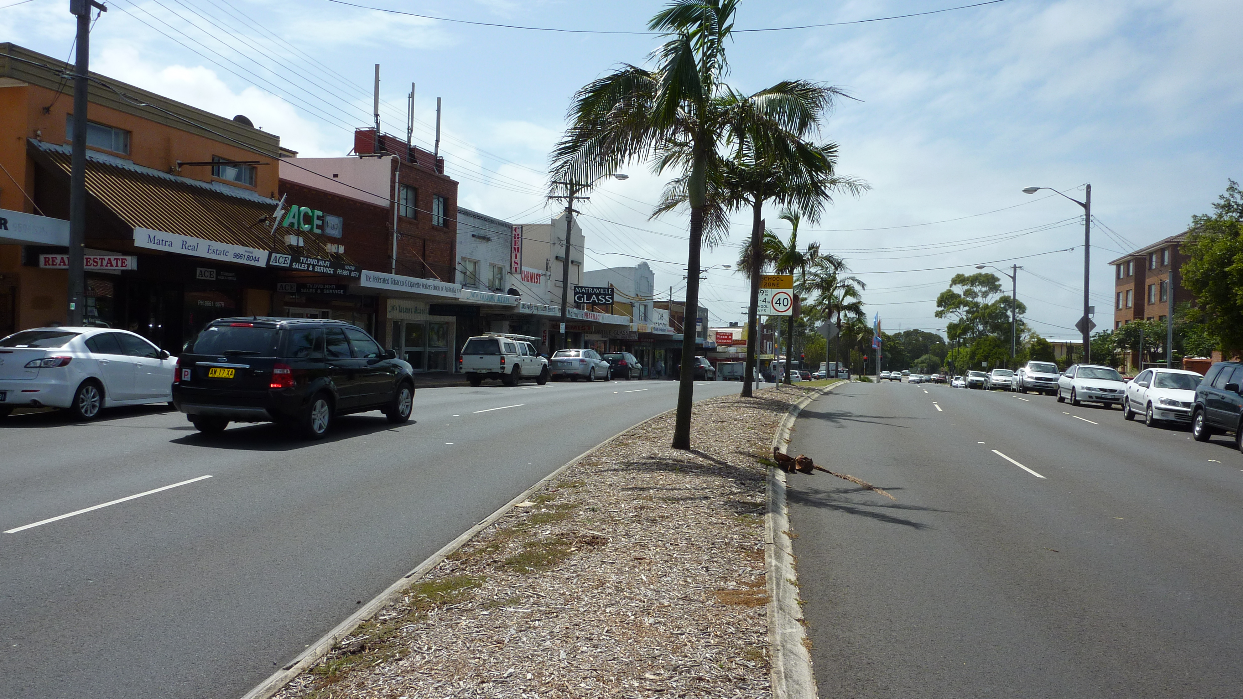
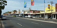 Matraville shopping strip
Today Matraville is primarily a residential area. The area has predominately low-rise housing, giving a quiet and relaxed suburban feel. There is also a diverse range of retail, commercial and recreational uses. Approximately 52 per cent of all private dwellings in Matraville are separate houses, significantly higher than the Randwick City average (28 per cent).[7]
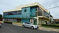
The Matraville shopping centre[8] is located in Bunnerong Road, between Beauchamp Road and Franklin Street. It is recognised by locals as offering great shopping opportunities, a variety of dining experiences, activities for all ages and as a starting point for sightseeing that takes in the history of both European and indigenous Australians. The range and variety of shops is extensive. Arts and crafts are wonderfully supported with flower stores, gift shops and the renowned Kim's Art and Framing Gallery. Services are well provided with three medical centres,an optometrist, dentist, physiotherapist, pharmacies, a bank, a supermarket,a scuba diving equipment shop, a bait and tackle shop and the Post Office, which has moved from its older, more stylish premises. Another service not found in every neighbourhood centre is Sydney Animal Hospital with a veterinarian on duty, an animal transport facility and a pet shop. Matraville is close to all general services and amenities.
 Matraville shopping centre
Dining facilities in Matraville cater to just about every taste preference. There are cafes such as Carmelos, Poppy's and Munchkins, fresh seafood, an award winning pie shop (House of Pie), Italian, Chinese, Turkish, chicken shops and even authentic Indian at Matraville Chickens. If you are looking for a night out there is a newly renovated Matraville Hotel and the Matraville RSL both offering excellent contemporary Australian cuisine as well as live entertainment.
The suburb experience increased gentrification largely due to its proximity to the CBD, the city's famous beaches and the University of NSW which caused an increase in demand for homes in the area and in turn significant price growth. In keeping with the style of the suburb, older homes are being bought and renovated to their former glory.
Landmarks
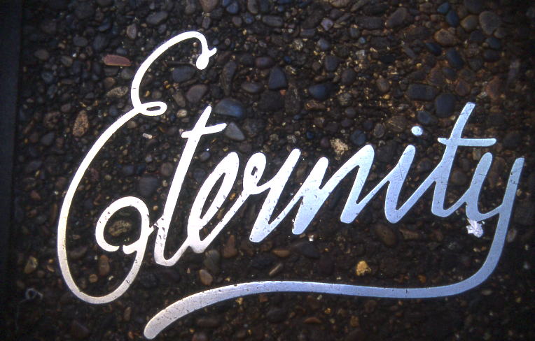
 Copy of the Eternity sign Arthur Stace used to write around Sydney
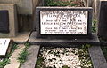
Landmarks include Heffron Park, a large reserve bordering Maroubra, formerly the site of a naval stores base in World War II. Eastern Suburbs Memorial Park [9] sits along the southern border of the suburb and incorporates Botany Cemetery, Eastern Suburbs Crematorium and Pioneer Park. Arthur Stace, known in Sydney as Mr Eternity, is buried at Botany Cemetery. He was famous for his practice of writing the word Eternity all over Sydney during the fifties and sixties.
Churches
Matraville is home to St Agnes Catholic Church [10] Matraville Baptist Church and East Sydney Community Christian Church.[11] Matraville also has a large Jehovah's Witness congregation with a Kingdom Hall.
Schools
There are three primary schools,[12] two public and one Catholic [13] and Matraville Sports High School. A child care centre [14] and preschool is also in the suburb. Soldiers Settlement School previously had a separate Infants and Primary School which are now combined into one larger school following the acquisition of park land at Finucane Crescent. The first dux of Matraville High School in 1964, was Robert Carr who later went on to become the Premier of New South Wales. The University of New South Wales, one of Australia’s leading teaching and research institutions, is only minutes away from Matraville.
Transport
Matraville is conveniently located 9 km from Sydney CBD and 3 km along Bunnerong Road from Kingsford town centre. Sydney Bus routes 309,390,391,392,394,398,399 and X92 provides fast and frequent service to City - Central Railway station, Martin Place and Circular Quay via Bunnerong Road, ANZAC Parade (UNSW), and Oxford Street.
Sport and recreation
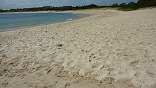 Yarra Bay beach
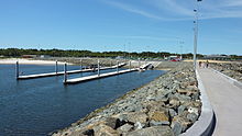 Boat ramp
Heffron Park [15] bounded by Bunnerong Road, Jersey Road, Robey Street and Fitzgerald Avenue comprises many sporting facilities including The Matraville Sports Centre with its squash and tennis courts. The Des Renford Aquatic Centre has an indoor heated pool, an outdoor Olympic sized pool and 2 pools for juniors. The Heffron Park sporting fields are set in extensive grasslands with a 4.2 kilometre bicycle track that weaves through the entire park. The park also provides opportunities for passive recreation such as walking, jogging, kite flying and ball games.In addition nearby Matraville RSL club,[16] provides activities such as lawn bowls, social golf, tennis, darts and snooker. The Malabar Riding school [17] is located on Wassel Street near the Chinese Gardens. Matraville Sports High School's Rugby League Program is one of the fastest growing in schoolboy Rugby League.
Matraville [18] is close to some of Sydney's well-known beaches such as Maroubra Beach, Coogee Beach and Bondi Beach. Sydney Dive Academy is based at Matraville, just north of one of Sydney’s premier scuba diving locations,[19] Bare Island.[20] If you're interested in sailing the Yarra Bay Sailing Club [21] is located a short distance from Matraville. The extensive range of world-class coastal golf courses is nearby. Major tournaments such as the Australian Open (golf) have been held in the area.
A number of places of interest are but a short distance from Matraville. The Prince of Wales Drive will take you out to Molineaux Point where you can enjoy the stunning views of Botany Bay. You will be able to see all the historical locations around Botany Bay on a large compass-type platform that provides explanations for each location. One of the State's biggest boat ramps with four lanes and two pontoons is located a couple of kilometers away at Foreshore Beach, on the northern side of Botany Bay.[22]
Culture
The Star Drive-in theatre opened in August 1958 and operated until 8 August 1984 when it closed for the last time because it was no longer profitable. No fanfare greeted the last screening and only nine cars were there to view the last film screened, The Exterminator. Drive-ins have featured in many Australian films. The best known is movie Dead End Drive-In (1986), a satirical futuristic action film in which troublesome youth, the unemployed and unwanted immigrants are herded into a drive-in converted into a detention centre. Filming took place at Sydney’s Matraville Drive-in. The Matraville Drive-in was demolished shortly after movie was completed, joining the hundreds of Australian drive-ins to suffer a similar fate in the 1980s. Matraville also hosts a very large Christmas lights decoration in the areas around Flanders Avenue, Knowles Avenue, Franklin Street and Clarence Street.
Demographics
According to the 2006 Australian Bureau of Statistics Census of Population, there were 8,645 people living in Matraville. Of the total population in Matraville, 58.7% stated they were born in Australia. Other common responses were United Kingdom 3.9%, China 2.4% and New Zealand 2.2%. English was stated as the only language spoken at home by 62.9% of residents. The most common responses for religious affiliation were Catholic 40.1%, Anglican 15.6%, No religion 10.6 %, non Christian 8.7% and Orthodox 5.7 %. As far as occupation is concerned, residents surveyed come from all walks of life, ranging from the professionals and managers (28.6%), clerical and administrative workers (19.2%) to technicians and trades workers (15%).[23]
Gallery
-

Matraville Center
-

House of Pie
-
Matraville RSL Club
-
Bait & Tackle shop
-

Bunnerong Road, Matraville
-

St Agnes's Catholic Church, Bunnerong Road
-
Grave of Arthur Stace, Botany Cemetery
-

Scenic Lookout, Molineaux Point
-

Yarra Sailing Club
-

Heffron Park
-

Cottage in Somme Way, the only surviving cottage from the soldiers' settlement
-

Foundation stone laid by Prime Minister Hughes
References
- ^ http://nona.net/features/map/placedetail.1507844/Matraville/
- ^ http://www.randwick.nsw.gov.au/library/scripts/objectifyMedia.aspx?file=pdf/8/66.pdf&siteID=1&str_title=Randwick City Council Precincts Map.pdf
- ^ http://adbonline.anu.edu.au/biogs/AS10326b.htm
- ^ The Book of Sydney Suburbs, Compiled by Frances Pollon, Angus & Robertson Publishers, 1990, p.167 ISBN 0-207-14495-8
- ^ Pictorial History of Randwick, Joan Lawrence (Kingsclear Books) pp.88-89
- ^ http://www.randwick.nsw.gov.au/About_Randwick/Heritage/Bicentennial_plaques/index.aspx
- ^ http://www.randwick.nsw.gov.au/About_Randwick/Heritage/History_of_the_Randwick_area/Your_suburb/Matraville/index.aspx
- ^ http://media.randwickcitytourism.com.au/movies/Matraville.wmv
- ^ http://www.esmp.net.au/ Eastern Suburbs Memorial Park
- ^ http://www.sydney.catholic.org.au/parishes/parish_mass_times_details.asp?ID=91
- ^ East Sydney Community Christian Church
- ^ http://www.matraville-p.schools.nsw.edu.au/
- ^ http://www.stagnesmatraville.com.au/
- ^ http://www.pumpkindaycare.com/
- ^ http://media.randwickcitytourism.com.au/movies/Cycling.wmv
- ^ http://www.matravillersl.com.au/
- ^ http://media.randwickcitytourism.com.au/movies/Horse_riding.wmv
- ^ http://www.australian1.com/maps/Matraville_Australia_Map.html
- ^ http://media.randwickcitytourism.com.au/movies/Scuba_diving.wmv
- ^ http://www.abyss.com.au/sites/bare_W.html
- ^ http://media.randwickcitytourism.com.au/movies/Yarra_bay_Sailing.wmv
- ^ http://www.maritime.nsw.gov.au/news/media-port_botany.html
- ^ http://info.id.com.au/dosydney/Default.aspx?pg=1&gid=3920
External links
- Matraville, New South Wales is at coordinates 33°57′41″S 151°13′53″E / 33.96134°S 151.23151°ECoordinates: 33°57′41″S 151°13′53″E / 33.96134°S 151.23151°E
Suburbs and localities within the City of Randwick · Eastern Suburbs · Sydney Centennial Park · Chifley · Clovelly · Coogee · Hillsdale · Kensington · Kingsford · La Perouse · Little Bay · Malabar · Maroubra · Maroubra Junction · Matraville · Phillip Bay · Port Botany · Randwick · South Coogee
Categories:- Suburbs of Sydney
- Australian soldier settlements
-


Wikimedia Foundation. 2010.