- Chifley, New South Wales
-
Chifley
Sydney, New South Wales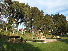
Bob Clarke Memorial Reserve, Anzac ParadePostcode: 2036 Location: 13 km (8 mi) south-east of Sydney CBD LGA: City of Randwick State District: Maroubra Federal Division: Kingsford Smith Suburbs around Chifley: Matraville Matraville Malabar Matraville Chifley Malabar Phillip Bay Little Bay Little Bay  Cannon at Bob Clarke Memorial Reserve
Chifley is a suburb in south-eastern Sydney, in the state of New South Wales, Australia. Chifley is located 13km south east of the Sydney central business district and is part of the City of Randwick. The postcode is 2036. Chifley is surrounded by the suburbs of Matraville, Malabar, Little Bay and Phillip Bay.
Contents
History
The first house built in the Chifley area was Bunnerong House, which was built in 1825. Most land in that area was owned by the Crown; during the Depression of the 1930s, land was leased to people who built homes in the area gradually, over a drawn-out period of time. Chifley was named after Ben Chifley (1885-1951), Australia's Labor Prime Minister at the end of World War II. Randwick Council made the area, which had been part of southern Matraville, a separate suburb in 1964.[1]
A large public housing complex was established in the area the 1960s. It featured a number of four- and five-storey buildings, plus some smaller buildings containing bedsit-style accommodation, in which lounge-room and bedroom are combined in one room.[2]
Chifley today
Chifley today is predominantly residential. Its low to medium density housing has attracted a larger proportion of families with children than many other suburbs in the City of Randwick[3]. In recent years, much of the original housing stock has been demolished and replaced by large family homes.
At the 2006 Census, Chifley recorded a population of just over 3000 people living in 1129 households. The majority of the inhabitants (73%) are Christian with Catholicism the largest denomination (38%). Approximately one quarter of the population was born overseas, slightly less than the average for the Sydney region[4].
The suburb contains two schools, Chifley Public School and Matraville Sports High School, and a number of preschool centres. Recreational areas include the Women's Athletic Field and Dr Walters Park.
The western edge of Chifley contains a small remnant of Eastern Suburbs Banksia Scrub, which was once the major flora habitat in this coastal region of Sydney. Efforts are being made to remediate and preserve this area[5].
A number of notable local points of interest adjoin Chifley, including the Long Bay Correctional Centre, Eastern Suburbs Memorial Park and the Bunnerong Equestrian Park.
Schools
- Chifley Public School
- Matraville Sports High School
Parks
- Dr Walters Park on Mawson Parade.
- Women's Athletic Field
References
- ^ The Book of Sydney Suburbs, Frances Pollon, Angus & Robertson Publishers, 1990, p.60, ISBN 0-207-14495-8
- ^ Randwick Website:Retrieved 22nd April 2009
- ^ Randwick Website:Retrieved 22nd April 2009
- ^ "Randwick Council Community Profile Chifley". http://profile.id.com.au/Default.aspx?id=305&pg=138&gid=100&type=enum&#ma. Retrieved 2011-10-21.
- ^ "Eastern Suburbs Banksia Scrub Endangered Ecological Community Recovery Plan". http://www.environment.nsw.gov.au/resources/nature/recoveryFinalEsbs.pdf. Retrieved 2011-10-21.
 Weatherboard home, Macquarie Street
External links
- Chifley, New South Wales is at coordinates 33°58′06″S 151°14′23″E / 33.96845°S 151.23979°ECoordinates: 33°58′06″S 151°14′23″E / 33.96845°S 151.23979°E
Suburbs and localities within the City of Randwick · Eastern Suburbs · Sydney Centennial Park · Chifley · Clovelly · Coogee · Hillsdale · Kensington · Kingsford · La Perouse · Little Bay · Malabar · Maroubra · Maroubra Junction · Matraville · Phillip Bay · Port Botany · Randwick · South Coogee
List of Sydney suburbs Categories:- Suburbs of Sydney
- Sydney geography stubs


Wikimedia Foundation. 2010.