- Idrijca
-
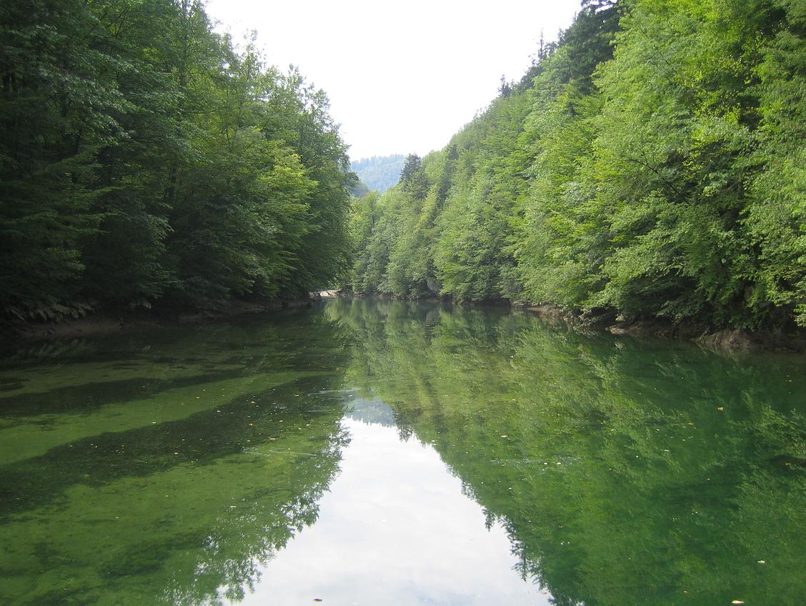
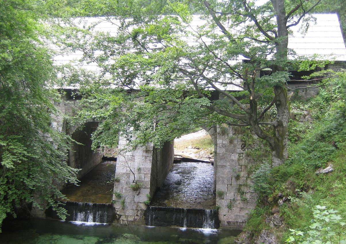
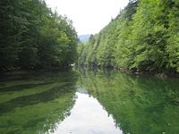 The Idrijca River near the Wild Lake
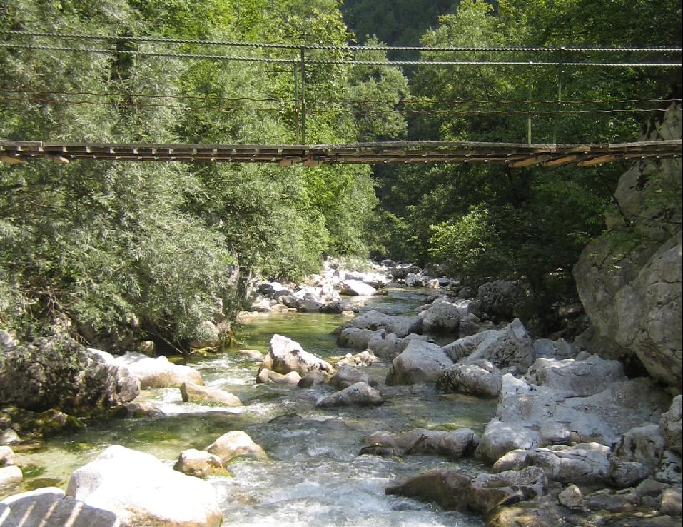
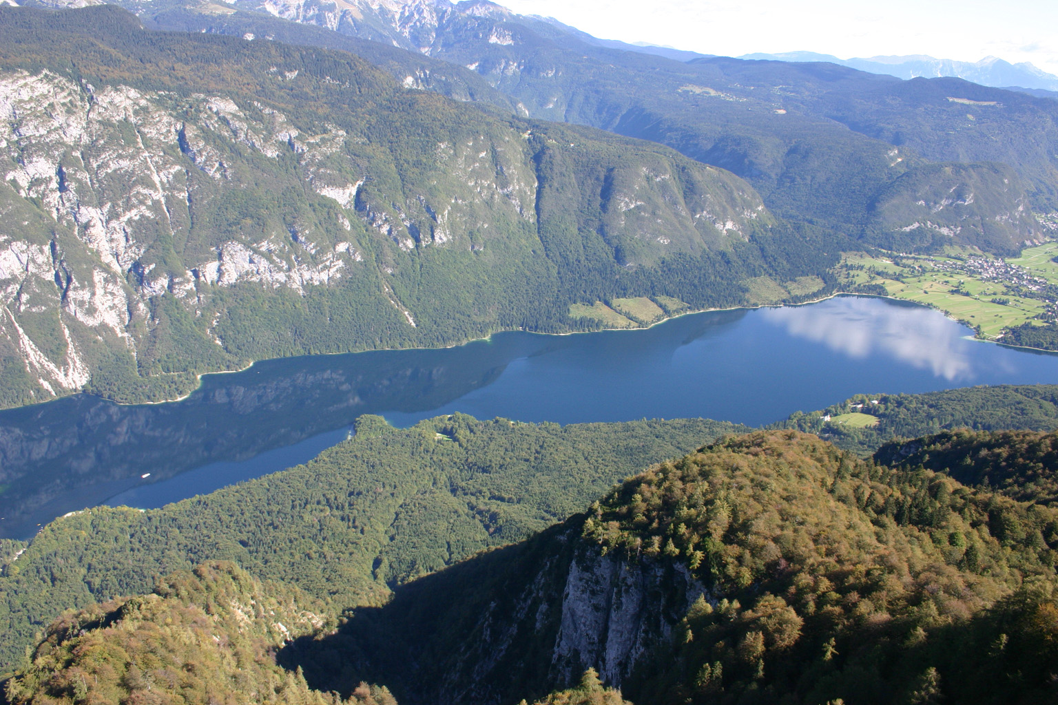
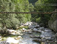 The upper Idrijca River
The Idrijca is a river flowing through the Idrija Hills and Cerkno Hills. It is 60 km long. It rises near Vojsko, flows towards northeast and after passing through Idrija turns to the northwest. After passing through Spodnja Idrija and Cerkno it joins the Soča in Most na Soči.
The river basin extends over 598 km2. The major tributaries are the Belca, Zala, Cerknica, and Bača from the right and the Nikomlja, Kanošica, and Trebušica from the left. One of the right tributaries is also the Jezernica River, which originates from the Wild Lake (Slovene: Divje jezero). Being only 55 m long, the Jezernica is the shortest river in Slovenia.
The river has many fish, among which the Salmo marmoratus, the Rainbow Trout, and the Grayling are noteworthy. In the past, timber was driven down the Idrijca to Idrija to be used as pillars in the Idrija mercury mine. Special logging sluices (Sln. klavže) were employed for this purpose from the 17th until the 19th century.
The area of the upper Idrijca has been proclaimed the Upper Idrijca Natural Park. It encompasses numerous karst features and diverse plant species. During World War II the Pavla partisan hospital stood there.
Tributaries
- Senčni potok
- Nikova
- Kanomljica
- Otuška
- Sevnica
- Trebuščica
- Hotenja
- Črni potok
- Belca
- Zala
- Ljubevšca
- Zaspana grapa
- Skavnica
- Peklenska graba
- Grda grapa
- Luknjica
- Zaganjalčnica
- Cerknica
- Jesenica
- Bukovška grapa
- Žibernik
- Doberšček
- Bača
References
- A map of the Idrijca. Geopedia.si online project. Acquired March 30, 2008.
- Upper Idrijca Natural Park. Idrija Tourism. Acquired March 30, 2008.
Hydrography of Slovenia Rivers Sava - Drava - Kolpa - Savinja - Soča - Mura - Krka - Sotla - Dravinja - Ledava - Pesnica - Idrijca - Ščavnica - Reka - Sora - Vipava - Mirna - Meža -Ljubljanica - Paka - Polskava - Mislinja - Voglajna - Lahinja - Gradaščica - Kamniška Bistrica - Kokra - Radulja - Bolska - Hudinja - Iška - Dreta - Oplotniščica - Pšata - Pivka - Tržiška Bistrica - Fram Creek - Ložnica - Temenica - Dragonja - Rinža - Davča - Nevljica - Sava Dolinka - Velika Krka - Čabranka - Rak - Nadiža
Lakes Lake Bled - Lake Bohinj - Lake Cerknica - Lake Gradišče - Lake Kreda - Lake Palčje - Lake Ptuj - Lake Žovnek - Wild LakeValleys Logar Valley - Radovna Valley - Rakov Škocjan - Triglav Lakes Valley - Upper Sava Valley - Trenta Valley - Tuhinj Valley - Vipava ValleyCanyons and Gorges Pekel Gorge - VintgarWaterfalls Idrija Settlements Administrative centre: Idrija
Dole, Čekovnik, Črni Vrh, Godovič, Gore, Gorenja Kanomlja, Gorenji Vrsnik, Govejk, Idrijska Bela, Idrijske Krnice, Idrijski Log, Idršek, Javornik, Jelični Vrh, Kanji Dol, Korita, Ledine, Ledinske Krnice, Lome, Masore, Mrzli Log, Mrzli Vrh, Pečnik, Potok, Predgriže, Spodnja Idrija, Spodnja Kanomlja, Spodnji Vrsnik, Srednja Kanomlja, Strmec, Vojsko, Zadlog, Zavratec, ŽirovnicaLandmarks Wild Lake, Idrijca, Gewerkenegg Castle, Kenda manor, Idrija Museum, Idrija mine, Idrija lace school, Church of the Holy TrinityNotable people Anton Bebler, Karel Dežman, Belsazar Hacquet, Vladimír Karfík, Giovanni Antonio Scopoli, Pier Paolo PasoliniCoordinates: 46°09′N 13°46′E / 46.15°N 13.767°E
Categories:- Rivers of Slovenia
- Idrija
- Goriška statistical region geography stubs
Wikimedia Foundation. 2010.