- Harlem Line
Infobox rail line
name = Harlem Line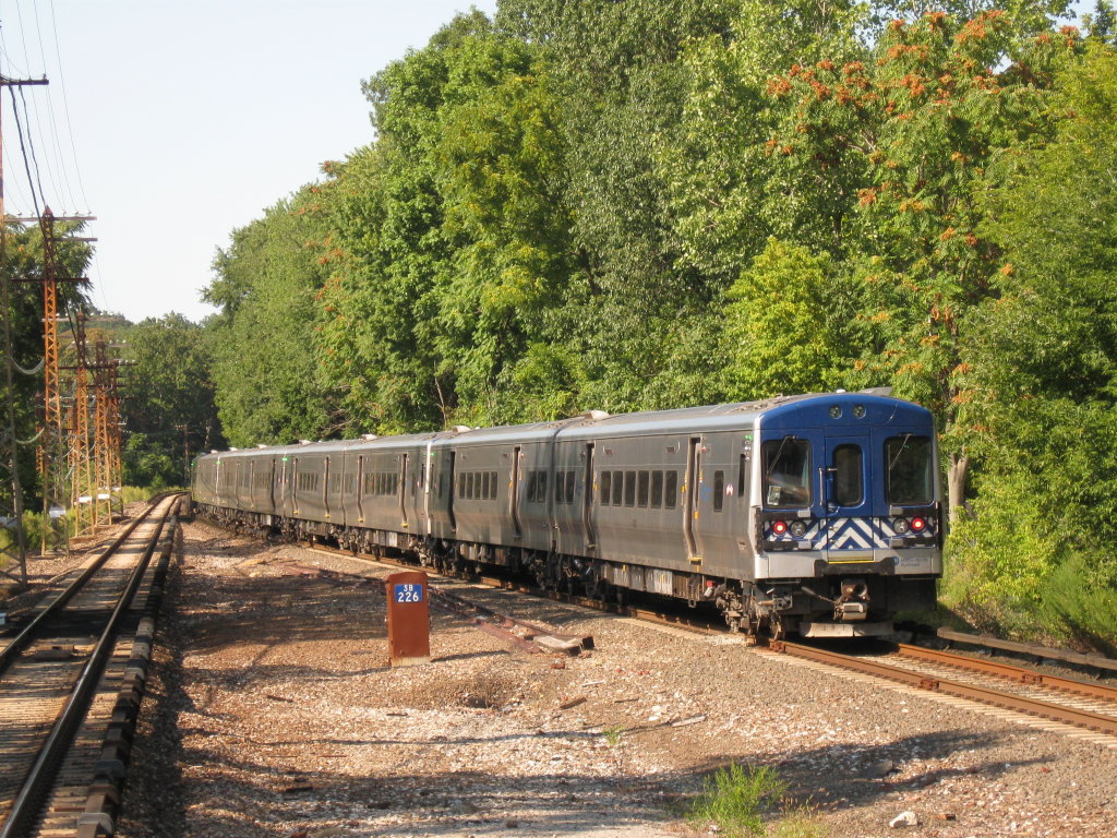
image_width = 300px
caption = Train #645 leaves the White Plains station, northbound to Southeast.
type = Commuter rail line
system = Metro-North
status =
locale =New York City , Westchester, Putnam, and Dutchess counties
start =Grand Central Terminal
end = Southeast
(end of electric service)
Wassaic
(end of line)
stations = 38
routes =
ridership =
open =
close =
owner =Argent Ventures
(south of CP 76.2)
Metro-North
(north of Dover Plains)
operator = Metro-North
character = Commuter rail
stock =
linelength =
tracklength = 82-mile (132 km)
notrack =
gauge = RailGauge|sg
el =
speed =
elevation =
infobox rdt|Harlem Line-infobox|Metro-North 's Harlem Line, originally chartered as theNew York & Harlem Railroad , is an 82-mile (132 km)commuter rail line running north fromNew York City into eastern Dutchess County. The lower 53 miles (86 km) fromGrand Central Terminal to Southeast, in Putnam County, are electrified with athird rail and has two tracks; north of that point, trains usediesel locomotive s on a single track. The diesel trains run as a shuttle on the northern end of the line except during rush hours, when they run as expresses to or from Grand Central. While the line has traditionally served to bring commuters from Westchester County to jobs in the city, in recent years it has begun to see more "reverse commuting", as Bronx residents use it to reach jobs inSouthern Westchester where many stations are within walking distance of city centers. The northern reaches of the line are also close enough toWestern Massachusetts to enable residents of part of that region to commute to jobs in the city as well, albeit at a considerable expense in time and money.With 38 stations, the Harlem Line has the most of any Metro-North main line. Its northern terminal, Wassaic, is the northernmost station in the system. It is the only Metro-North line used exclusively by that carrier (no use by
Amtrak , thoughCSX services freight customers as far north as Mount Vernon) and the only one that uses the entirety of existing track. Metro-North has assigned it thecolor code blue, used as trim on station signs andspot color on printedtimetable s. The blue color-coding appears to have started with timetables issued by predecessorNew York Central as far back as 1965.History
Prior to becoming part of the Metro-North system, the line continued all the way north to
Chatham, New York on theBoston and Albany Railroad , about 52 miles past the current terminal at Wassaic. Passenger service from Dover Plains to Chatham was abandoned in1972 , and the tracks were removed north of Millerton shortly thereafter. A decade later, freight service between Dover Plains and Millerton was abandoned, with tracks removed from Wassaic to Millerton. OnJuly 9 ,2000 , Metro-North restored service between Dover Plains and Wassaic, a move the railroad billed as its first service expansion since it was created in 1983.The Metropolitan Transportation Authority (MTA) leased the line south of Dover Plains from
Penn Central onJune 1 ,1972 . Penn Central operated the last southbound passenger train between Chatham andGrand Central Terminal onMarch 20 ,1972 , ending service in the middle of the day. With no scheduled return trip to Chatham, passengers who had gone south in the morning were left stranded, with service going only as far north as Dover Plains (52 miles shy of Chatham). [http://www.prrths.com/Hagley/PRR1972%20Jun%2005.pdf]The segment of the line that ran from Wassaic to
Craryville, New York is now under control of the [http://www.hvrt.org Harlem Valley Rail Trail Association] which currently has trails operating from Wassaic to the former Millerton station and between Boston Corners and Hillsdale.Future
With the entire existing track in use since service to Wassaic was restored in 2000, there is little talk of expansion or branching. For now, Metro-North and the MTA have focused on improving existing facilities on the line, particularly stations such as Brewster where increasing usage has caused growing pains.
Incidents
A train/car collision on
January 2 ,2008 made national news. That evening, Bo Bai, a computerconsultant fromSunnyvale, California , was driving back to his temporary residence in Fishkill, relying on his rental car'sGlobal Positioning System (GPS) unit to give him directions. At the Green Lane crossing south of the Bedford Hills station, he followed the GPS's instructions to turn right, believing he was about to get on theSaw Mill River Parkway just ahead of the tracks. His vehicle quickly became stuck on the rails, and he abandoned it minutes before a northbound train came through. No one was injured, but service on the line was delayed for hours. He was issued a minor summons and billed for damage to the train and track.cite news|last=Thomson|first=Iain|title=GPS steers driver into path of train|url=http://www.vnunet.com/vnunet/news/2206534/gps-steers-man-train|publisher="vnunet"|date=January 4 ,2008 |accessdate=2008-05-14]tation stops
"Past Wassaic, the following stations once existed:"
*Amenia
*Sharon
*Coleman's
*Millerton
*Mount Riga
*Boston Corners
*Copake Falls
*Hillsdale
*Craryville
*Martindale
*Philmont
*Ghent
*ChathamLine description
The Harlem Line hews closely to roads along
river -based transportation corridors dating back to even pre-rail times. It follows three majorfreeway s closely from the Bronx northwards through Westchester: theBronx River Parkway (and a short portion that becomes theTaconic State Parkway ), theSaw Mill River Parkway andInterstate 684 . In the last section it also begins to run close to NY 22, the long north-south two-lane state highway that parallels the eastern border of the state.In Westchester, it serves some of that county's most affluent communities as it slowly trends eastward.
Manhattan/Bronx
The Harlem Line begins at
Grand Central Terminal . The train tracks rise to ground level north of 97th Street inManhattan . After stopping at Harlem-125th Street, the Harlem Line crosses the Harlem River at 135th Street inManhattan , enteringthe Bronx .In
the Bronx , the Harlem Line cuts through the neighborhoods of the southwest Bronx, with two stations: Melrose, at 162nd Street, and Tremont, at 177th Street. It then runs under theCross Bronx Expressway (I-95). Fordham station is next, at 190th Street, also known as Fordham Road. The Harlem Line then parallels the western edge ofFordham University until the Botanical Garden station at 200th Street, also known as Bedford Park Boulevard.The Harlem Line then cuts northeast to join the Bronx River Parkway, which lies to the east of the tracks. The Williams Bridge station is next, at 210th Street, also known as Gun Hill Road. After the Williams Bridge station, Woodlawn Cemetery begins to the west of the tracks, with Webster Avenue in between the cemetery and tracks. The Woodlawn station is at 233rd Street.
The Harlem Line then goes under a bridge for the parkway, and it remains to the west of the tracks until Scarsdale station. The Wakefield station at 241st Street concludes the
Bronx portion of the Harlem Line.Westchester County
The Westchester portion of the Harlem Line begins at
Bronx River Road in southeasternYonkers . After the Mount Vernon West station, the Harlem Line runs along the on-ramp to theCross County Parkway eastbound, right before Fleetwood station. After the Bronxville station, the Harlem Line parallels theBronx River Parkway all the way up to White Plains.From White Plains, the railroad winds its way through the city and passing through the yards at North White Plains which until
1984 was the northern boundary of third-rail electrification. The stretch north of North White Plains is unique because it is the only electrified stretch of Metro-North's network that has grade crossings, a byproduct of its existence pre-electrification. Katonah and Brewster are located right next to grade crossings.After North White Plains, there is one more stop, Valhalla along the Taconic State Parkway, the successor to the Bronx River, and then the double-track railroad curves to follow the
Saw Mill River Valley and the eponymous parkway. Rail and road briefly separate at Mount Kisco, but then remain close by at the last stop along the Saw Mill, Bedford Hills (although the parkway cannot be seen from the station).Past Katonah, the railroad runs between the
Croton River and I-684. Goldens Bridge and Purdy's are both located very close to the interstate, although only the former can be seen from it. North of the latter, the tracks choose the river over the interstate to take them to Croton Falls, and pick up Route 22 for the first time.Putnam County
After Croton Falls station, the Harlem Line runs along
East Branch Reservoir and crosses into Putnam County. The landscape is increasingly rural. Above Southeast station (formerly Brewster North), the railroad passes under Interstate 84 and through the yards at Putnam Junction. This is the northern boundary of third-rail electrification. Diesel territory and single track begin here. The tracks finally follow their own course, away from any road or river, past the long-abandoned Towners station up to Patterson and into Dutchess County.Dutchess County
Shortly before reaching Pawling, the line enters the Harlem Valley from which it takes its name and begins to parallel Route 22, although not as closely as it did the roads further south (indeed, they even cross over a few times). A few miles north of Pawling the
Appalachian Trail crossing has earned its own flag stop to allow thru-hikers to take a break in the city and day hikers to visit the nearbyPawling Nature Preserve .The next two stops, Harlem Valley-Wingdale and Dover Plains, are roughly eight miles (13 km) apart, the longest distance between any two stops on the Harlem Line. Until 2000, Dover Plains was the last stop on the line, but then tracks remaining from the NYCRR era that had not yet been torn up were renovated and the line was extended to Tenmile River and their new northern terminus, Wassaic. A small yard where diesel trains await their routes just past the station marks the end of the line.
Rolling stock
On the electrified portions of the line, M3s and M7s are usually used. The thirty remaining M1s (to be used for Yankee Stadium shuttle service in the future) are also occasionally used to serve passengers. And also as with the Hudson Line, diesels are driven by dual-mode Genesis locomotives. However, in addition to Genesises in its own colors, Metro-North has leased some
Amtrak Genesis for use on the Harlem Line due to the age of some of the FL9s and F10s in its own fleet. The FL9s and F10s are generally used on the upper Harlem Line for shuttle service between Southeast (where the third rail ends) and Wassaic, 29 miles north in Dutchess County.References
External links
* [http://www.thetreblemakers.com/Putnam%20Division.jpgMap of the Putnam and Harlem Divisions of the New York Central Railroad]
* [http://piercehaviland.com/rail/harlem.html New York Central: Harlem Line]
Wikimedia Foundation. 2010.