- Mountville, South Carolina
-
Mountville, South Carolina — CDP — Location of Mountville, South Carolina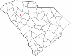
Coordinates: 34°21′45″N 81°58′14″W / 34.3625°N 81.97056°WCoordinates: 34°21′45″N 81°58′14″W / 34.3625°N 81.97056°W Country United States State South Carolina County Laurens Area – Total 2.8 sq mi (7.4 km2) – Land 2.8 sq mi (7.3 km2) – Water 0.0 sq mi (0.0 km2) Elevation 630 ft (192 m) Population (2000) – Total 130 – Density 45.9/sq mi (17.7/km2) Time zone Eastern (EST) (UTC-5) – Summer (DST) EDT (UTC-4) ZIP code 29370 Area code(s) 864 FIPS code 45-48670[1] GNIS feature ID 1249752[2] Mountville is a census-designated place in Laurens County, South Carolina, United States. The population was 130 at the 2000 census. It is part of the Greenville–Mauldin–Easley Metropolitan Statistical Area.
Contents
Geography
Mountville is located at 34°21′45″N 81°58′14″W / 34.3625°N 81.97056°W (34.362544, -81.970573)[3].
According to the United States Census Bureau, the CDP has a total area of 2.8 square miles (7.4 km²), of which, 2.8 square miles (7.3 km²) of it is land and 0.04 square miles (0.1 km²) of it (0.70%) is water.
Demographics
As of the census[1] of 2000, there were 130 people, 51 households, and 41 families residing in the CDP. The population density was 45.9 people per square mile (17.7/km²). There were 59 housing units at an average density of 20.8/sq mi (8.0/km²). The racial makeup of the CDP was 83.85% White, 15.38% African American, and 0.77% from two or more races.
There were 51 households out of which 27.5% had children under the age of 18 living with them, 58.8% were married couples living together, 15.7% had a female householder with no husband present, and 19.6% were non-families. 13.7% of all households were made up of individuals and 9.8% had someone living alone who was 65 years of age or older. The average household size was 2.55 and the average family size was 2.78.
In the CDP the population was spread out with 21.5% under the age of 18, 5.4% from 18 to 24, 23.8% from 25 to 44, 28.5% from 45 to 64, and 20.8% who were 65 years of age or older. The median age was 42 years. For every 100 females there were 85.7 males. For every 100 females age 18 and over, there were 88.9 males.
The median income for a household in the CDP was $42,885, and the median income for a family was $32,083. Males had a median income of $38,750 versus $31,250 for females. The per capita income for the CDP was $20,498. There were 17.4% of families and 18.0% of the population living below the poverty line, including 46.2% of under eighteens and none of those over 64.
References
- ^ a b "American FactFinder". United States Census Bureau. http://factfinder.census.gov. Retrieved 2008-01-31.
- ^ "US Board on Geographic Names". United States Geological Survey. 2007-10-25. http://geonames.usgs.gov. Retrieved 2008-01-31.
- ^ "US Gazetteer files: 2010, 2000, and 1990". United States Census Bureau. 2011-02-12. http://www.census.gov/geo/www/gazetteer/gazette.html. Retrieved 2011-04-23.
External links
- ACCESS 15; Laurens County Public, educational, and government access (PEG) cable TV channel
Municipalities and communities of Laurens County, South Carolina Cities Clinton | Fountain Inn‡ | Laurens
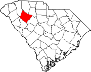
Towns Cross Hill | Gray Court | Ware Shoals‡ | Waterloo
CDPs Joanna | Mountville | Princeton | Watts Mills
Unincorporated
communitiesHickory Tavern | Kinards‡
Footnotes ‡This populated place also has portions in an adjacent county or counties
Categories:- Laurens County, South Carolina
- Census-designated places in South Carolina
- Greenville, South Carolina metropolitan area


Wikimedia Foundation. 2010.