- Dunean, South Carolina
-
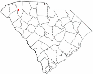
Dunean, South Carolina — CDP — Location of Dunean, South Carolina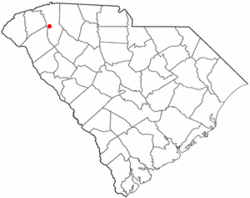
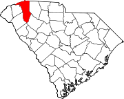
Coordinates: 34°49′24″N 82°25′13″W / 34.82333°N 82.42028°WCoordinates: 34°49′24″N 82°25′13″W / 34.82333°N 82.42028°W Country United States State South Carolina County Greenville Area – Total 1.7 sq mi (4.3 km2) – Land 1.7 sq mi (4.3 km2) – Water 0.0 sq mi (0.0 km2) Elevation 997 ft (304 m) Population (2000) – Total 4,158 – Density 2,499.0/sq mi (964.9/km2) Time zone Eastern (EST) (UTC-5) – Summer (DST) EDT (UTC-4) FIPS code 45-21310[1] GNIS feature ID 1231247[2] Dunean is a census-designated place (CDP) in Greenville County, South Carolina, United States. The population was 4,158 at the 2000 census. It is part of the Greenville–Mauldin–Easley Metropolitan Statistical Area.
Geography
Dunean is located at 34°49′24″N 82°25′13″W / 34.82333°N 82.42028°W (34.823377, -82.420234)[3].
According to the United States Census Bureau, the CDP has a total area of 1.7 square miles (4.4 km2), all of it land.
Demographics
As of the census[1] of 2000, there were 4,158 people, 1,779 households, and 1,056 families residing in the CDP. The population density was 2,499.0 people per square mile (967.1/km²). There were 1,999 housing units at an average density of 1,201.4/sq mi (465.0/km²). The racial makeup of the CDP was 67.99% White, 26.29% African American, 0.31% Native American, 0.51% Asian, 3.08% from other races, and 1.83% from two or more races. Hispanic or Latino of any race were 8.10% of the population.
There were 1,779 households out of which 25.0% had children under the age of 18 living with them, 38.1% were married couples living together, 16.8% had a female householder with no husband present, and 40.6% were non-families. 34.1% of all households were made up of individuals and 14.6% had someone living alone who was 65 years of age or older. The average household size was 2.34 and the average family size was 2.95.
In the CDP the population was spread out with 22.3% under the age of 18, 9.4% from 18 to 24, 30.0% from 25 to 44, 20.8% from 45 to 64, and 17.5% who were 65 years of age or older. The median age was 38 years. For every 100 females there were 91.9 males. For every 100 females age 18 and over, there were 90.9 males.
The median income for a household in the CDP was $25,319, and the median income for a family was $32,563. Males had a median income of $25,332 versus $21,651 for females. The per capita income for the CDP was $13,833. About 16.9% of families and 18.8% of the population were below the poverty line, including 21.6% of those under age 18 and 14.2% of those age 65 or over.
References
- ^ a b "American FactFinder". United States Census Bureau. http://factfinder.census.gov. Retrieved 2008-01-31.
- ^ "US Board on Geographic Names". United States Geological Survey. 2007-10-25. http://geonames.usgs.gov. Retrieved 2008-01-31.
- ^ "US Gazetteer files: 2010, 2000, and 1990". United States Census Bureau. 2011-02-12. http://www.census.gov/geo/www/gazetteer/gazette.html. Retrieved 2011-04-23.
Municipalities and communities of Greenville County, South Carolina Cities Fountain Inn‡ | Greenville | Greer‡ | Mauldin | Simpsonville | Travelers Rest
CDPs Berea | City View | Dunean | Five Forks | Gantt | Golden Grove | Judson | Parker | Piedmont‡ | Sans Souci | Slater-Marietta | Tigerville | Taylors | Wade Hampton | Ware Place | Welcome
Footnotes ‡This populated place also has portions in an adjacent county or counties
Categories:- Greenville County, South Carolina
- Census-designated places in South Carolina
- Greenville, South Carolina metropolitan area

Wikimedia Foundation. 2010.