- Coward, South Carolina
-
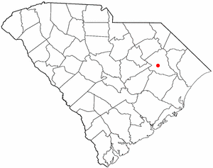
Coward, South Carolina — Town — Location of Coward in
South CarolinaCoordinates: 33°58′32″N 79°44′50″W / 33.97556°N 79.74722°WCoordinates: 33°58′32″N 79°44′50″W / 33.97556°N 79.74722°W Country United States State South Carolina County Florence Area – Total 3.4 sq mi (8.9 km2) – Land 3.4 sq mi (8.9 km2) – Water 0.0 sq mi (0.0 km2) Elevation 82 ft (25 m) Population (2000) – Total 650 – Density 190.1/sq mi (73.4/km2) Time zone EST (UTC-5) – Summer (DST) EDT (UTC-4) ZIP code 29530 Area code(s) 843 FIPS code 45-17215[1] GNIS feature ID 1247407[2] Coward is a town in Florence County, South Carolina, United States. The population was 650 at the 2000 census. It is part of the Florence Metropolitan Statistical Area.
Geography
Coward is located at 33°58′32″N 79°44′50″W / 33.975560°N 79.747097°W.[3]
According to the United States Census Bureau, the town has a total area of 3.4 square miles (8.8 km2), of which, 3.4 square miles (8.8 km2) of it is land and 0.29% is water.
Demographics
As of the census[1] of 2000, there were 650 people, 246 households, and 178 families residing in the town. The population density was 189.9 people per square mile (73.4/km2). There were 263 housing units at an average density of 76.8 per square mile (29.7/km2). The racial makeup of the town was 84.15% White, 14.00% African American, 0.15% Asian, 0.62% from other races, and 1.08% from two or more races. Hispanic or Latino of any race were 1.38% of the population.
There were 246 households out of which 32.9% had children under the age of 18 living with them, 56.1% were married couples living together, 12.2% had a female householder with no husband present, and 27.6% were non-families. 24.8% of all households were made up of individuals and 8.1% had someone living alone who was 65 years of age or older. The average household size was 2.64 and the average family size was 3.17.
In the town the population was spread out with 26.2% under the age of 18, 9.7% from 18 to 24, 28.8% from 25 to 44, 25.5% from 45 to 64, and 9.8% who were 65 years of age or older. The median age was 35 years. For every 100 females there were 98.8 males. For every 100 females age 18 and over, there were 94.3 males.
The median income for a household in the town was $28,182, and the median income for a family was $30,208. Males had a median income of $28,977 versus $17,039 for females. The per capita income for the town was $12,711. About 16.1% of families and 24.4% of the population were below the poverty line, including 37.2% of those under age 18 and 43.2% of those age 65 or over.
References
- ^ a b "American FactFinder". United States Census Bureau. http://factfinder.census.gov. Retrieved 2008-01-31.
- ^ "US Board on Geographic Names". United States Geological Survey. 2007-10-25. http://geonames.usgs.gov. Retrieved 2008-01-31.
- ^ "US Gazetteer files: 2010, 2000, and 1990". United States Census Bureau. 2011-02-12. http://www.census.gov/geo/www/gazetteer/gazette.html. Retrieved 2011-04-23.
Municipalities and communities of Florence County, South Carolina Cities 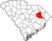
Towns Coward | Olanta | Pamplico | Quinby | Scranton | Timmonsville
Unincorporated
communitiesCategories:- Florence County, South Carolina
- Towns in South Carolina
- Florence, South Carolina metropolitan area

Wikimedia Foundation. 2010.