- Crookham Village
-
Coordinates: 51°16′27″N 0°51′40″W / 51.274052°N 0.861053°W
Crookham Village 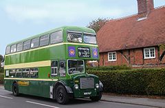
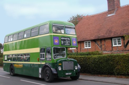
A preserved 1960s Aldershot and District Traction Company bus (a Dennis Loline III) passes an old cottage in Crookham Village
 Crookham Village
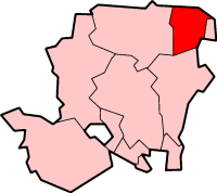
Crookham Village shown within HampshirePopulation 3,648 [1](2001 Census) OS grid reference SU792524 - London 42 mi (68 km) Parish Crookham Village District Hart Shire county Hampshire Region South East Country England Sovereign state United Kingdom Post town FLEET Postcode district GU51, GU52 Dialling code 01252 Police Hampshire Fire Hampshire Ambulance South Central EU Parliament South East England UK Parliament North East Hampshire Website Crookham Village Parish Council List of places: UK • England • Hampshire Crookham Village is located south-west of Fleet, in northeast Hampshire, England and lies within the Hart District.
Contents
History
Crookham (formerly Crokeham) dates back at least as far as the Domesday Book, although Crookham Village and Church Crookham did not become separate entities until the founding of the Christ Church in 1840.[2][3] It is this church for which Church Crookham is named. Whilst Church Crookham has become largely subsumed in the urban dormitory town of Fleet, Crookham Village lies across the Basingstoke Canal from its neighbour, in a more rural setting.
The village centre has evolved around scattered ancient cottages, many of which are timber-framed. Agriculture and horticulture are important industries, and hops were grown and kiln-dried in the parish until 1974. Crookham was formerly noted for brick making and potteries which produced coarse red ware of the flower-pot-type. A traditional Mummers play is performed outside two of the public houses and on the village green each Boxing Day.
Notes of Interest
The Basingstoke Canal passes through Crookham Village, and a wharf once existed at the historic former Chequers public house, now rebuilt and renamed The Exchequer. Here, timber was loaded and coal unloaded. A picnic area is now at the site, and the towpath provides attractive walks. Another of the village pubs, the Fox and Hounds, was host to the Fleet Folk club from the 1960s until 2001 when redevelopment work at the pub did away with the venue. The club was run independently of the pub management in a separate function room and gained a reputation for featuring high quality musicians in the tiny room, often early appearances by artists later to become famous. The Black Horse is the village's third pub.
One of the old houses to the south-west of the village was formerly King Henry VIII's holiday home, where he stayed during the hunting season to hunt deer (which give Hart district its name).
References
- ^ "Neighbourhood Statistics: Parish Headcounts". http://neighbourhood.statistics.gov.uk/dissemination/LeadTableView.do?a=3&b=795080&c=crookham+village&d=16&e=15&g=451149&i=1001x1003x1004&m=0&r=1&s=1203188577442&enc=1&dsFamilyId=779. Retrieved 2008-02-16.
- ^ Church Crookham.co.uk. "Church Crookham: A pleasant village in Hampshire, England". http://www.church-crookham.co.uk/. Retrieved November 28, 2006.
- ^ Hampshire Treasures: Volume 3 ( Hart and Rushmoor), Page 32 - Crookham Village
Further reading
- Rose, B. (2001). Family walks around Fleet, Crookham and Crondall. Fleet: Footmark. ISBN 0952736373
External links
Towns, villages and hamlets in the Hart District of Hampshire, England  Blackwater • Blounce • Bramshill • Chandlers Green • Church Crookham • Crondall • Crookham Village • Darby Green • Dogmersfield • Dora's Green • Eversley • Eversley Centre • Eversley Cross • Ewshot • Fleet • Frogmore • Greywell • Hartfordbridge • Hartley Wespall • Hartley Wintney • Hawley • Hazeley • Heckfield • Heckfield Heath • Hook • Hook Common • Hound Green • Long Sutton • Lower Common • Mattingley • Mill Lane • Minley • North Warnborough • Odiham • Phoenix Green • Rotherwick • Rye • South Warnborough • Warnborough Green • Well • West Green • Whitehall • Winchfield • Winchfield Green • YateleyCategories:
- Villages in Hampshire
- Hart (district)
- Places in Hart (district)

Wikimedia Foundation. 2010.