- North Warnborough
-
Coordinates: 51°15′34″N 0°57′09″W / 51.259507°N 0.95250808°W
North Warnborough 
 North Warnborough
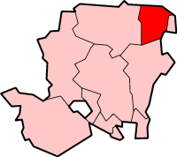
North Warnborough shown within HampshireOS grid reference SU7318951670 - London 38 miles District Hart Shire county Hampshire Region South East Country England Sovereign state United Kingdom Post town HOOK Postcode district RG29 1 Police Hampshire Fire Hampshire Ambulance {{{ambulance_service}}} EU Parliament South East England UK Parliament North East Hampshire List of places: UK • England • Hampshire North Warnborough is a small village situated in North East Hampshire. Its neighbouring villages are Odiham, Hook and Winchfield and the current representative of Parliament is the Rt. Hon. James Arbuthnot. The London-Basingstoke Canal conservation area passes through the middle of the village, which is bounded to the north by the River Whitewater.
Today, North Warnborough consists of a conservation area, bounded by Mill Corner in the north and The Street in the south, lying to each side of the B3349 Reading to Alton road. Most of the village's listed buildings lie within the conservation area. There are also later housing developments with post-war housing beyond the southern boundary of the conservation area to the Odiham boundary and also in the Old Orchard.
Held by King Harold before the Norman invasion of 1066, North Warnborough and Odiham had become a royal burgh by 1086. Half-way between Winchester and Windsor, the Saxon kings maintained a palace and lodgings in Odiham. By 1207 work had begun on King John's castle in 20 acres (81,000 m2) of meadowland at North Warnborough, the ruins of which stand by the canal, itself a site of special scientific interest and a unique conservation area.
Near the canal lies North Warnborough Green, another SSI, including a ford where children often swim during the summer months.
The village once boasted two mills and seven pubs. Some of the pubs were converted into private homes, but The Lord Derby, The Jolly Miller, The Anchor and The Swan still remain and the Old Mill is now a popular family restaurant.
External links
 Media related to North Warnborough at Wikimedia Commons
Towns, villages and hamlets in the Hart District of Hampshire, England  Blackwater • Blounce • Bramshill • Chandlers Green • Church Crookham • Crondall • Crookham Village • Darby Green • Dogmersfield • Dora's Green • Eversley • Eversley Centre • Eversley Cross • Ewshot • Fleet • Frogmore • Greywell • Hartfordbridge • Hartley Wespall • Hartley Wintney • Hawley • Hazeley • Heckfield • Heckfield Heath • Hook • Hook Common • Hound Green • Long Sutton • Lower Common • Mattingley • Mill Lane • Minley • North Warnborough • Odiham • Phoenix Green • Rotherwick • Rye • South Warnborough • Warnborough Green • Well • West Green • Whitehall • Winchfield • Winchfield Green • YateleyCategories:
- Villages in Hampshire
- Places in Hart (district)

Wikimedia Foundation. 2010.