- Chandlers Green
-
Coordinates: 51°18′49″N 0°56′56″W / 51.313705°N 0.94876707°W
Chandlers Green 
 Chandlers Green
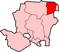
Chandlers Green shown within HampshireOS grid reference SU7336457701 District Hart Shire county Hampshire Region South East Country England Sovereign state United Kingdom Post town HARTLEY WINTNEY Postcode district GU51 Police Hampshire Fire Hampshire Ambulance {{{ambulance_service}}} EU Parliament South East England UK Parliament North East Hampshire List of places: UK • England • Hampshire Chandlers Green is a hamlet in the civil parish of Mattingley in the Hart District of Hampshire, England. Its nearest town is Hook approximately 2.5 miles (3 km) away.
Towns, villages and hamlets in the Hart District of Hampshire, England  Blackwater • Blounce • Bramshill • Chandlers Green • Church Crookham • Crondall • Crookham Village • Darby Green • Dogmersfield • Dora's Green • Eversley • Eversley Centre • Eversley Cross • Ewshot • Fleet • Frogmore • Greywell • Hartfordbridge • Hartley Wespall • Hartley Wintney • Hawley • Hazeley • Heckfield • Heckfield Heath • Hook • Hook Common • Hound Green • Long Sutton • Lower Common • Mattingley • Mill Lane • Minley • North Warnborough • Odiham • Phoenix Green • Rotherwick • Rye • South Warnborough • Warnborough Green • Well • West Green • Whitehall • Winchfield • Winchfield Green • YateleyCategories:
- Hampshire geography stubs
- Villages in Hampshire
- Places in Hart (district)

Wikimedia Foundation. 2010.