- Church Crookham
-
Coordinates: 51°16′04″N 0°49′56″W / 51.267835°N 0.83228946°W
Church Crookham 
 Church Crookham
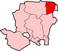
Church Crookham shown within HampshireOS grid reference SU8156352723 Parish Church Crookham District Hart Shire county Hampshire Region South East Country England Sovereign state United Kingdom Post town FLEET Postcode district GU15 Dialling code 01252 01276 Police Hampshire Fire Hampshire Ambulance South East Coast EU Parliament South East England UK Parliament Aldershot List of places: UK • England • Hampshire Church Crookham is a suburb, village and civil parish on the southern edge of the town of Fleet, in north east Hampshire, England, located 39 miles (63 km) south west of London. Formerly a separate village, the area comprises one of the 18 wards of the Hart District, in addition to parts of two others.
Contents
History
Crookham (formerly Crokeham) dates back at least as far as the Domesday Book, though Church Crookham and Crookham Village did not become distinct entities until the founding of the Christ Church in 1840.[1] It is this church for which Church Crookham is named.
The region had few inhabitants at this time, with the 1831 edition of Samuel Lewis's "Topographical Dictionary of England" claiming Crookham had 623 inhabitants and not even mentioning the (at the time) much smaller Fleet.[2] The settlements in area, particularly Fleet, experienced a minor population bloom in 1840 when a railway station was built at nearby Fleet Pond; while this was primarily for the benefit of day-trippers, many Londoners enjoyed the area so much that they decided to settle there.
World War Two
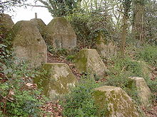
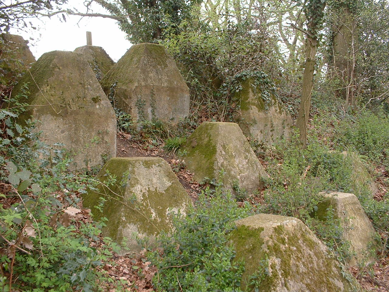
Church Crookham lies on GHQ Line - the most important of a number of fortified stop lines constructed as a part of British anti-invasion preparations of World War II - and was at one of the most heavily fortified sections of that line.[3][4]
Notes of interest
Although now completely enveloped by its formerly-separate and larger neighbour, local residents of Church Crookham still consider the area to be a village in its own right. Motorists entering "Greater Fleet" from the south and west are met with signs welcoming them to Church Crookham, whereas those entering the town from the north and east are welcomed to Fleet instead.
The Basingstoke Canal passes through Church Crookham.
Vertu mobile phones are made at the company headquarters, located in Church Crookham. The HSES Group headquarters are located in Church Crookham. The head office of Ferranti Thomson Sonar Systems, was located on the Redfields Industrial Estate, to the south of the town.
John Keble was a regular visitor to Church Crookham's Christ Church.[5]
Queen Elizabeth Barracks
Queen Elizabeth Barracks (Boyce Barracks) - Crookham - Date of construction 1938
Originally named Boyce Barracks, but re-named in 1948 following the visit of Queen Elizabeth, the Queen Mother.
This large barracks complex was built to act as the Depot for the Royal Army Medical Corps, who used it until 1962. From 1965 until 1970 it was used by Training Regiments of the Royal Corps of Transport. From 1970 until 2000 it was used by Gurkha Regiments.
Wooden hutted camp, with single storey barrack blocks arranged as 'spiders'. The camp could accommodate 2500 men in peace time. This camp also included a numbers of stores and administration buildings, as well as a large parade area, gymnasium and cinema.
Site sold by the MOD and due for redevelopment as housing. The headquarters administration building has been moved and preserved at the Aldershot Military Museum. The Battalion vacated the barracks in August 2000, and the abandoned site is still present. Bryant Homes bought the site in 2002,[6] and planning permission has been sought for a housing estate which will include a medical centre, school, and shops.
Tweseldown race course
Another well-known site is Tweseldown race course, a point-to-point horse racing track. This race track was used for the eventing steeplechase in the 1948 London Olympics.[7] Famously, Churchill raced here while at Sandhurst, with scandal attending him in one race, in which he was accused of bullying a fellow rider, an incident he glossed over in his account of his early life.
Filming location
Church Crookham has been used as a filming location for several movies. These include the 2002 James Bond movie Die Another Day, which used woodland and flat ground in between Church Crookham and Aldershot to represent the demilitarised zone between North and South Korea.[8] Church Crookham was also one of several English towns and villages (others including nearby Aldershot, Farnham, and Chobham) that served as filming locations for the 2006 movie Children of Men.
Tobacco
Church Crookham is also the location for the only commercially successful tobacco plantation in Britain which produced among other brands "Blue Prior" cigarettes and pipe tobacco. Production finished in 1938 and the plantation site is now occupied by Redfields Garden Centre, but Redfields House is part of the buildings that now encompass St Nicholas' School.
Redfields was also the centre for the British Pioneer Tobacco Growers Association (BPTGA) after the Second World War. Tobacco was grown there, cured and a commercial brand 'Trowards Rayon D'or' was produced alongside the main purpose of supplying plants to members, curing and shredding their final product before returning to the appropriate members. Among members of the staff were Charles Baggs ,General Manager throughout their existence, and Admiral Sir Clement Moody. A BBC film was made during the 1950s entitled Tobacco Road which featured the Redfields site and their site in nearby Crondall. The Association closed after the death of Mr Troward, although Charles Baggs did continue to supply plants and cure the members' product for a further period after his death. The works at Redfields employed some twenty to thirty local staff, which demonstrated its importance at that time in history.
Education
For a list of local schools see the list of Hampshire schools.
See also
References
Notes
- ^ Church Crookham.co.uk. "Church Crookham: A pleasant village in Hampshire, England". http://www.church-crookham.co.uk/. Retrieved 28 November 2006.
- ^ Hantsweb. "A Little Local History". http://www.hants.gov.uk/fclhg/localhistory.html. Retrieved 28 November 2006.
- ^ Foot, 2006, p335-341
- ^ "Defending Chequers Bridge". Pillbox study group. http://www.pillbox-study-group.org.uk/chequersbridgepage.htm. Retrieved 2 February 2007.
- ^ Guildford Diocese. "Aldershot Deanery > Crookham". Archived from the original on 29 September 2006. http://web.archive.org/web/20060929140409/http://www.cofeguildford.org.uk/parishes/aldershot/crookham.shtml. Retrieved 28 November 2006.
- ^ Tailor Woodrow (2002). "Bryant Acquires Major Brownfield Development Site". http://www.taylorwoodrow.com/pressarchcontent.asp?ArtID=104. Retrieved 28 November 2006.
- ^ House and Hound (2006). "BEF says Greenwich will work in 2012". http://www.horseandhound.co.uk/news/article.php?aid=81777. Retrieved 28 November 2006.
- ^ News.com.au (7 October 2006). "Licence to thrill". The Courier-Mail. http://www.news.com.au/travel/story/0,23483,20549138-27977,00.html. Retrieved 28 November 2006.
General references
- Foot, William (2006). Beaches, fields, streets, and hills ... the anti-invasion landscapes of England, 1940. Council for British Archaeology. ISBN 1-902771-53-2.
External links
- http://www.church-crookham.co.uk
- Fleet & Crookham Local History Group – Group Books and Historical Papers – includes reference to paper "Mr Brandon's Tobacco Farm" by Phyllis Ralton (2007)
Towns, villages and hamlets in the Hart District of Hampshire, England  Blackwater • Blounce • Bramshill • Chandlers Green • Church Crookham • Crondall • Crookham Village • Darby Green • Dogmersfield • Dora's Green • Eversley • Eversley Centre • Eversley Cross • Ewshot • Fleet • Frogmore • Greywell • Hartfordbridge • Hartley Wespall • Hartley Wintney • Hawley • Hazeley • Heckfield • Heckfield Heath • Hook • Hook Common • Hound Green • Long Sutton • Lower Common • Mattingley • Mill Lane • Minley • North Warnborough • Odiham • Phoenix Green • Rotherwick • Rye • South Warnborough • Warnborough Green • Well • West Green • Whitehall • Winchfield • Winchfield Green • YateleyCategories:
- Places in Hart (district)
- Villages in Hampshire

Wikimedia Foundation. 2010.