- Osage Township, Bourbon County, Kansas
-
Osage Township — Township — Location in Bourbon County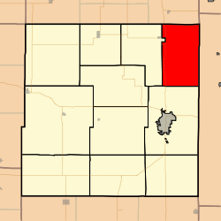
Coordinates: 37°58′00″N 094°40′01″W / 37.9666667°N 94.66694°WCoordinates: 37°58′00″N 094°40′01″W / 37.9666667°N 94.66694°W Country United States State Kansas County Bourbon Area - Total 48.39 sq mi (125.33 km2) - Land 48.31 sq mi (125.13 km2) - Water 0.08 sq mi (0.2 km2) 0.16% Elevation 853 ft (260 m) Population (2000) - Total 394 - Density 8.2/sq mi (3.1/km2) GNIS feature ID 0474559 Osage Township is a township in Bourbon County, Kansas, USA. As of the 2000 census, its population was 394.
Contents
Geography
Osage Township covers an area of 48.39 square miles (125.3 km2) and contains no incorporated settlements. According to the USGS, it contains four cemeteries: Barnesville, Fairview, Maple Grove and West Liberty.
The streams of Fish Creek, Indian Creek, Moores Branch and Moores Branch run through this township.
Transportation
Osage Township contains two airports or landing strips: Emmerson Airport and Lyons Field.
References
External links
Municipalities and communities of Bourbon County, Kansas County seat: Fort Scott Cities 
Townships Drywood | Franklin | Freedom | Marion | Marmaton | Mill Creek | Osage | Pawnee | Scott | Timberhill | Walnut
Unincorporated
communitiesDevon | Garland | Hiattville | Hammond | Marmaton | Pawnee Station | Xenia
Categories:- Townships in Bourbon County, Kansas
- Southeast Kansas geography stubs

Wikimedia Foundation. 2010.