- Antelope, Oregon
Infobox Settlement
official_name = Antelope, Oregon
settlement_type =City
nickname =
motto =
imagesize =
image_caption =
image_
imagesize =
image_caption =
image_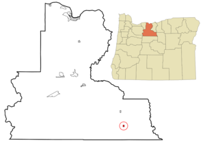
mapsize = 250px
map_caption = Location inOregon
mapsize1 =
map_caption1 =
subdivision_type = Country
subdivision_name =United States
subdivision_type1 = State
subdivision_name1 =Oregon
subdivision_type2 = County
subdivision_name2 = Wasco
government_type =
leader_title =Mayor
leader_name = Brian Sheer
established_title = Incorporated
established_date = 1901
area_magnitude =
area_total_sq_mi = 0.5
area_total_km2 = 1.3
area_land_sq_mi = 0.5
area_land_km2 = 1.3
area_water_sq_mi = 0
area_water_km2 = 0
area_urban_sq_mi =
area_urban_km2 =
area_metro_sq_mi =
area_metro_km2 =
population_as_of = 2000
population_note =
population_total = 59
population_metro =
population_urban =
population_density_km2 = 44.7
population_density_sq_mi = 116.8
timezone = Pacific
utc_offset = -8
timezone_DST = Pacific
utc_offset_DST = -7
latd = 44 |latm = 54 |lats = 39 |latNS = N
longd = 120 |longm = 43 |longs = 22 |longEW = W
elevation_m = 818.4
elevation_ft = 2685
website =
postal_code_type =ZIP code
postal_code = 97001
area_code = 541
blank_name = FIPS code
blank_info = 41-02250GR|2
blank1_name = GNIS feature ID
blank1_info = 1116966GR|3
footnotes =Antelope is a city in Wasco County,
Oregon ,United States . The population was 59 at the 2000 census.History
The Antelope Valley was probably named by members of
Joseph Sherar 's party who were packing supplies to mines in the John Day area.cite book
last = McArthur
first = Lewis A.
authorlink = Lewis A. McArthur
coauthors =Lewis L. McArthur
title =Oregon Geographic Names
origyear = 1928
edition = Seventh Edition
year = 2003
publisher =Oregon Historical Society Press
location = Portland,Oregon
id = ISBN 0-87595-277-1
pages = 27] Sherar became known as the operator of a toll bridge across the Deschutes River, on a cut-off of theBarlow Road .cite web|title=Sherar's Hotel & Toll Bridge, c. 1910|url=http://www.ohs.org/education/oregonhistory/historical_records/dspDocument.cfm?doc_ID=8A131DA8-92FB-C912-7A9F8C3B09FBF50D|publisher=Oregon Historical Society |accessdate=2007-09-20] There were manypronghorn s (often called pronghorn antelope) in the area in the early 1800s. Antelope post office was established in 1871, withHoward Maupin , founder ofMaupin, Oregon , as the first postmaster. The town flourished briefly but when Shaniko, a few miles north, became the terminus of the railroad, Antelope began to fade.Fact|date=September 2007In the 1980s the town grew again when followers of Bhagwan Shree Rajneesh, who had started the city ofRajneeshpuram on the nearby "Big Muddy Ranch", began to move in. Rajneeshpuram was anintentional community (or commune) of "Rajneeshee s". OnSeptember 18 ,1984 , Antelope's charter was amended by a vote of 57 to 22 to change the name of the city to Rajneesh. A short time later Rajneesh was indicted on federal immigration charges, attempted to leave the country, and pleaded no contest to two of the 34 chargesFact|date=September 2007 and returned toIndia . OnNovember 6 ,1985 , the remaining residents, both original and Rajneeshee, voted 34 to 0 to restore the original name, which was never changed by the Postal Service. The ranch is now owned byYoung Life and has been converted into a camp, known as "Wildhorse Canyon." [ [http://sites.younglife.org/camps/Wildhorse/default.aspx Wildhorse Canyon] ]Geography
According to the
United States Census Bureau , the city has a total area of 0.5square mile s (1.3km² ), all of it land.Demographics
As of the
census GR|2 of 2000, there were 59 people, 27 households, and 18 families residing in the city. Thepopulation density was 116.8 people per square mile (44.7/km²). There were 41 housing units at an average density of 81.2/sq mi (31.0/km²). The racial makeup of the city was 93.22% White and 6.78% Native American. Hispanic or Latino of any race were 3.39% of the population.There were 27 households out of which 14.8% had children under the age of 18 living with them, 63.0% were married couples living together, 3.7% had a female householder with no husband present, and 33.3% were non-families. 29.6% of all households were made up of individuals and 7.4% had someone living alone who was 65 years of age or older. The average household size was 2.19 and the average family size was 2.72.
In the city the population was spread out with 22.0% under the age of 18, 1.7% from 18 to 24, 18.6% from 25 to 44, 32.2% from 45 to 64, and 25.4% who were 65 years of age or older. The median age was 50 years. For every 100 females there were 103.4 males. For every 100 females age 18 and over, there were 100.0 males.
The median income for a household in the city was $40,208, and the median income for a family was $37,500. Males had a median income of $30,000 versus $30,417 for females. The
per capita income for the city was $17,444. There were 16.7% of families and 22.2% of the population living below thepoverty line , including 64.3% of under eighteens and none of those over 64.Further reading
* Donna Quick, "A Place Called Antelope: The Rajneesh Story" (August Pr.) 1995 ISBN 0-9643118-0-1
References
External links
* [http://bluebook.state.or.us/local/cities/ad/antelope.htm Entry for Antelope] from the "
Oregon Blue Book "
* [http://www.a2zgorge.info/community/towns/antelope.htm Antelope, Oregon] from a2zgorgeinfo.com (contains entire text of "Antelope" and "Rajneeshpuram" from "Oregon Geographic Names ")
Wikimedia Foundation. 2010.