- Ochelata, Oklahoma
-
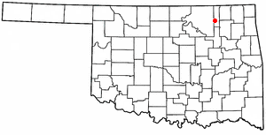
Ochelata, Oklahoma — Town — Location of Ochelata, Oklahoma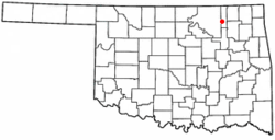
Coordinates: 36°36′1″N 95°58′50″W / 36.60028°N 95.98056°WCoordinates: 36°36′1″N 95°58′50″W / 36.60028°N 95.98056°W Country United States State Oklahoma County Washington Area – Total 0.2 sq mi (0.6 km2) – Land 0.2 sq mi (0.6 km2) – Water 0.0 sq mi (0.0 km2) Elevation 738 ft (225 m) Population (2000) – Total 494 – Density 2,018.0/sq mi (779.2/km2) Time zone Central (CST) (UTC-6) – Summer (DST) CDT (UTC-5) ZIP code 74051 Area code(s) 539/918 FIPS code 40-53700[1] GNIS feature ID 1096171[2] Ochelata is a town in Washington County, Oklahoma, United States. The population was 494 at the 2000 census.
Geography
Ochelata is located at 36°36′1″N 95°58′50″W / 36.60028°N 95.98056°W (36.600251, -95.980475).[3]
According to the United States Census Bureau, the town has a total area of 0.2 square miles (0.52 km2), all of it land.
Ochelata is home to Lucas Metal Works, a manufacturing company who manufacturers their own line of steel buildings, farm equipment, and The Ground Hog Arena Tool, which is used annually at the National Finals Rodeo (NFR).
Demographics
As of the census[1] of 2000, there were 494 people, 175 households, and 131 families residing in the town. The population density was 2,018.0 people per square mile (794.7/km²). There were 188 housing units at an average density of 768.0 per square mile (302.4/km²). The racial makeup of the town was 72.27% White, 18.83% Native American, 1.01% from other races, and 7.89% from two or more races. Hispanic or Latino of any race were 1.42% of the population.
There were 175 households out of which 36.0% had children under the age of 18 living with them, 60.6% were married couples living together, 10.3% had a female householder with no husband present, and 25.1% were non-families. 23.4% of all households were made up of individuals and 12.6% had someone living alone who was 65 years of age or older. The average household size was 2.82 and the average family size was 3.34.
In the town the population was spread out with 32.0% under the age of 18, 9.5% from 18 to 24, 25.3% from 25 to 44, 21.1% from 45 to 64, and 12.1% who were 65 years of age or older. The median age was 33 years. For every 100 females there were 100.0 males. For every 100 females age 18 and over, there were 90.9 males.
The median income for a household in the town was $37,500, and the median income for a family was $40,781. Males had a median income of $31,250 versus $21,875 for females. The per capita income for the town was $14,365. 7.1% of the population and 8.8% of families were below the poverty line. Out of the total population living in poverty, 10.5% of those under the age of 18 and 3.1% of those 65 and older were living below the poverty line.
References
- ^ a b "American FactFinder". United States Census Bureau. http://factfinder.census.gov. Retrieved 2008-01-31.
- ^ "US Board on Geographic Names". United States Geological Survey. 2007-10-25. http://geonames.usgs.gov. Retrieved 2008-01-31.
- ^ "US Gazetteer files: 2010, 2000, and 1990". United States Census Bureau. 2011-02-12. http://www.census.gov/geo/www/gazetteer/gazette.html. Retrieved 2011-04-23.
Municipalities and communities of Washington County, Oklahoma Cities 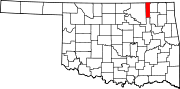
Towns Unincorporated
communitiesHog Shooter | Oak Park | Oglesby | Tuxedo
Footnotes ‡This populated place also has portions in an adjacent county or counties
Categories:- Towns in Oklahoma
- Populated places in Washington County, Oklahoma

Wikimedia Foundation. 2010.